Safety Score: 2,8 of 5.0 based on data from 9 authorites. Meaning we advice caution when travelling to Japan.
Travel warnings are updated daily. Source: Travel Warning Japan. Last Update: 2024-08-13 08:21:03
Touring Hiraoka
Hiraoka in Shimoina-gun (Nagano) is a town located in Japan about 107 mi (or 172 km) west of Tokyo, the country's capital place.
Time in Hiraoka is now 01:34 PM (Friday). The local timezone is named Asia / Tokyo with an UTC offset of 9 hours. We know of 11 airports nearby Hiraoka, of which 4 are larger airports. The closest airport in Japan is Nagoya Airport in a distance of 53 mi (or 86 km), West. Besides the airports, there are other travel options available (check left side).
There are several Unesco world heritage sites nearby. The closest heritage site in Japan is Fujisan, sacred place and source of artistic inspiration in a distance of 49 mi (or 79 km), East. Need some hints on where to stay? We compiled a list of available hotels close to the map centre further down the page.
Being here already, you might want to pay a visit to some of the following locations: Iida, Nakatsugawa, Komagane, Ena and Shinshiro. To further explore this place, just scroll down and browse the available info.
Local weather forecast
Todays Local Weather Conditions & Forecast: 10°C / 51 °F
| Morning Temperature | 3°C / 38 °F |
| Evening Temperature | 6°C / 42 °F |
| Night Temperature | 4°C / 38 °F |
| Chance of rainfall | 0% |
| Air Humidity | 59% |
| Air Pressure | 1015 hPa |
| Wind Speed | Light breeze with 4 km/h (3 mph) from East |
| Cloud Conditions | Few clouds, covering 21% of sky |
| General Conditions | Few clouds |
Saturday, 23rd of November 2024
8°C (47 °F)
-0°C (32 °F)
Sky is clear, light breeze, clear sky.
Sunday, 24th of November 2024
9°C (49 °F)
2°C (35 °F)
Scattered clouds, light breeze.
Monday, 25th of November 2024
12°C (53 °F)
3°C (37 °F)
Few clouds, light breeze.
Hotels and Places to Stay
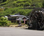
(RYOKAN) Ryusenkaku
(RYOKAN) Irori no Yado Shimabata
(RYOKAN) Nangu Onsen
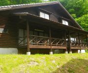
Kajika no Yu Cottage Kajikaso
Videos from this area
These are videos related to the place based on their proximity to this place.
[解放軍]Fireworks on water 水中花火 水中スターマイン 深見の祇園祭
ブログ http://review.jihei.org/2013/04/blog-post_247.html 迫力ある水中花火、水中スターマインが楽しめる『深見の祇園祭』です。 谷間にある池なので迫...
Wild monkeys in the Tenryu village Japan 天龍村の猿
天龍村で偶然遭遇した猿です。 谷間を移動中で撮影している私を警戒しています。 長くて明るいレンズが欲しいと思った瞬間です。 あと、...
平岡駅から天龍村へ一人旅 / Traveled alone from Hiraoka Station to Tenryu village
一人旅の軌跡(旅と鉄道のブログ) ⇒ http://hitoritabi-kiseki.com/ 日付:2012年10月15日 場所:長野県下伊那郡 天龍村へは、JR飯田線の平岡駅で下車し...
[解放軍]2008天龍村花火
http://www.vill-tenryu.jp/natumaturi.html 天龍村の花火です。 とても近くで見ることが出来良かったですがカメラの画角以上の広さのためフレームからは...
Videos provided by Youtube are under the copyright of their owners.
Attractions and noteworthy things
Distances are based on the centre of the city/town and sightseeing location. This list contains brief abstracts about monuments, holiday activities, national parcs, museums, organisations and more from the area as well as interesting facts about the region itself. Where available, you'll find the corresponding homepage. Otherwise the related wikipedia article.
Ina-Kozawa Station
Ina-Kozawa Station is a railway station in Tenryū, Shimoina, Nagano Prefecture, Japan.
Nakaisamurai Station
Nakaisamurai Station is a railway station in Tenryū, Shimoina, Nagano Prefecture, Japan.
Ugusu Station
Ugusu Station is a railway station in Tenryū, Shimoina, Nagano Prefecture, Japan.
Hiraoka Station (Nagano)
Hiraoka Station is a railway station in Tenryū, Shimoina, Nagano Prefecture, Japan.
Hiraoka Dam
Hiraoka Dam is a dam in Nagano Prefecture, Japan, completed in 1951.
Mitsushima
Mitsushima, also known as Matsushima, Tokyo No. 2 Detached Camp and Tokyo #3B, was a prisoner of war camp that provided labour to build the Hiraoka Dam on the Tenryū River in the Central Highlands in Japan. Tatsuo Tsuchiya (also known as "Little Glass Eye") was the first Japanese to be convicted of war crimes at the Yokohama War Crimes Trials.


!['[解放軍]Fireworks on water 水中花火 水中スターマイン 深見の祇園祭' preview picture of video '[解放軍]Fireworks on water 水中花火 水中スターマイン 深見の祇園祭'](https://img.youtube.com/vi/vPrS8XZUuKY/mqdefault.jpg)


!['[解放軍]2008天龍村花火' preview picture of video '[解放軍]2008天龍村花火'](https://img.youtube.com/vi/x7luFa6pdHw/mqdefault.jpg)
