Safety Score: 2,8 of 5.0 based on data from 9 authorites. Meaning we advice caution when travelling to Japan.
Travel warnings are updated daily. Source: Travel Warning Japan. Last Update: 2024-08-13 08:21:03
Discover Wada
Wada in Kamiminochi-gun (Nagano) is a town in Japan about 114 mi (or 184 km) north-west of Tokyo, the country's capital city.
Current time in Wada is now 02:16 AM (Friday). The local timezone is named Asia / Tokyo with an UTC offset of 9 hours. We know of 12 airports near Wada, of which 4 are larger airports. The closest airport in Japan is Matsumoto Airport in a distance of 31 mi (or 50 km), South. Besides the airports, there are other travel options available (check left side).
There are several Unesco world heritage sites nearby. The closest heritage site in Japan is Tomioka Silk Mill and Related Sites in a distance of 56 mi (or 89 km), South-East. Looking for a place to stay? we compiled a list of available hotels close to the map centre further down the page.
When in this area, you might want to pay a visit to some of the following locations: Chikuma, Omachi, Nagano, Suzaka and Azumino. To further explore this place, just scroll down and browse the available info.
Local weather forecast
Todays Local Weather Conditions & Forecast: 15°C / 59 °F
| Morning Temperature | 11°C / 52 °F |
| Evening Temperature | 13°C / 55 °F |
| Night Temperature | 10°C / 51 °F |
| Chance of rainfall | 0% |
| Air Humidity | 71% |
| Air Pressure | 1019 hPa |
| Wind Speed | Light breeze with 3 km/h (2 mph) from East |
| Cloud Conditions | Overcast clouds, covering 100% of sky |
| General Conditions | Light rain |
Saturday, 16th of November 2024
16°C (61 °F)
10°C (51 °F)
Scattered clouds, light breeze.
Sunday, 17th of November 2024
18°C (65 °F)
12°C (54 °F)
Heavy intensity rain, light breeze, broken clouds.
Monday, 18th of November 2024
6°C (43 °F)
1°C (34 °F)
Rain and snow, light breeze, broken clouds.
Hotels and Places to Stay
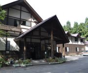
(RYOKAN) Morinoyado Rinrin Kan
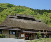
(RYOKAN) Yakimochiya
Hoshi To Midori no Roman Kan
Videos from this area
These are videos related to the place based on their proximity to this place.
8輪バギー体験 ~中山高原~ Vol.2 [ 下山編 ]
2011/09/18 長野県大町市中山高原チャレンジフィールドにて。 水陸両用車MAX-ⅡのフロントにビデオカメラATC-2Kをくくり付けてクルージングです。
8輪バギー体験 ~中山高原~ Vol.1 [ 登山編 ]
2011/09/18 長野県大町市中山高原チャレンジフィールドにて。 水陸両用車MAX-ⅡのフロントにビデオカメラATC-2Kをくくり付けてクルージングです。
ジムニー3時間耐久トライアル
【市川モータース】 http://www.ichikawa-motors.com 8月7日に行われたNASC主催の3時間耐久トライアルの車載映像です。 結果はなんと!2位でしたⅴ.
冬の白馬 Hakuba in winter (Shot on RED ONE)
長野県白馬村の冬景色/雪景色です。 Hakuba is a small ski resort village located in the northern part of Nagano Prefecture, Japan. http://www.aquageographic.com/biz/4K_2K.html...
快速 リゾートビューふるさと 信濃大町駅と白馬間の車窓 雪の仁科三湖
信濃大町駅と白馬駅間の車窓 The scenery from Shinao-Ohmachi station to Hakuba station.
アキーラさん運転②長野県・長野自動車道・更埴IC付近,Nagano-highway,Nagano,Japan
2013年(平成25年)4月12日に長野で用事があるために、浜松から東名高速道路、東海環状道路を使い、中央高速道路、長野自動車道を使い、長...
アキーラさん利用②長野県・千曲市・姨捨山SA,Obasuteyama-SA,Chuo-highway,Nagano,Japan
平成25年(2013年)4月14日に長野市から地元の浜松に帰る際に寄った中央高速道路の姨捨山サービスエリア。姨捨山は昔話しで多くの日本人が聞い...
Obasute station opening (長野県千曲市姨捨駅開会式 )
Obasute station opening July 2010, Chikuma City, Nagano, Japan 姨捨駅・開会式・2010年7月 長野県千曲市.
アキーラさん利用①長野県・千曲市・姨捨山SA,Obasuteyama-SA,Chuo-highway,Nagano,Japan
平成25年(2013年)4月14日に長野市から地元の浜松に帰る際に寄った中央高速道路の姨捨山サービスエリア。姨捨山は昔話しで多くの日本人が聞い...
Videos provided by Youtube are under the copyright of their owners.
Attractions and noteworthy things
Distances are based on the centre of the city/town and sightseeing location. This list contains brief abstracts about monuments, holiday activities, national parcs, museums, organisations and more from the area as well as interesting facts about the region itself. Where available, you'll find the corresponding homepage. Otherwise the related wikipedia article.
Nakajō, Nagano
Nakajō, Nagano was a village located in Kamiminochi District, Nagano, Japan. On 1 January 2010 the village merged into the city of Nagano. As of 2003, the village had an estimated population of 2,742 and a population density of 82.37 persons per km². The total area was 33.29 km². This village lies about 20 km west of Nagano City along route 19. Its landscape is surrounded by dense forests and mountains. The village's landmark, Mt. Mushikura (虫倉山), is the centerpiece of local lore.


!['8輪バギー体験 ~中山高原~ Vol.2 [ 下山編 ]' preview picture of video '8輪バギー体験 ~中山高原~ Vol.2 [ 下山編 ]'](https://img.youtube.com/vi/Szkw5vRPbcg/mqdefault.jpg)
!['8輪バギー体験 ~中山高原~ Vol.1 [ 登山編 ]' preview picture of video '8輪バギー体験 ~中山高原~ Vol.1 [ 登山編 ]'](https://img.youtube.com/vi/Y4Y1sg9a2fs/mqdefault.jpg)


