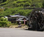
Kamimachi
in Iida-shi of Nagano, Japan

Noteable things around
Location Summary
Decimal Coordinates (Latitude, Longitude):
35.383 and 137.967 (Lat./Lng.)
Coordinates by Time:
N 35° 22' 59" and E 137° 58' 0"
Currency and Currency Code:
Yen - JPY
Spoken languages:
Japanese
Local electricity:
230 V - 50 Hz (plugs: G)
Mobile phone / cellular frequencies (MHz):
900 MHz, 1800 MHz, 3G, 4G
Local Time: 02:04 PM (Friday)
Timezone: Asia/Tokyo
UTC/GMT offset: 9 hours
Sunrise and Sunset:
6:30 am and 4:38 pm
Antipode Coordinates:
-28.605 and -48.819 (Lat./Lng.)
Closest place to antipode coordinates:
Farol de Santa Marta
References
This place on Geonames.org
Current travel safety evaluation for Japan in Eastern Asia

Safety Score: 2,8 of 5.0 based on data from 9 authorites. Meaning we advice caution when travelling to Japan.

Travel warnings are updated daily. Source: Travel Warning Japan. Last Update: 2024-08-13 08:21:03

Delve into Kamimachi

Kamimachi in Iida-shi (Nagano) is a city located in Japan about 99 mi (or 160 km) west of Tokyo, the country's capital town.

Current time in Kamimachi is now 02:04 PM (Friday). The local timezone is named Asia / Tokyo with an UTC offset of 9 hours. We know of 10 airports closer to Kamimachi, of which 4 are larger airports. The closest airport in Japan is Matsumoto Airport in a distance of 54 mi (or 87 km), North. Besides the airports, there are other travel options available (check left side).

There are several Unesco world heritage sites nearby. The closest heritage site in Japan is Fujisan, sacred place and source of artistic inspiration in a distance of 43 mi (or 69 km), East. In need of a room? We compiled a list of available hotels close to the map centre further down the page.

Since you are here already, you might want to pay a visit to some of the following locations: Iida, Komagane, Ina, Nakatsugawa and Minami-Alps. To further explore this place, just scroll down and browse the available info.

Local weather forecast

Todays Local Weather Conditions & Forecast: 10°C / 51 °F

Morning Temperature 3°C / 38 °F
Evening Temperature 6°C / 42 °F
Night Temperature 4°C / 38 °F
Chance of rainfall 0%
Air Humidity 59%
Air Pressure 1015 hPa
Wind Speed Light breeze with 4 km/h (3 mph) from East
Cloud Conditions Few clouds, covering 21% of sky
General Conditions Few clouds

Saturday, 23rd of November 2024

8°C (47 °F)
-0°C (32 °F)
Sky is clear, light breeze, clear sky.

Sunday, 24th of November 2024

9°C (49 °F)
2°C (35 °F)
Scattered clouds, light breeze.

Monday, 25th of November 2024

12°C (53 °F)
3°C (37 °F)
Few clouds, light breeze.

Hotels and Places to Stay

(RYOKAN) Irori no Yado Shimabata

Address
6,3 mi
580, MINAMISHINANO YAEGOCHI, IIDA SHI, NAGANO, 399 1312, JAPAN.
3991312 Iida Shi
Japan

Time Information

Checkout: 09:30 - Checkin: 15:00
Reception
Weekday: -
Weekend: closed


Videos from this area

These are videos related to the place based on their proximity to this place.

下山ダッシュ

Published: June 05, 2012
Length: 24:37 min
Rating: 5 of 5
Author: hiroa2yt

飯田線の飯田駅近くでは、一度電車を降りた後、近道を必死に走れば、もう一度同じ電車に乗ることが出来るという。それを、人は"下山ダッシュ"...


ちょっと長野に行ってきた 【第三話 下山ダッシュ編】 HD

Published: November 10, 2012
Length: 54:06 min
Rating: 5 of 5
Author: inductance239

長野などに、旅へ行った記録をうpしてみました。 Episode 3 , Shimoyama Dash 下山村駅から伊那上郷駅間で電車と競争します! ついでに田切駅でぶら...


119系(JR飯田線)遠州街道踏切通過

Published: March 10, 2012
Length: 13:21 min
Rating: 0 of 5
Author: zikadensinfonie

2012年3月のJR東海ダイヤ改正で全廃される飯田線専用車両「119系」E15編成が、時又(ときまた)駅を出て遠州街道踏切を通過した際の映像です。...


兵越峠

Published: February 24, 2014
Length: 40:13 min
Rating: 0 of 5
Author: jun yossy


平岡ダム クレスト放流 全開 2011台風15号

Published: September 25, 2011
Length: 02:06 min
Rating: 0 of 5
Author: じへいの動画解放軍

2011年の台風15号の増水のため全ゲートを開放して放水をしました。 初めて見た平岡ダムの放水です。


浄心の瀧

Published: February 24, 2008
Length: 03:39 min
Rating: 1 of 5
Author: じへいの動画解放軍

長野県天龍村にある浄心の瀧です。 近くに飯田線の廃線後があります。


2009年5月20日 ツアーオブジャパン南信州ステージ 1

Published: May 23, 2009
Length: 25:04 min
Rating: 0 of 5
Author: mihagetoyooka

13th TOUR OF JAPAN 南信州ステージ 2009年5月20日 水曜日 焼肉観戦ポイントにて撮影 1周目 2周目 3周目.


天竜川増水中(2010年7月14日)

Published: July 15, 2010
Length: 18:00 min
Rating: 0 of 5
Author: icats007

梅雨で天竜川水位が水防団待機を超えました。弁天で濁流を撮影、増水時の異様な雰囲気がただよっています。河川敷に許可を受けて置いた物置...


Wild monkeys in the Tenryu village Japan 天龍村の猿

Published: January 07, 2009
Length: 39:03 min
Rating: 5 of 5
Author: じへいの動画解放軍

天龍村で偶然遭遇した猿です。 谷間を移動中で撮影している私を警戒しています。 長くて明るいレンズが欲しいと思った瞬間です。 あと、...


平岡駅から天龍村へ一人旅 / Traveled alone from Hiraoka Station to Tenryu village

Published: November 04, 2012
Length: 58:18 min
Rating: 0 of 5
Author: 一人旅の軌跡 OKAPI TRAVEL CHANNEL

一人旅の軌跡(旅と鉄道のブログ) ⇒ http://hitoritabi-kiseki.com/ 日付:2012年10月15日 場所:長野県下伊那郡 天龍村へは、JR飯田線の平岡駅で下車し...


Videos provided by Youtube are under the copyright of their owners.

Popular in vicinity

These are some bigger and more relevant cities in the wider vivinity of Kamimachi.

capture of the webcam Kamimachi: 長野県飯田市 下栗の里ライブカメラ

Kamimachi: 長野県飯田市 下栗の里ライブカメラ, Kamimachi (source)

Webcams provided by webcam.travel are under the copyright of their owners.


This place is known by different names. Here the ones we know:
Uemachi, Kadomura, Kadomachi, Kamimachi