Safety Score: 2,8 of 5.0 based on data from 9 authorites. Meaning we advice caution when travelling to Japan.
Travel warnings are updated daily. Source: Travel Warning Japan. Last Update: 2024-08-13 08:21:03
Delve into Takaishihama
Takaishihama in Kesennuma Shi (Miyagi) is located in Japan about 248 mi (or 399 km) north-east of Tokyo, the country's capital town.
Current time in Takaishihama is now 09:00 PM (Friday). The local timezone is named Asia / Tokyo with an UTC offset of 9 hours. We know of 8 airports close to Takaishihama. The closest airport in Japan is Hanamaki Airport in a distance of 45 mi (or 72 km), North-West. Besides the airports, there are other travel options available (check left side).
There are two Unesco world heritage sites nearby. The closest heritage site in Japan is Hiraizumi – Temples, Gardens and Archaeological Sites Representing the Buddhist Pure Land in a distance of 30 mi (or 48 km), West. If you need a hotel, we compiled a list of available hotels close to the map centre further down the page.
While being here, you might want to pay a visit to some of the following locations: Kesennuma, Rikuzentakata, Ofunato, Tono and Kamaishi. To further explore this place, just scroll down and browse the available info.
Local weather forecast
Todays Local Weather Conditions & Forecast: 16°C / 61 °F
| Morning Temperature | 9°C / 48 °F |
| Evening Temperature | 12°C / 53 °F |
| Night Temperature | 9°C / 48 °F |
| Chance of rainfall | 0% |
| Air Humidity | 63% |
| Air Pressure | 1019 hPa |
| Wind Speed | Light breeze with 4 km/h (2 mph) from South-East |
| Cloud Conditions | Overcast clouds, covering 100% of sky |
| General Conditions | Overcast clouds |
Saturday, 16th of November 2024
14°C (58 °F)
11°C (52 °F)
Scattered clouds, light breeze.
Sunday, 17th of November 2024
17°C (62 °F)
11°C (52 °F)
Moderate rain, gentle breeze, overcast clouds.
Monday, 18th of November 2024
8°C (46 °F)
2°C (35 °F)
Rain and snow, moderate breeze, broken clouds.
Hotels and Places to Stay
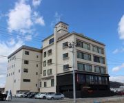
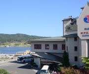
Kyukamura Kesennuma Oshima
(RYOKAN) Kisennuma Hotel Ikkeikaku
Sun Marine Kesennuma Hotel Kanyo
(RYOKAN) Ainsu Kuriko
Hotel Route Inn Kesennuma
Videos from this area
These are videos related to the place based on their proximity to this place.
Japan Earthquake 東日本大震災 3.11 Giant Tsunami Kesennuma-city in Japan,11 March 2011
The Giant Tsunami in Kesennuma-city, Miyagi-prefecture, Japan JST15:35(Junpei Satoh) 気仙沼湾に押し寄せる大津波。船は無人状態。スクリューにロープやゴミが絡...
[V0302] 陸前2:唐桑半島の巨釜半造から御崎岬や陸前大島の大島瀬戸へ
動画開始地点: 地図拡大表示の中心点 (RECORDING START POINT): Center point of this map http://maps.live.com/?v=2&cp=38.90712922045664~141.65214458216047&lvl=13.488888...
気仙沼 その2 「鹿折唐桑(大火災跡地)」 (2012年8月23日)
気仙沼・鹿折唐桑 (2012年8月23日) のようすです。 大震災で大火災に見舞われた地区です。 参考:NHKニュース 宮城県気仙沼市の火災...
[VM0402B]_100430_宮城県気仙沼市02_大浦_浪板海岸_鹿折川_本浜_魚浜_南町海岸_気仙沼漁港
直前区間(Prev.): [VM0402A] http://www.youtube.com/watch?v=vLRz6X6F2Rw&list=PLF2A20F07635CD5E3&index=49 直後区間(Next): [VM0402C] ...
Kesennuma Port in Miyagi, Japan 気仙沼港
As a ship leaves Kesennuma Port, we can see Ukimido. 船が浮見堂の横を通り過ぎます。 Hi there! I am alive after the devastating earthquake and tsunami. Thank you.
Videos provided by Youtube are under the copyright of their owners.
Attractions and noteworthy things
Distances are based on the centre of the city/town and sightseeing location. This list contains brief abstracts about monuments, holiday activities, national parcs, museums, organisations and more from the area as well as interesting facts about the region itself. Where available, you'll find the corresponding homepage. Otherwise the related wikipedia article.
Karakuwa, Miyagi
Karakuwa, Miyagi was a town located in the extreme northeast of Miyagi Prefecture, bordering Kesennuma to the north-west and Rikuzentakata, part of Iwate Prefecture, to the north, and with Kesennuma Bay including Oshima island to the west, Hirota Bay to the north-east, and the Pacific Ocean to the south and east. On March 31, 2006, Karakuwa was merged into the neighboring city of Kesennuma and is no longer an independent municipality.


!['[V0302] 陸前2:唐桑半島の巨釜半造から御崎岬や陸前大島の大島瀬戸へ' preview picture of video '[V0302] 陸前2:唐桑半島の巨釜半造から御崎岬や陸前大島の大島瀬戸へ'](https://img.youtube.com/vi/EJhOCl5KmsA/mqdefault.jpg)


!['[VM0402B]_100430_宮城県気仙沼市02_大浦_浪板海岸_鹿折川_本浜_魚浜_南町海岸_気仙沼漁港' preview picture of video '[VM0402B]_100430_宮城県気仙沼市02_大浦_浪板海岸_鹿折川_本浜_魚浜_南町海岸_気仙沼漁港'](https://img.youtube.com/vi/PS0STLC4s8I/mqdefault.jpg)


