Safety Score: 2,8 of 5.0 based on data from 9 authorites. Meaning we advice caution when travelling to Japan.
Travel warnings are updated daily. Source: Travel Warning Japan. Last Update: 2024-08-13 08:21:03
Discover Erihara
Erihara in Sōraku-gun (Kyoto) is a city in Japan about 223 mi (or 360 km) west of Tokyo, the country's capital city.
Local time in Erihara is now 12:29 PM (Friday). The local timezone is named Asia / Tokyo with an UTC offset of 9 hours. We know of 8 airports in the vicinity of Erihara, of which 3 are larger airports. The closest airport in Japan is Osaka International Airport in a distance of 26 mi (or 41 km), West. Besides the airports, there are other travel options available (check left side).
There are several Unesco world heritage sites nearby. The closest heritage site in Japan is Historic Monuments of Ancient Nara in a distance of 8 mi (or 13 km), South. Looking for a place to stay? we compiled a list of available hotels close to the map centre further down the page.
When in this area, you might want to pay a visit to some of the following locations: Kizugawa, Joyo, Kyotanabe, Nara-shi and Uji. To further explore this place, just scroll down and browse the available info.
Local weather forecast
Todays Local Weather Conditions & Forecast: 19°C / 66 °F
| Morning Temperature | 16°C / 60 °F |
| Evening Temperature | 18°C / 64 °F |
| Night Temperature | 16°C / 62 °F |
| Chance of rainfall | 0% |
| Air Humidity | 73% |
| Air Pressure | 1019 hPa |
| Wind Speed | Light breeze with 4 km/h (2 mph) from South-East |
| Cloud Conditions | Overcast clouds, covering 100% of sky |
| General Conditions | Light rain |
Saturday, 16th of November 2024
20°C (68 °F)
19°C (67 °F)
Overcast clouds, moderate breeze.
Sunday, 17th of November 2024
20°C (69 °F)
17°C (63 °F)
Moderate rain, gentle breeze, broken clouds.
Monday, 18th of November 2024
14°C (58 °F)
9°C (48 °F)
Light rain, moderate breeze, broken clouds.
Hotels and Places to Stay
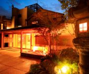
(RYOKAN) Mikasa
(RYOKAN) Ryori Ryokan Yoshiya
(RYOKAN) Minshuku Dosembosanso
Videos from this area
These are videos related to the place based on their proximity to this place.
Abandoned Nara Dreamland - A Walk On The Aska Rollercoaster
Facebook: https://www.facebook.com/AbandonedKansai Blog: http://abandonedkansai.com/ A walk on the Aska Rollercoaster - the pride of the late Nara Dreamland amusement park. 720p, unedited....
Aska Coaster POV - Nara Dreamland - Nara, Nara, Japan
Aska is one of the best wooden coasters I've ridden. The park closed the following year and Aska was lost forever. One of many on-ride point of view coaster video's I have filmed and collected...
Yagyuuyamaguchi Shrine in Ōyagyūchō, Nara-ken!
A few days ago, I was in the village of Ōyagyūchō and visited the Yagyuuyamaguchi Shrine on a hilly forested slope. Yagyu Village (柳生の里) is located east side of Nara Prefecture....
Videos provided by Youtube are under the copyright of their owners.
Attractions and noteworthy things
Distances are based on the centre of the city/town and sightseeing location. This list contains brief abstracts about monuments, holiday activities, national parcs, museums, organisations and more from the area as well as interesting facts about the region itself. Where available, you'll find the corresponding homepage. Otherwise the related wikipedia article.
Kuni-kyō
Kuni-kyō (恭仁京, or Kuni no miyako), was the capital city of Japan between 740 and 744, whose imperial palace (恭仁宮 Kuni-kyū or Kuni no miya) built in present-day city of Kizugawa in Kyoto Prefecture by order of Emperor Shōmu.
Kamo Station (Kyoto)
Kamo Station is a railway station on the West Japan Railway Company (JR West) Kansai Main Line in Kizugawa, Kyoto Prefecture, Japan.


