Safety Score: 2,8 of 5.0 based on data from 9 authorites. Meaning we advice caution when travelling to Japan.
Travel warnings are updated daily. Source: Travel Warning Japan. Last Update: 2024-08-13 08:21:03
Explore Uekimachi-tomiō
Uekimachi-tomiō in Kumamoto Shi (Kumamoto) is located in Japan about 549 mi (or 884 km) west of Tokyo, the country's capital.
Local time in Uekimachi-tomiō is now 04:19 PM (Friday). The local timezone is named Asia / Tokyo with an UTC offset of 9 hours. We know of 9 airports in the wider vicinity of Uekimachi-tomiō, of which 3 are larger airports. The closest airport in Japan is Kumamoto Airport in a distance of 12 mi (or 20 km), South-East. Besides the airports, there are other travel options available (check left side).
There is one Unesco world heritage site nearby. It's Itsukushima Shinto Shrine in a distance of 135 mi (or 217 km), North-East. If you need a place to sleep, we compiled a list of available hotels close to the map centre further down the page.
Depending on your travel schedule, you might want to pay a visit to some of the following locations: Tamana, Yamaga, Kumamoto, Koshi and Kikuchi. To further explore this place, just scroll down and browse the available info.
Local weather forecast
Todays Local Weather Conditions & Forecast: 17°C / 63 °F
| Morning Temperature | 13°C / 55 °F |
| Evening Temperature | 16°C / 61 °F |
| Night Temperature | 13°C / 55 °F |
| Chance of rainfall | 0% |
| Air Humidity | 43% |
| Air Pressure | 1019 hPa |
| Wind Speed | Gentle Breeze with 7 km/h (4 mph) from East |
| Cloud Conditions | Clear sky, covering 0% of sky |
| General Conditions | Sky is clear |
Saturday, 23rd of November 2024
16°C (61 °F)
10°C (49 °F)
Scattered clouds, gentle breeze, broken clouds.
Sunday, 24th of November 2024
15°C (59 °F)
9°C (48 °F)
Sky is clear, gentle breeze, clear sky.
Monday, 25th of November 2024
16°C (61 °F)
12°C (53 °F)
Sky is clear, light breeze, clear sky.
Hotels and Places to Stay
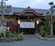
(RYOKAN) Ueki Onsen Kirinoyu
(RYOKAN) Ryokan Yaya no Yu
(RYOKAN) Takanoya
(RYOKAN) Araki Kanko Hotel
(RYOKAN) Miyabaru Onsen Chomeikan
Kikunan Onsen UBL Hotel
(RYOKAN) Oama Onsen Nakoikan
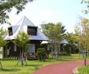
Hotel AZ Kumamoto Hokubu
Hotel AZ Kumamoto Koshi Kita Bypass
Riverside Park Shichijo
Videos from this area
These are videos related to the place based on their proximity to this place.
ヤマガ空撮 - 熊本県立装飾古墳館【HD】
【サンプル:016】 〒861-0561 熊本県山鹿市鹿央町岩原3085 とてもいい所です! 皆様も行ってみましょう!(^_^) □ウィキペディアより... 熊本県立装...
Enjoy A-TRAIN by EOS7D HiV movie with EF70-200mmF2.8L USM !
MyBlog is here:http://railroadjapan.way-nifty.com/railroadjapan/ Why don't you play at 1080p/HD mode if possible! Ltd train A-TRAIN is named because of its destination Misumi located near...
熊本市・熊本都市バス・熊本電鉄「ゆうゆうバス」@植木駅
2014年3月26日加筆・修正 この熊本市コミュニティバス「ゆうゆうバス」ですが、南区で運行していた路線は、2014年3月で全廃となり、換わってデ...
JR九州 817系電車 回送列車到着@植木駅
2012年8月16日撮影。熊本市北区(旧 熊本県鹿本郡植木町)はJR鹿児島本線植木駅に到着する、JR九州 817系電車回送列車です。 熊本駅か八代駅まで回送...
田原坂ニュータウン売地【熊本市北区植木町大和 売地】
詳しくは➔A区画 http://www.icomf.jp/index.php?s=iview&cid=1f&oid=3b&sid= B区画 http://www.icomf.jp/index.php?s=iview&cid=1f&oid=3d&sid= C区画...
Driving TV 12-7 [合志市須屋 九州沖縄農業試験センター 桜並木]
2倍速で九州の道路をドライブします。熊本市 熊本県 車載カメラ 日本 In-vehicle camera 1080p.
旧鹿本鉄道菊池川鉄橋跡 (ancient Kamoto Tetsudo railways Kikuchigawa river bridge)
旧鹿本鉄道 (山鹿温泉鉄道) は 1917(大正6)年に最初の区間が開業し、1923(大正12)年に植木~山鹿の全線開業、1960(昭和35)年に全線...
金峰山(熊本市)拝ケ石巨石群(おがみがいしきょせきぐん)ペトログラフ
wikipediaより 拝ケ石巨石群(おがみがいしきょせきぐん)は、熊本県熊本市の西部の金峰山東門寺地区にある遺跡。古くは「おかミノ石(拝みの石...
Videos provided by Youtube are under the copyright of their owners.
Attractions and noteworthy things
Distances are based on the centre of the city/town and sightseeing location. This list contains brief abstracts about monuments, holiday activities, national parcs, museums, organisations and more from the area as well as interesting facts about the region itself. Where available, you'll find the corresponding homepage. Otherwise the related wikipedia article.
Ueki, Kumamoto
Ueki, Kumamoto was a town located in Kamoto District, Kumamoto, Japan. On March 23, 2010 Ueki, along with the town of Jōnan, from Shimomashiki District, was merged into the expanded city of Kumamoto and no longer exists as an independent municipality. As of April 1, 2012, the area is part of the Kita-ku ward. As of 2003, the town had an estimated population of 31,088 and a density of 472.39 persons/km² (293.59 persons/sq mi). The total area was 65.81 km² (40.90 sq mi).
Konoha Station
Konoha Station is a railway station on the Kagoshima Main Line, operated by JR Kyushu in Gyokutō, Kumamoto, Japan.
Ueki Station
Ueki Station is a railway station on the Kagoshima Main Line, operated by JR Kyushu in Kita-ku, Kumamoto, Japan.
Tabaruzaka Station
Tabaruzaka Station is a railway station on the Kagoshima Main Line, operated by JR Kyushu in Kita-ku, Kumamoto, Japan.
Kita-ku, Kumamoto
Kita-ku, Kumamoto is one of the five wards of Kumamoto City, Japan. Meaning literally "north ward," it is bordered by the Nishi-ku, Chūō-ku, Higashi-ku and also by the cities of Yamaga, Kikuchi, Kōshi and the towns of Gyokutō and Kikuyō. As of 2012, it has a population of 140,684 people and an area of 115.65 km.


!['Driving TV 12-7 [合志市須屋 九州沖縄農業試験センター 桜並木]' preview picture of video 'Driving TV 12-7 [合志市須屋 九州沖縄農業試験センター 桜並木]'](https://img.youtube.com/vi/Qgxo8o7BYKo/mqdefault.jpg)


