Safety Score: 2,8 of 5.0 based on data from 9 authorites. Meaning we advice caution when travelling to Japan.
Travel warnings are updated daily. Source: Travel Warning Japan. Last Update: 2024-08-13 08:21:03
Delve into Otojiya
Otojiya in Ashikita-gun (Kumamoto) is a city located in Japan about 575 mi (or 925 km) south-west of Tokyo, the country's capital town.
Current time in Otojiya is now 06:51 AM (Wednesday). The local timezone is named Asia / Tokyo with an UTC offset of 9 hours. We know of 8 airports closer to Otojiya, of which two are larger airports. The closest airport in Japan is Kagoshima Airport in a distance of 37 mi (or 60 km), South. Besides the airports, there are other travel options available (check left side).
In need of a room? We compiled a list of available hotels close to the map centre further down the page.
Since you are here already, you might want to pay a visit to some of the following locations: Minamata, Kamiamakusa, Hitoyoshi, Isa and Izumi. To further explore this place, just scroll down and browse the available info.
Local weather forecast
Todays Local Weather Conditions & Forecast: 11°C / 53 °F
| Morning Temperature | 10°C / 50 °F |
| Evening Temperature | 10°C / 49 °F |
| Night Temperature | 9°C / 48 °F |
| Chance of rainfall | 2% |
| Air Humidity | 80% |
| Air Pressure | 1016 hPa |
| Wind Speed | Gentle Breeze with 8 km/h (5 mph) from East |
| Cloud Conditions | Overcast clouds, covering 100% of sky |
| General Conditions | Light rain |
Thursday, 28th of November 2024
11°C (52 °F)
9°C (48 °F)
Light rain, gentle breeze, broken clouds.
Friday, 29th of November 2024
9°C (47 °F)
9°C (48 °F)
Moderate rain, gentle breeze, overcast clouds.
Saturday, 30th of November 2024
10°C (51 °F)
4°C (39 °F)
Light rain, gentle breeze, overcast clouds.
Hotels and Places to Stay
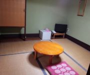
(RYOKAN) Nozakaya Ryokan
(RYOKAN) Yunoura Onsen Kameiso
Videos from this area
These are videos related to the place based on their proximity to this place.
湯の児温泉郷ウォーキング in Minamata City,Kumamoto
水俣市の海沿いにある温泉です。波の音と潮風と透き通るような青い海に癒されながら散策出来ました。もちろん、温泉も楽しんで帰りました。...
Life in Minamata, Kumamoto-Ken, Japan
This is a video from a small matsuri/festival in Minamata-shi on 2012/08/04. A small hawaiian dance from some of the locals. Loving it!
道の駅みなまたのバラ園(Spring Roses 2013 in Minamata city, Kumamoto)
『道の駅みなまた』に併設されている薔薇公園に咲いた春バラです。七分咲き程度でしたが、新緑の頃の爽やかな風も映像の中に捉えたし、コン...
超高速!! 雪の中、新幹線通過!! JR Kyushu Shinkansen pass through a station!!
The Kyushu-Shinkansen "Tsubame" pass Shin-Minamata station without stopping. 九州新幹線つばめ800系 雪降りしきる中での迫力の新水俣駅通過4連発です!!
九州新幹線つばめ 新水俣駅到着(Kyushu Shinkansen)
800系の九州新幹線つばめが、新水俣駅に到着する様子を撮影しました。 Japanese Kyusyu Sinkansen "TSUBAME" arrive at Shin-minamata Station.
九州新幹線つばめ 新水俣駅を出発(Kyushu Shinkansen)
800系の九州新幹線つばめ号が、新水俣駅を出発する様子を撮影しました。 Japanese Kyusyu Sinkansen "TSUBAME" depart from Shin-minamata Station.
[V0239] 八代1:水俣市からウネウネ山道で八代海沿いの津奈木港へ
動画開始地点: 地図拡大表示の中心点 (RECORDING START POINT): Center point of this map http://maps.live.com/default.aspx?v=2&cp=32.21481734205252~130.38815753163396&l...
[V0240] 八代2:天草諸島を臨む津奈木町から佐敷港FTを経て田浦湾沿いへ
"○動画開始地点: 地図拡大表示の中心点 (RECORDING START POINT): Center point of this map http://maps.live.com/?v=2&cp=32.24471247797685~130.42956545948982&lvl=12.99777...
Flight Simulator X V-22 Osprey
八代市上空から田浦に着陸 V-22オスプレイ 国内ショップの並行輸入品よりも送料込みで何百円か個人輸入したほうが安かったレートの時に...
けっこう詰めて並べた祐徳バス 旅館に駐車・ガイドさん達誘導 観光バス動画 巴士 Tourist Bus Turning round RYOKAN Parking.
Tourist Bus Turning round RYOKAN Parking. この動画は観光バスフェチさん専用BGM無しバージョン。 佐賀営業所所属の祐徳バスさんです。 バスは西日本...
Videos provided by Youtube are under the copyright of their owners.
Attractions and noteworthy things
Distances are based on the centre of the city/town and sightseeing location. This list contains brief abstracts about monuments, holiday activities, national parcs, museums, organisations and more from the area as well as interesting facts about the region itself. Where available, you'll find the corresponding homepage. Otherwise the related wikipedia article.
Ashikita District, Kumamoto
Ashikita District, Kumamoto is a district located in Kumamoto Prefecture, Japan. As of 2003, the district has an estimated population of 27,264 and a density of 101.94 persons per square kilometer. The total area is 267.45 km².


!['[V0239] 八代1:水俣市からウネウネ山道で八代海沿いの津奈木港へ' preview picture of video '[V0239] 八代1:水俣市からウネウネ山道で八代海沿いの津奈木港へ'](https://img.youtube.com/vi/UgpheC18XZI/mqdefault.jpg)
!['[V0240] 八代2:天草諸島を臨む津奈木町から佐敷港FTを経て田浦湾沿いへ' preview picture of video '[V0240] 八代2:天草諸島を臨む津奈木町から佐敷港FTを経て田浦湾沿いへ'](https://img.youtube.com/vi/YXAbYBdaAuA/mqdefault.jpg)


