Safety Score: 2,8 of 5.0 based on data from 9 authorites. Meaning we advice caution when travelling to Japan.
Travel warnings are updated daily. Source: Travel Warning Japan. Last Update: 2024-08-13 08:21:03
Explore Matsubae
Matsubae in Ashikita-gun (Kumamoto) is located in Japan about 574 mi (or 924 km) south-west of Tokyo, the country's capital.
Local time in Matsubae is now 06:07 AM (Wednesday). The local timezone is named Asia / Tokyo with an UTC offset of 9 hours. We know of 8 airports in the wider vicinity of Matsubae, of which two are larger airports. The closest airport in Japan is Kagoshima Airport in a distance of 32 mi (or 52 km), South. Besides the airports, there are other travel options available (check left side).
If you need a place to sleep, we compiled a list of available hotels close to the map centre further down the page.
Depending on your travel schedule, you might want to pay a visit to some of the following locations: Minamata, Isa, Hitoyoshi, Izumi and Kamiamakusa. To further explore this place, just scroll down and browse the available info.
Local weather forecast
Todays Local Weather Conditions & Forecast: 11°C / 53 °F
| Morning Temperature | 10°C / 50 °F |
| Evening Temperature | 10°C / 49 °F |
| Night Temperature | 9°C / 48 °F |
| Chance of rainfall | 2% |
| Air Humidity | 80% |
| Air Pressure | 1016 hPa |
| Wind Speed | Gentle Breeze with 8 km/h (5 mph) from East |
| Cloud Conditions | Overcast clouds, covering 100% of sky |
| General Conditions | Light rain |
Thursday, 28th of November 2024
11°C (52 °F)
9°C (48 °F)
Light rain, gentle breeze, broken clouds.
Friday, 29th of November 2024
9°C (47 °F)
9°C (48 °F)
Moderate rain, gentle breeze, overcast clouds.
Saturday, 30th of November 2024
10°C (51 °F)
4°C (39 °F)
Light rain, gentle breeze, overcast clouds.
Hotels and Places to Stay
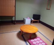
(RYOKAN) Yunoura Onsen Kameiso
(RYOKAN) Nozakaya Ryokan
Videos from this area
These are videos related to the place based on their proximity to this place.
マルチコプター 空撮7 津奈木町彫刻橋<DJI PHANTOM2>
津奈木町の橋の上に設置された彫刻「爽風」「風ん子」「薫風」は風をテーマに製作され、父・母・子どもたちの平和で理想的な家庭を表してい...
[V0241] 八代3:肥薩おれんじ鉄道と対面し海沿い南九州道を往復
動画開始地点: 地図拡大表示の中心点 (RECORDING START POINT): Center point of this map http://maps.live.com/?v=2&cp=32.35545476366832~130.507922750663&lvl=13&sty=r&ex...
熊本県ドクターヘリ 2015.02.15 10:35~ 芦北町 岩崎グラウンドより離陸
肥後うらら(道の駅)から出た時に、ドクターヘリが近くの芦北町営岩崎グラウンドに着陸しそうな感じだったので見に行ってみました。 ...
マルチコプター 空撮3 熊本県芦北町 佐敷城跡<DJI PHANTOM2>
佐敷城は佐敷川の河口の南側にある標高88mの山頂に築かれており、 総石垣造りによる城郭は、整備以前には石垣があることも知られず埋もれてい...
Spring Youth Camp 2015 Roller Luge ローラーリュージュ
2015 Spring Youth Camp in Ashikita, Yatsushiro-shi, Kumamoto-ken Japan. Our recreation time was spent at a nearby park that had roller luge, among other things. http://www.ashikita.kaihin.hinokuni-...
Videos provided by Youtube are under the copyright of their owners.
Attractions and noteworthy things
Distances are based on the centre of the city/town and sightseeing location. This list contains brief abstracts about monuments, holiday activities, national parcs, museums, organisations and more from the area as well as interesting facts about the region itself. Where available, you'll find the corresponding homepage. Otherwise the related wikipedia article.
Ashikita District, Kumamoto
Ashikita District, Kumamoto is a district located in Kumamoto Prefecture, Japan. As of 2003, the district has an estimated population of 27,264 and a density of 101.94 persons per square kilometer. The total area is 267.45 km².


!['[V0241] 八代3:肥薩おれんじ鉄道と対面し海沿い南九州道を往復' preview picture of video '[V0241] 八代3:肥薩おれんじ鉄道と対面し海沿い南九州道を往復'](https://img.youtube.com/vi/198SbBzis6c/mqdefault.jpg)


