Safety Score: 2,8 of 5.0 based on data from 9 authorites. Meaning we advice caution when travelling to Japan.
Travel warnings are updated daily. Source: Travel Warning Japan. Last Update: 2024-08-13 08:21:03
Discover Kawauramachi-imada
Kawauramachi-imada in Amakusa Shi (Kumamoto) is a place in Japan about 596 mi (or 958 km) south-west of Tokyo, the country's capital city.
Current time in Kawauramachi-imada is now 10:44 AM (Friday). The local timezone is named Asia / Tokyo with an UTC offset of 9 hours. We know of 8 airports near Kawauramachi-imada, of which two are larger airports. The closest airport in Japan is Nagasaki Airport in a distance of 40 mi (or 64 km), North. Besides the airports, there are other travel options available (check left side).
We encountered 1 points of interest in the vicinity of this place. If you need a hotel, we compiled a list of available hotels close to the map centre further down the page.
While being here, you might want to pay a visit to some of the following locations: Amakusa, Kamiamakusa, Minamata, Akune and Minamishimabara. To further explore this place, just scroll down and browse the available info.
Local weather forecast
Todays Local Weather Conditions & Forecast: 22°C / 71 °F
| Morning Temperature | 20°C / 68 °F |
| Evening Temperature | 21°C / 69 °F |
| Night Temperature | 20°C / 69 °F |
| Chance of rainfall | 4% |
| Air Humidity | 78% |
| Air Pressure | 1017 hPa |
| Wind Speed | Gentle Breeze with 8 km/h (5 mph) from North-West |
| Cloud Conditions | Overcast clouds, covering 100% of sky |
| General Conditions | Moderate rain |
Saturday, 16th of November 2024
22°C (71 °F)
20°C (69 °F)
Light rain, light breeze, overcast clouds.
Sunday, 17th of November 2024
23°C (73 °F)
20°C (68 °F)
Light rain, moderate breeze, few clouds.
Monday, 18th of November 2024
17°C (62 °F)
14°C (58 °F)
Light rain, fresh breeze, clear sky.
Hotels and Places to Stay
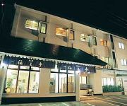
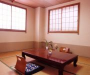
(RYOKAN) Shimoda Onsen Yumoto no Syo Yumehotaru
(RYOKAN) AJINOYADO KAIOTEI
(RYOKAN) Shimoda Onsen Igaya Ryokan
(RYOKAN) Shimoda Onsen Maruco
Videos from this area
These are videos related to the place based on their proximity to this place.
天草市西の久保公園の花菖蒲園へ(Iris garden) 2014 in Amakusa City
数日前、花菖蒲まつりのイベントが開催されたとか。広大な公園の中を重いフライカムを抱えての散歩、良い運動になりました。うーーんむ?(^^);;、まだフライカムのセッティングが不完全みたいです。錘は左右に3枚 ...
[V0411] 島原湾2:天草下島から天草瀬戸大橋で本渡瀬戸を天草上島へ
動画開始地点: 地図拡大表示の中心点 (RECORDING START POINT): Center point of this map http://maps.live.com/?v=2&cp=32.458328766372205~130.19664280535656&lvl=13&dir=0...
天草市の西の久保公園お散歩(taking a walk at Nishi no kubo Iris park)
天草市の花菖蒲を撮影に来たけと゚駐車場から目的の花菖蒲園は600m先なので、先ずは鳥の鳴き声を聴きながら途中の眺めを歩行撮影練習開始。平坦なルートなので絶好のトレーニング場でした。あっ、カメラの ...
Videos provided by Youtube are under the copyright of their owners.
Attractions and noteworthy things
Distances are based on the centre of the city/town and sightseeing location. This list contains brief abstracts about monuments, holiday activities, national parcs, museums, organisations and more from the area as well as interesting facts about the region itself. Where available, you'll find the corresponding homepage. Otherwise the related wikipedia article.
Amakusa
Amakusa (天草), which means "Heaven's Grass," is a series of islands belonging to Japan, off the west coast of Kyushu, the southernmost of the four main islands of Japan. The largest island of the Amakusa group is Shimoshima, which is 26.5 miles long and 13.5 miles in extreme width ( km × km). It is situated at 32°20'N, 130°E, separated from the rest of Kumamoto Prefecture by the Yatsushiro Sea.


!['[V0411] 島原湾2:天草下島から天草瀬戸大橋で本渡瀬戸を天草上島へ' preview picture of video '[V0411] 島原湾2:天草下島から天草瀬戸大橋で本渡瀬戸を天草上島へ'](https://img.youtube.com/vi/VIeNW7uPY7Q/mqdefault.jpg)


