Safety Score: 2,8 of 5.0 based on data from 9 authorites. Meaning we advice caution when travelling to Japan.
Travel warnings are updated daily. Source: Travel Warning Japan. Last Update: 2024-08-13 08:21:03
Touring Ōtaguchi
Ōtaguchi in Nagaoka Gun (Kochi) is a town located in Japan about 364 mi (or 585 km) west of Tokyo, the country's capital place.
Time in Ōtaguchi is now 12:26 AM (Friday). The local timezone is named Asia / Tokyo with an UTC offset of 9 hours. We know of 10 airports nearby Ōtaguchi, of which two are larger airports. The closest airport in Japan is Kōchi Ryōma Airport in a distance of 17 mi (or 27 km), South. Besides the airports, there are other travel options available (check left side).
There are several Unesco world heritage sites nearby. The closest heritage site in Japan is Hiroshima Peace Memorial (Genbaku Dome) in a distance of 83 mi (or 134 km), North-West. Need some hints on where to stay? We compiled a list of available hotels close to the map centre further down the page.
Being here already, you might want to pay a visit to some of the following locations: Kami, Miyoshi, Konan, Nankoku and Shikokuchuo. To further explore this place, just scroll down and browse the available info.
Local weather forecast
Todays Local Weather Conditions & Forecast: 17°C / 63 °F
| Morning Temperature | 10°C / 51 °F |
| Evening Temperature | 15°C / 58 °F |
| Night Temperature | 11°C / 51 °F |
| Chance of rainfall | 0% |
| Air Humidity | 42% |
| Air Pressure | 1017 hPa |
| Wind Speed | Light breeze with 4 km/h (3 mph) from South |
| Cloud Conditions | Clear sky, covering 9% of sky |
| General Conditions | Sky is clear |
Friday, 22nd of November 2024
16°C (61 °F)
9°C (49 °F)
Few clouds, light breeze.
Saturday, 23rd of November 2024
12°C (54 °F)
8°C (47 °F)
Light rain, gentle breeze, scattered clouds.
Sunday, 24th of November 2024
14°C (56 °F)
7°C (45 °F)
Sky is clear, gentle breeze, clear sky.
Hotels and Places to Stay
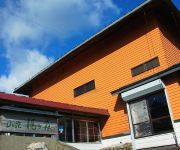
(RYOKAN) Sanso Kajigamori
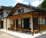
(RYOKAN) Oyama no Yado Michitsuji
Tabibito no Yado Nakone
Videos from this area
These are videos related to the place based on their proximity to this place.
男子10人四国旅行その2(Chor.Draft)
毎週新動画を公開中!〕 Chor.Draftのオフショット! メンバーで四国へ行ってきました 協力 ホテル秘境の湯 その1はコチラ http://youtu.be/1ujmtUFj8jA.
JR四国 土讃線 春の土佐路 上り特急 南風 2011.4
春の土佐路を北へ上る南風です。タイトル以降は路順に従って編集してあります。 BGMなし。 撮影時に同時録音した、走行音・春風・踏切の警報...
Videos provided by Youtube are under the copyright of their owners.
Attractions and noteworthy things
Distances are based on the centre of the city/town and sightseeing location. This list contains brief abstracts about monuments, holiday activities, national parcs, museums, organisations and more from the area as well as interesting facts about the region itself. Where available, you'll find the corresponding homepage. Otherwise the related wikipedia article.
Toyonaga Station
Toyonaga Station is a railway station in Ōtoyo, Nagaoka District, Kōchi Prefecture, Japan.
Ōtaguchi Station
Ōtaguchi Station is a railway station in Ōtoyo, Nagaoka District, Kōchi Prefecture, Japan.
Tosa-Ananai Station
Tosa-Ananai Station is a railway station in Ōtoyo, Nagaoka District, Kōchi Prefecture, Japan.


!['110718_新高須TN[国道439号-徳島県徳島市方面]' preview picture of video '110718_新高須TN[国道439号-徳島県徳島市方面]'](https://img.youtube.com/vi/7dZx_Nqsvqs/mqdefault.jpg)
!['110717_桧生TN[高知道-窪川IC方面]' preview picture of video '110717_桧生TN[高知道-窪川IC方面]'](https://img.youtube.com/vi/qSu5yJnFvqY/mqdefault.jpg)


