Safety Score: 2,8 of 5.0 based on data from 9 authorites. Meaning we advice caution when travelling to Japan.
Travel warnings are updated daily. Source: Travel Warning Japan. Last Update: 2024-08-13 08:21:03
Discover Matsuzaki
Matsuzaki in Hata-gun (Kochi) is a town in Japan about 444 mi (or 715 km) south-west of Tokyo, the country's capital city.
Current time in Matsuzaki is now 11:39 AM (Saturday). The local timezone is named Asia / Tokyo with an UTC offset of 9 hours. We know of 11 airports near Matsuzaki, of which 3 are larger airports. The closest airport in Japan is Matsuyama Airport in a distance of 73 mi (or 118 km), North. Besides the airports, there are other travel options available (check left side).
There are two Unesco world heritage sites nearby. The closest heritage site in Japan is Itsukushima Shinto Shrine in a distance of 109 mi (or 175 km), North. Looking for a place to stay? we compiled a list of available hotels close to the map centre further down the page.
When in this area, you might want to pay a visit to some of the following locations: Sukumo, Tosashimizu, Shimanto, Uwajima and Seiyo. To further explore this place, just scroll down and browse the available info.
Local weather forecast
Todays Local Weather Conditions & Forecast: 20°C / 68 °F
| Morning Temperature | 13°C / 56 °F |
| Evening Temperature | 16°C / 61 °F |
| Night Temperature | 13°C / 56 °F |
| Chance of rainfall | 0% |
| Air Humidity | 63% |
| Air Pressure | 1025 hPa |
| Wind Speed | Light breeze with 3 km/h (2 mph) from West |
| Cloud Conditions | Few clouds, covering 21% of sky |
| General Conditions | Few clouds |
Sunday, 10th of November 2024
21°C (70 °F)
16°C (60 °F)
Light rain, light breeze, broken clouds.
Monday, 11th of November 2024
17°C (63 °F)
15°C (59 °F)
Moderate rain, calm, overcast clouds.
Tuesday, 12th of November 2024
23°C (73 °F)
14°C (57 °F)
Sky is clear, calm, clear sky.
Hotels and Places to Stay
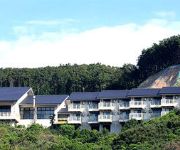
Hotel Bellreef Otsuki
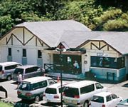
Otsuki Ecology Camping Ground
Videos from this area
These are videos related to the place based on their proximity to this place.
[V0426] 西四国3:泊浦漁港から狭路のタッチ漁港で戻り宿毛市の栄喜湾へ
動画開始地点: 地図拡大表示の中心点 (RECORDING START POINT): Center point of this map http://maps.live.com/?v=2&cp=32.825310420424906~132.65541173937555&lvl=13&dir=0...
[ウォールハンドボール]日本初!正式ワンウォールコート 宿毛
1-wall handball in Sukumo city Japan. ウォールハンドボール(ワンウォール)ダブルスのデモンストレーション動画です。 日本初の正式ワンウォールコート...
[V0427] 西四国4:栄喜漁港から小筑紫湾や内外ノ浦漁港や宿毛湾漁港へ
動画開始地点: 地図拡大表示の中心点 (RECORDING START POINT): Center point of this map http://maps.live.com/?v=2&cp=32.87761555857076~132.70904519084044&lvl=13&dir=0&...
[V0105] 030602 高知県西岸の大堂海岸沿いの狭路を過ぎ柏島経由で安満地漁港を越えたが夕暮れ迎えUターン Japanese country roads; Kashiwajima Island
動画開始地点: 地図拡大表示の中心点 (RECORDING START POINT): Center point of this map http://maps.live.com/default.aspx?v=2&FORM=LMLTCP&cp=32.781646~132.732887&style...
[V0424] 西四国1:周防形漁港から大堂海岸で野猿に囲まれ新柏島大橋へ
動画開始地点: 地図拡大表示の中心点 (RECORDING START POINT): Center point of this map http://maps.live.com/?v=2&cp=32.79744743711046~132.716812868144&lvl=13&dir=0&st...
高知県 大堂海岸
大堂海岸の詳細情報や地図はこちら↓ http://www.healing-japan.tv/spot-96.html 高知県の映像素材の一覧は、以下のページをご参照ください。 http://www...
柏島でシュノーケリング2014年7月26日その1_怒るクマノミ
高知県幡多郡大月町柏島の竜ヶ浜です。正確には柏島の近くの海岸ですけどね。 中央部の砂地エリア周辺の岩場にシコロサンゴが生育しており,...
Videos provided by Youtube are under the copyright of their owners.


!['[V0426] 西四国3:泊浦漁港から狭路のタッチ漁港で戻り宿毛市の栄喜湾へ' preview picture of video '[V0426] 西四国3:泊浦漁港から狭路のタッチ漁港で戻り宿毛市の栄喜湾へ'](https://img.youtube.com/vi/a6LK2XYhTxw/mqdefault.jpg)
!['[ウォールハンドボール]日本初!正式ワンウォールコート 宿毛' preview picture of video '[ウォールハンドボール]日本初!正式ワンウォールコート 宿毛'](https://img.youtube.com/vi/r99XQWKX5Mw/mqdefault.jpg)
!['[V0427] 西四国4:栄喜漁港から小筑紫湾や内外ノ浦漁港や宿毛湾漁港へ' preview picture of video '[V0427] 西四国4:栄喜漁港から小筑紫湾や内外ノ浦漁港や宿毛湾漁港へ'](https://img.youtube.com/vi/6NTov61IZQY/mqdefault.jpg)
!['[V0105] 030602 高知県西岸の大堂海岸沿いの狭路を過ぎ柏島経由で安満地漁港を越えたが夕暮れ迎えUターン Japanese country roads; Kashiwajima Island' preview picture of video '[V0105] 030602 高知県西岸の大堂海岸沿いの狭路を過ぎ柏島経由で安満地漁港を越えたが夕暮れ迎えUターン Japanese country roads; Kashiwajima Island'](https://img.youtube.com/vi/lXNz64UEKtI/mqdefault.jpg)
!['[V0424] 西四国1:周防形漁港から大堂海岸で野猿に囲まれ新柏島大橋へ' preview picture of video '[V0424] 西四国1:周防形漁港から大堂海岸で野猿に囲まれ新柏島大橋へ'](https://img.youtube.com/vi/onFQPEVpX2c/mqdefault.jpg)


