Safety Score: 2,8 of 5.0 based on data from 9 authorites. Meaning we advice caution when travelling to Japan.
Travel warnings are updated daily. Source: Travel Warning Japan. Last Update: 2024-08-13 08:21:03
Discover Heinokoshi
The district Heinokoshi of in Miura-gun (Kanagawa) is a subburb in Japan about 30 mi south of Tokyo, the country's capital city.
If you need a hotel, we compiled a list of available hotels close to the map centre further down the page.
While being here, you might want to pay a visit to some of the following locations: Zushi, Kamakura, Yokosuka, Miura and Fujisawa. To further explore this place, just scroll down and browse the available info.
Local weather forecast
Todays Local Weather Conditions & Forecast: 13°C / 55 °F
| Morning Temperature | 11°C / 52 °F |
| Evening Temperature | 13°C / 56 °F |
| Night Temperature | 14°C / 56 °F |
| Chance of rainfall | 2% |
| Air Humidity | 78% |
| Air Pressure | 1015 hPa |
| Wind Speed | Fresh Breeze with 14 km/h (9 mph) from South |
| Cloud Conditions | Overcast clouds, covering 100% of sky |
| General Conditions | Light rain |
Friday, 22nd of November 2024
14°C (58 °F)
14°C (58 °F)
Broken clouds, moderate breeze.
Saturday, 23rd of November 2024
12°C (54 °F)
12°C (53 °F)
Scattered clouds, fresh breeze.
Sunday, 24th of November 2024
12°C (54 °F)
13°C (56 °F)
Broken clouds, moderate breeze.
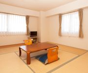
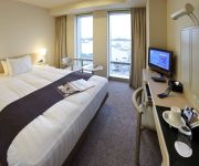
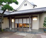
Hotels and Places to Stay
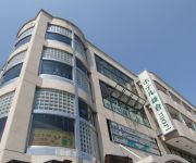
Kamakura Park Hotel
Hotel Kamakura Mori
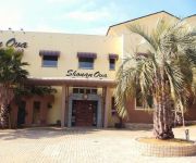
Shonan OVA
Hayamakan (Kanagawa)
(RYOKAN) Kotsubo Kaigan Rinka
Sajima Marina Hotel
Hotel Mets Kamakura Ofuna
Mercure Yokosuka
(RYOKAN) Arasakikaion Sagamiya
(RYOKAN) Kaihinso Kamakura
Videos from this area
These are videos related to the place based on their proximity to this place.
Zushi Marina 逗子マリーナ
神奈川県逗子市にある逗子マリーナです。 Zushi Marina Kamakura Kanagawa Japan. DJI Phantom 逗子マリーナ(ずしマリーナ)は、神奈川県逗子市小坪の相模湾...
ZUSHI MARINA aerial shot by DJI Phantom2 + GoPro HERO3
DJI Phantom2 + GoPro HERO3によるリビエラ逗子マリーナの空撮ムービー。 協力 リビエラシネマスタジオ http://www.riviera-i.jp/ リビエラ逗子マリーナ...
逗子Zushi BC定例活動 8月7日(土) 2010
Zushi Beachclub 定例活動 ウインドウインドサーフィン シーカヤック ディンギーヨット アウトリガーカヌー シーカヤック サーフィンなどの...
逗子zushi BC 海の日イベント 7月19日(月祭)2010
7月19日(土)逗子ビーチクラブ海の日特別イベント ウインドサーフィン シーカヤック ディンギーヨット アウトリガーカヌー シーカヤッ...
湘南のカフェ 「なぎさ橋珈琲」 逗子デニーズ跡 Nagisa-bashi coffee shop at Zushi
かの有名デニーズ「逗デニ」跡地に「なぎさ橋珈琲」というカフェができていた。 Some other videos https://www.youtube.com/user/tsugiyamanet 逗子デニーズは高...
[V0042] 020113 湘南相模湾の国道134号で江ノ電とすれ違い変貌を遂げた片瀬鵠沼海岸の江ノ島大橋を渡る Japanese country roads; Syonan
動画開始地点: 地図拡大表示の中心点 (RECORDING START POINT): Center point of this map http://maps.live.com/default.aspx?v=2&FORM=LMLTCP&cp=35.286712~139.573951&style...
Morito beach, Hayama, Japan 葉山の森戸海岸
This was filmed back in December, 2013. But the day was warm and sunny. Thank you for watching. (^.^)
Let explore the forest of seaweed of Hayama while rowing a stand up paddle.
Listen with headphones.The noise of paddle tickles your ears. A camera WG-M1 has been underwater fixed behind the board.
Action Cam WG-M1 Waterproof Test in Hayama, Japan
This is a test to use the action camera WG-M1 for Stand Up Paddling.
Videos provided by Youtube are under the copyright of their owners.
Attractions and noteworthy things
Distances are based on the centre of the city/town and sightseeing location. This list contains brief abstracts about monuments, holiday activities, national parcs, museums, organisations and more from the area as well as interesting facts about the region itself. Where available, you'll find the corresponding homepage. Otherwise the related wikipedia article.
Oppama Station
Oppama Station is a railway station operated by the Keikyū Main Line located in Yokosuka, Kanagawa Prefecture, Japan. It is located 42.8 rail kilometers from the northern terminus of the Keikyū Main Line at Shinagawa Station, in Tokyo.
Keikyū Taura Station
Keikyū Taura Station is a railway station operated by the Keikyū Main Line located in Yokosuka, Kanagawa Prefecture, Japan. It is located 44.5 rail kilometers from the northern terminus of the Keikyū Main Line at Shinagawa Station, in Tokyo.
Anjinzuka Station
Anjinzuka Station is a railway station operated by the Keikyū Main Line located in Yokosuka, Kanagawa Prefecture, Japan. It is located 47.2 rail kilometers from the northern terminus of the Keikyū Main Line at Shinagawa Station, in Tokyo.
Zushi Station
Zushi Station is a railway station in Yokosuka, Kanagawa, Japan, operated by East Japan Railway Company (JR East). It is located 8.4 kilometers from the junction at Ōfuna Station, and 57.8 kilometers from Tokyo Station.
Mutsuura Station
Mutsuura Station is a railway station operated by Keikyū Zushi Line located in Kanazawa ward, Yokohama, Kanagawa Prefecture, Japan. It is located 1.3 rail kilometers from the Kanazawa Hakkei junction, and 42.2 rail kilometers from the opposing northern terminus at Shinagawa Station.
Jimmuji Station
Jimmuji Station is a railway station operated by Keikyu on the Zushi Line located in Zushi, Kanagawa, Japan. It is located 4.1 rail kilometers from the junction at Kanazawa Hakkei Station, and 45.0 rail kilometers from the northern terminus at Shinagawa Station.
Shin-Zushi Station
Shin-Zushi Station is a railway station operated by Keikyū Zushi Line located in Zushi, Kanagawa Prefecture, Japan. It is the southern terminus of the Zushi Line, and is located 5.9 rail kilometers from the Kanazawa Hakkei junction, and 46.8 kilometers from the opposing northern terminus at Shinagawa Station.
Wakae Island
Wakae Island is an artificial island, the oldest in Japan, now in ruins. The name means "Waka Bay Island" from Waka, Zaimokuza's old name (see the text of the commemorative stele, below). Its remains are located at the east end of Zaimokuza Beach near Kamakura and are still visible at low tide. It was built in 1232 and, in spite of its state of disrepair, it has been declared a national Historic Site because it is the sole surviving example of an artificial harbor from the Kamakura Period.
Graduate University for Advanced Studies
The Graduate University for Advanced Studies is one of the national universities of Japan. It is located in the town of Hayama in Kanagawa Prefecture. It was established in 1988. Its nickname is Sōkendai . From 1988 to 1995 the university's headquarters was located in Nagatsuta, Midori-ku, Yokohama.
An'yō-in (Kamakura)
An'yō-in is a Jōdo shū Buddhist temple in Kamakura, Kanagawa, Japan. Famous for its azaleas, it was named after its founder's (great historical figure Hōjō Masako) posthumous name. The main object of worship is Amida Nyorai, but it also enshrines Senju Kannon, Goddess of Mercy. An’yō-in is Number three of the 33 temples of the Bandō Sanjūsankasho pilgrimage circuit.
Zaimokuza
is an area within the Kamakura, Kanagawa Pref. , in Japan that runs along the sea from Cape Iijima near Kotsubo harbor to the estuary of the Namerigawa. The relation between the beach's name and that of its neighboring areas is complex. Although Yuigahama is in fact the entire 3.2 km beach that goes from Inamuragasaki to Zaimokuza's Iijima cape, the name is usually used to indicate just its half west of the Namerigawa river, while the eastern half is called Zaimokuza Beach .
Moto Hachiman
Moto Hachiman is a small but very old and historically important Shinto shrine in Kamakura, Kanagawa Pref. , Japan.
Hayama Imperial Villa
, located in the town of Hayama, Kanagawa Prefecture, Japan is a residence owned by the Japanese Imperial Family, and used on infrequent intervals as an informal winter retreat.
Ōmachi (Kanagawa)
Ōmachi is a locality (a machi or chō) in Kamakura, Kanagawa prefecture, Japan, defined as the part of town south of the Ebisubashi bridge on the Namerigawa. The part of town north of the same bridge is called Komachi .
Kantō kubō
(also called Kantō gosho, Kamakura kubō, or Kamakura gosho) was a title equivalent to shogun assumed by Ashikaga Motouji after his nomination to Kantō kanrei, or deputy shogun for the Kamakura-fu, in 1349. Motouji transferred his original title to the Uesugi family, which had previously held the hereditary title of shitsuji, and would thereafter provide the Kantō kanrei.
Nikaidō
is the name of one of the administrative units of Kamakura, a city located in Kanagawa, Japan, about 50 km south-south-west of Tokyo. Nikaidō lies immediately to the east of Nishi Mikado and Yukinoshita, and used to be called Higashi Mikado. The name is still sometimes used. In it lie famous temples and shrines like Zuisen-ji, Egara Tenjinsha, Kamakura-gū and Kakuon-ji. It's in Nikaidō that first Kamakura shogun Minamoto no Yoritomo built Yōfuku-ji, one of his most important temples.
Myōhō–ji
Myōhō–ji is a Buddhist temple of the Nichiren sect in Kamakura, Kanagawa, Japan. It is one of a group of three built near the site in Matsubagayatsu, or the Valley of Pine Needles, where Nichiren, founder of the Buddhist sect that bears his name, is supposed to have had his hut. The temple has also close ties with Prince Morinaga and the Imperial House.
Ankokuron-ji
Ankokuron-ji is a Buddhist temple of the Nichiren sect in Kamakura, Kanagawa, Japan. It is one of a group of three built near the site in Matsubagayatsu (Valley of Pine Needles where Nichiren, founder of the Buddhist sect that bears his name, is supposed to have had his hut.
Chōshō-ji
Chōshō-ji is a Buddhist temple of the Nichiren Shū in Kamakura, Kanagawa, Japan. It's one of a group of three built near the site in Matsubagayatsu (Valley of Pine Needles where Nichiren, founder of the Buddhist sect that bears his name, is supposed to have had his hut. The first part of its name derives from the founder's last name, the second is an alternative reading of the characters for Nagakatsu, the founder's first name.
Kōmyō-ji (Kamakura)
is a Buddhist temple of the Jōdo sect in Zaimokuza, near Kamakura, Japan, the only major one in the city to be close to the sea. Kōmyō-ji is number one among the Kantō Jūhachi Danrin, a group of 18 Jōdo temples established during the Edo period by Tokugawa Ieyasu, and dedicated to both the training of priests and scholarly research. It is also the sect's head temple for the Kantō region.
Jōmyō-ji (Kamakura)
is a Zen Buddhist temple of the Rinzai sect, Kenchō-ji school, in Kamakura, Kanagawa Prefecture, Japan. Jōmyō-ji is Number Five of the five temples known as Kamakura Gozan ("Kamakura's Five Mountains"), and the only one of the five not founded by a member of the Hōjō clan. Jōmyō-ji has instead, as nearby Zuisen-ji, deep ties with the Ashikaga clan, and was one of the family's funeral temples. For this reason the family's kamon, or crest, is ubiquitous on its premises.
Sugimoto-dera
Sugimoto-dera is a Buddhist temple in Kamakura, Kanagawa Prefecture, Japan, one of the oldest temple in Kamakura and, together with Hōkai-ji, the only one of the Tendai denomination. The temple is Number one of the Bandō Sanjūsankasho pilgrimage circuit. Two of the three statues of goddess Kannon it enshrines are Important Cultural Properties. Sugimotodera is nicknamed Geba Kannon ("Dismount Kannon"), because horsemen never failed to dismount from their steeds when they passed by.
Higashi-Zushi Station
Higashi-Zushi Station is a railway station operated by JR East's Yokosuka Line located in Zushi, Kanagawa, Japan. It is located 10.4 kilometers from Ōfuna switch point, and 59.8 kilometers from the Tokyo Station.
Taura Station
Taura Station is a railway station operated by JR East's Yokosuka Line located in Yokosuka, Kanagawa, Japan. It is located 13.8 kilometers from Ōfuna switch point, and 63.2 kilometers from the Tokyo Station.
Hōkoku-ji
Hōkoku-ji is an old temple in the Kenchō-ji school of the Rinzai sect of Zen Buddhism located in Kamakura, Japan. Famous for its bamboo garden, it is also known as "Bamboo Temple". A statue of Gautama Buddha, called Shaka Nyorai in Japanese, in a sacred hall is the temple's principal image. The original of a statue of Sho Kan'non is on display at the Kamakura Museum of National Treasures.







!['[V0042] 020113 湘南相模湾の国道134号で江ノ電とすれ違い変貌を遂げた片瀬鵠沼海岸の江ノ島大橋を渡る Japanese country roads; Syonan' preview picture of video '[V0042] 020113 湘南相模湾の国道134号で江ノ電とすれ違い変貌を遂げた片瀬鵠沼海岸の江ノ島大橋を渡る Japanese country roads; Syonan'](https://img.youtube.com/vi/DP5UDuPEUZs/mqdefault.jpg)


