Safety Score: 2,8 of 5.0 based on data from 9 authorites. Meaning we advice caution when travelling to Japan.
Travel warnings are updated daily. Source: Travel Warning Japan. Last Update: 2024-08-13 08:21:03
Delve into Kamioda
Kamioda in Ashigarakami-gun (Kanagawa) is a town located in Japan about 41 mi (or 66 km) south-west of Tokyo, the country's capital town.
Time in Kamioda is now 12:43 AM (Friday). The local timezone is named Asia / Tokyo with an UTC offset of 9 hours. We know of 9 airports closer to Kamioda, of which 3 are larger airports. The closest airport in Japan is Atsugi Naval Air Facility in a distance of 23 mi (or 37 km), East. Besides the airports, there are other travel options available (check left side).
There are several Unesco world heritage sites nearby. The closest heritage site in Japan is Fujisan, sacred place and source of artistic inspiration in a distance of 18 mi (or 29 km), West. We saw 2 points of interest near this location. In need of a room? We compiled a list of available hotels close to the map centre further down the page.
Since you are here already, you might want to pay a visit to some of the following locations: Minamiashigara, Gotenba, Hadano, Tsuru and Odawara. To further explore this place, just scroll down and browse the available info.
Local weather forecast
Todays Local Weather Conditions & Forecast: 12°C / 53 °F
| Morning Temperature | 8°C / 46 °F |
| Evening Temperature | 10°C / 49 °F |
| Night Temperature | 9°C / 48 °F |
| Chance of rainfall | 0% |
| Air Humidity | 84% |
| Air Pressure | 1015 hPa |
| Wind Speed | Light breeze with 3 km/h (2 mph) from North-West |
| Cloud Conditions | Overcast clouds, covering 96% of sky |
| General Conditions | Light rain |
Friday, 22nd of November 2024
13°C (55 °F)
8°C (46 °F)
Scattered clouds, gentle breeze.
Saturday, 23rd of November 2024
9°C (48 °F)
6°C (44 °F)
Light rain, light breeze, broken clouds.
Sunday, 24th of November 2024
10°C (50 °F)
6°C (43 °F)
Light rain, light breeze, broken clouds.
Hotels and Places to Stay
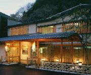
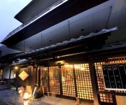
(RYOKAN) Nakagawa Onsen Gyozantei Yamabuki
(RYOKAN) Nakagawa Onsen Shingenkan
(RYOKAN) Ochiaikan
(RYOKAN) Hokizawaso
Videos from this area
These are videos related to the place based on their proximity to this place.
平成27年 山北町<道祖神祭>花車・神輿巡行(室生神社~樋口橋)
まつり巡行記<申>2015年1月18日 神奈川県足柄上郡山北町 例年1月の旧正月におこなわれる山北町の伝統行事で、華やかに飾り付けられた花車...
東京から滋賀 高速 SA・PA全部寄ってみた 05 鮎沢PA ⇒ 足柄SA (東名高速道路) 【車載動画】Tokyo to Osaka Expressway All parking Japan.
東名高速道路 下り、鮎沢PAから足柄SAまでの約9.1kmです 06 → http://youtu.be/yLtxTVwlUJY 04 → http://youtu.be/SRho6lXhd_g リスト → https://www.youtube.com/playlist?list=P...
国道246号線(小山町) 等倍速 highway construction.avi
By ROAD WORK SPEED LIMIT, coordinating movement.I wait for passing while massaging a calf.道路工事中で、交互通行。ふくらはぎをマサージしながら、通行を待つ。場所...
ステディカムで山歩き『不老山』 - 富士箱根トレイル
『不老山』(神奈川県足柄上郡山北町) 2011年4月24日(日)08時34分〜10時34分 「登山口〜不老山山頂」 - 富士箱根トレイル Hague Mini Motion-Camを使...
Trailwalker Japan 2012: CP7-CP8
Team #001 SS Bonjour☆2012 100kms with 36 hours 44 minutes! http://trailwalker.jp/
Minato Mirai - Yokohama みなとみらい21 横浜市
Minatomirai in Yokohama. Just a short clip of the Landmark Tower, Minatomirai & Ferriswheel in "Cosmoworld".
CRF250L 美味しそうだったので天重を食べに行った 後編
天重を食べに行きます!目的地は道の駅「山北」です。 久しぶりに富士山を間近でみました。「山北」の水道水が美味しかったw 目当ての天重・...
Videos provided by Youtube are under the copyright of their owners.
Attractions and noteworthy things
Distances are based on the centre of the city/town and sightseeing location. This list contains brief abstracts about monuments, holiday activities, national parcs, museums, organisations and more from the area as well as interesting facts about the region itself. Where available, you'll find the corresponding homepage. Otherwise the related wikipedia article.
Lake Tanzawa
, is a lake located to the east of Mt. Fuji in Yamakita town, Ashigarakami district, in the Kanagawa Prefecture of Japan. It was created due to construction of the Miho dam in 1978. The lake and its surroundings are frequently visited during fall to admire autumn colors.
Miho Dam
The Miho Dam is a multi-purpose dam on the Kawauchi River, a tributary stream of the Sakawa River in the town of Yamakita, Ashigarakami District, Kanagawa Prefecture on the island of Honshū, Japan. The dam is located within the borders of the Tanzawa-Ōyama Quasi-National Park.


