Safety Score: 2,8 of 5.0 based on data from 9 authorites. Meaning we advice caution when travelling to Japan.
Travel warnings are updated daily. Source: Travel Warning Japan. Last Update: 2024-08-13 08:21:03
Discover Kunugibaru
Kunugibaru in Tarumizu Shi (Kagoshima-ken) is a place in Japan about 593 mi (or 954 km) south-west of Tokyo, the country's capital city.
Current time in Kunugibaru is now 02:04 PM (Wednesday). The local timezone is named Asia / Tokyo with an UTC offset of 9 hours. We know of 8 airports near Kunugibaru, of which two are larger airports. The closest airport in Japan is Kagoshima Airport in a distance of 23 mi (or 38 km), North. Besides the airports, there are other travel options available (check left side).
There is one Unesco world heritage site nearby. It's Yakushima in a distance of 79 mi (or 127 km), South. If you need a hotel, we compiled a list of available hotels close to the map centre further down the page.
While being here, you might want to pay a visit to some of the following locations: Tarumizu, Kanoya, Kagoshima, Ibusuki and Kirishima. To further explore this place, just scroll down and browse the available info.
Local weather forecast
Todays Local Weather Conditions & Forecast: 16°C / 61 °F
| Morning Temperature | 14°C / 57 °F |
| Evening Temperature | 14°C / 57 °F |
| Night Temperature | 13°C / 55 °F |
| Chance of rainfall | 0% |
| Air Humidity | 62% |
| Air Pressure | 1016 hPa |
| Wind Speed | Fresh Breeze with 17 km/h (10 mph) from East |
| Cloud Conditions | Broken clouds, covering 82% of sky |
| General Conditions | Light rain |
Thursday, 28th of November 2024
14°C (57 °F)
14°C (58 °F)
Light rain, fresh breeze, broken clouds.
Friday, 29th of November 2024
12°C (54 °F)
13°C (55 °F)
Light rain, strong breeze, overcast clouds.
Saturday, 30th of November 2024
12°C (54 °F)
11°C (51 °F)
Light rain, fresh breeze, overcast clouds.
Hotels and Places to Stay
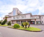
Bayside Hotel Azalea
(RYOKAN) Family Tarumizu
Videos from this area
These are videos related to the place based on their proximity to this place.
[V0050] 020103 大噴火で九州本土と桜島が陸続きになった桜島口から錦江湾沿いの国道220号で旧福山町へ Japanese country roads; Sakurajima
動画開始地点: 地図拡大表示の中心点 (RECORDING START POINT): Center point of this map http://maps.live.com/default.aspx?v=2&FORM=LMLTCP&cp=31.55592~130.697699&style=...
桜島昭和火口爆発的噴火2011/02/06
火 山:桜島 日 時:2011年02月06日19時41分(061041UTC) 第2報 現 象:爆発 有色噴煙:火口上1200m(海抜6600FT) 白色噴煙: 流 向:南...
桜島・錦江湾ドライブ
日本の自然、桜島・錦江湾ドライブ、Nature of Japan,To drive the Sakurajima・Kinkou -bay at sunset, リサーチアンドデザイン http://www.rad-c.com.
Eruption of SAKURAJIMA! Scary...!
I happened to see eruption of Mt. Sakurajima! For more information about Kagoshima, Japan, E-mail me at: kshoichiro@gmail.com Visit my WEBSITE at: http://www.kagoshimalove.com Follow me on...
[桜島南側おすすめコース] 桜島砂防センタ→有村展望台→埋没鳥居(2倍速).Recommended course of Sakurajima.
桜島の南側のオススメコースをめぐる車載動画(2倍速)です。順序は、桜島国際火山砂防センターの駐車場→有村溶岩展望所の駐車場→黒神埋没鳥...
Videos provided by Youtube are under the copyright of their owners.


!['[V0050] 020103 大噴火で九州本土と桜島が陸続きになった桜島口から錦江湾沿いの国道220号で旧福山町へ Japanese country roads; Sakurajima' preview picture of video '[V0050] 020103 大噴火で九州本土と桜島が陸続きになった桜島口から錦江湾沿いの国道220号で旧福山町へ Japanese country roads; Sakurajima'](https://img.youtube.com/vi/JZfTi5kn3Qo/mqdefault.jpg)


!['[桜島南側おすすめコース] 桜島砂防センタ→有村展望台→埋没鳥居(2倍速).Recommended course of Sakurajima.' preview picture of video '[桜島南側おすすめコース] 桜島砂防センタ→有村展望台→埋没鳥居(2倍速).Recommended course of Sakurajima.'](https://img.youtube.com/vi/2DiIV6sMbDA/mqdefault.jpg)


