Safety Score: 2,8 of 5.0 based on data from 9 authorites. Meaning we advice caution when travelling to Japan.
Travel warnings are updated daily. Source: Travel Warning Japan. Last Update: 2024-08-13 08:21:03
Discover Uraharu
Uraharu in Ōshima-gun (Kagoshima-ken) is a town in Japan about 766 mi (or 1,233 km) south-west of Tokyo, the country's capital city.
Current time in Uraharu is now 04:16 AM (Wednesday). The local timezone is named Asia / Tokyo with an UTC offset of 9 hours. We know of 9 airports near Uraharu, of which one is a larger airport. The closest airport in Japan is Kikai Airport in a distance of 3 mi (or 5 km), North-West. Besides the airports, there are other travel options available (check left side).
Looking for a place to stay? we compiled a list of available hotels close to the map centre further down the page.
When in this area, you might want to pay a visit to some of the following locations: Amami, Nago, Nishinoomote, Uruma and Okinawa. To further explore this place, just scroll down and browse the available info.
Local weather forecast
Todays Local Weather Conditions & Forecast: 20°C / 69 °F
| Morning Temperature | 17°C / 63 °F |
| Evening Temperature | 19°C / 66 °F |
| Night Temperature | 18°C / 65 °F |
| Chance of rainfall | 0% |
| Air Humidity | 54% |
| Air Pressure | 1019 hPa |
| Wind Speed | Gentle Breeze with 8 km/h (5 mph) from South |
| Cloud Conditions | Clear sky, covering 1% of sky |
| General Conditions | Sky is clear |
Wednesday, 4th of December 2024
19°C (67 °F)
17°C (62 °F)
Sky is clear, moderate breeze, clear sky.
Thursday, 5th of December 2024
18°C (64 °F)
16°C (61 °F)
Light rain, moderate breeze, overcast clouds.
Friday, 6th of December 2024
17°C (63 °F)
17°C (63 °F)
Light rain, moderate breeze, overcast clouds.
Hotels and Places to Stay
Business Hotel Kikai (Kikaijima)
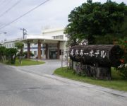
Kikai Daiichi Hotel (Kikaijima)
Videos from this area
These are videos related to the place based on their proximity to this place.
B-unit 2006.10.27-01 B Blue (BOOWY cover) in 喜界島SABANI
BOOWYのコピーユニット、B-unitが2006年10月27日に、喜界島のライヴハウスSABANIで演ったBOOWYのコピーライヴです。 http://catsops.blog.fc2.com/
B-unit 2006.10.27-02 Honky tonky crazy (BOOWY cover) in 喜界島SABANI
2006年10月27日に、喜界島のライヴハウスSABANIで演ったBOOWYのコピーです。
日本で二番目に短い定期航空路線 奄美⇒喜界島
奄美空港RWY21を離陸して、喜界空港RWY07に着陸する、JACのJA8594(SAAB340B) 日本で一番短い定期航空路線は、沖縄県の南大東島⇔北大東島.
B-unit 2006.10.27-04 Beat sweet (BOOWY cover) in 喜界島SABANI
2006年10月27日に、喜界島のライヴハウスSABANIで演ったBOOWYのコピーです。
喜界空港RWY25に着陸するJA8900(SAAB340B)
雨の中喜界空港に着陸する日本エアコミューターのJA8900(SAAB340B) 奄美空港の北側、万屋漁港を抜け、喜界空港と平行に西から東に飛び、 喜界空...
Videos provided by Youtube are under the copyright of their owners.
Attractions and noteworthy things
Distances are based on the centre of the city/town and sightseeing location. This list contains brief abstracts about monuments, holiday activities, national parcs, museums, organisations and more from the area as well as interesting facts about the region itself. Where available, you'll find the corresponding homepage. Otherwise the related wikipedia article.
Kikai Island
Kikai Island is an island in the Amami Islands, which are part of the Ryukyu Archipelago, Japan. It lies about 25 km east of Amami Ōshima, 380 km south of Kagoshima mainland, and 330 km north of Okinawa. Administratively, the whole island belongs to Kikai Town, Kagoshima Prefecture.


