Safety Score: 2,8 of 5.0 based on data from 9 authorites. Meaning we advice caution when travelling to Japan.
Travel warnings are updated daily. Source: Travel Warning Japan. Last Update: 2024-08-13 08:21:03
Discover Tachibana
Tachibana in Shōzu-gun (Kagawa-ken) is a town in Japan about 313 mi (or 504 km) west of Tokyo, the country's capital city.
Current time in Tachibana is now 09:25 AM (Sunday). The local timezone is named Asia / Tokyo with an UTC offset of 9 hours. We know of 9 airports near Tachibana, of which 3 are larger airports. The closest airport in Japan is Takamatsu Airport in a distance of 27 mi (or 43 km), South-West. Besides the airports, there are other travel options available (check left side).
There are several Unesco world heritage sites nearby. The closest heritage site in Japan is Himeji-jo in a distance of 31 mi (or 50 km), North-East. Looking for a place to stay? we compiled a list of available hotels close to the map centre further down the page.
When in this area, you might want to pay a visit to some of the following locations: Sanuki, Setouchi, Ako, Higashikagawa and Bizen. To further explore this place, just scroll down and browse the available info.
Local weather forecast
Todays Local Weather Conditions & Forecast: 12°C / 53 °F
| Morning Temperature | 9°C / 49 °F |
| Evening Temperature | 12°C / 54 °F |
| Night Temperature | 10°C / 51 °F |
| Chance of rainfall | 0% |
| Air Humidity | 58% |
| Air Pressure | 1028 hPa |
| Wind Speed | Gentle Breeze with 7 km/h (5 mph) from South-East |
| Cloud Conditions | Few clouds, covering 15% of sky |
| General Conditions | Few clouds |
Monday, 25th of November 2024
12°C (54 °F)
12°C (53 °F)
Sky is clear, gentle breeze, clear sky.
Tuesday, 26th of November 2024
18°C (64 °F)
14°C (57 °F)
Heavy intensity rain, fresh breeze, overcast clouds.
Wednesday, 27th of November 2024
14°C (58 °F)
13°C (56 °F)
Broken clouds, fresh breeze.
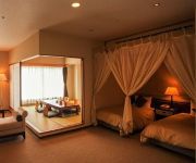
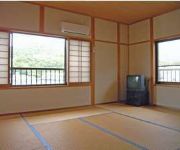
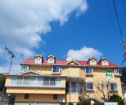
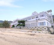
Hotels and Places to Stay
(RYOKAN) Chidori (Shodoshima)
Bay Resort Hotel Shodoshima
Aqua (Shodoshima)
Misaki (Shodoshima)
Pension Vingt-Quatre Yeux
(RYOKAN) Katsuya Ryokan (Shodoshima)
Olivex Uchinomi (Shodoshima)
Shodoshima Olive Youth Hostel
Videos from this area
These are videos related to the place based on their proximity to this place.
[V0096] 031228 瀬戸内最高峰を持つ小豆島で坂手湾から内海湾沿いの映画村に向かい渓谷美の寒霞渓へ登る Japanese country roads; Syodoshima Island Kankakei
動画開始地点: 地図拡大表示の中心点 (RECORDING START POINT): Center point of this map http://maps.live.com/default.aspx?v=2&FORM=LMLTCP&cp=34.446056~134.330435&style...
Takeshi Kitano's Anger from the Bottom
Takeshi Kitano is taking part in the Setouchi Triennale, with Anger from the Bottom in the town of Sakate on Shodoshima. More details: in English: (coming soon) in French: http://ogijima.fr/takesh...
Flapping flight in Shodoshima
A flight demonstration of the hand-made RC ornithopter for FABLAB Shodoshima. Design, built and flight by: Yusuke Takahashi(Flappingwing) Camera: Mika-san Thanks to: FABLAB Kitakagaya, ...
香川県 小豆島・寒霞渓
小豆島の詳細情報や地図はこちら↓ http://www.healing-japan.tv/spot-73.html 香川県の映像素材の一覧は、以下のページをご参照ください。 http://www.he...
La beauté changeante des quatre saisons de Shodoshima 《Kagawa Japon》
Shodoshima jouer la beauté de chaque saison.
Videos provided by Youtube are under the copyright of their owners.
Attractions and noteworthy things
Distances are based on the centre of the city/town and sightseeing location. This list contains brief abstracts about monuments, holiday activities, national parcs, museums, organisations and more from the area as well as interesting facts about the region itself. Where available, you'll find the corresponding homepage. Otherwise the related wikipedia article.
Kankakei Ropeway
The Kankakei Ropeway is a Japanese aerial lift line in Shōdoshima, Kagawa. This is the only line operated by Shōdoshima Sōgō Kaihatsu . The line opened in 1963. It runs through Kankakei, a gorge on Shōdoshima Island. The gorge is known for its unique view, made by diastrophisms and erosions.
Olive Jinja
Olive Jinja is a Greek-style Shinto shrine on the island of Shōdoshima in the Inland Sea, Kagawa Prefecture, Japan. Constructed in 1973 and standing amidst a grove of olives - a thriving industry on the island - the shrine takes the form of a replica Greek temple, with stylobate, Doric columns, entablature with triglyphs, and bronze pedimental reliefs. There is an annual festival with Greek themes. The shrine is located within Setonaikai National Park.
Kankakei
The gorge of Kankakei is a nationally-designated Place of Scenic Beauty on the island of Shōdo-shima, Kagawa Prefecture, Japan. Part of the Setonaikai National Park, the heights rise to 812 m. The area is celebrated for its Japanese maple trees. Volunteers formed a preservation society in 1898 and when, in 1912, foreigners tried to expropriate the area, a soy sauce magnate stepped in to ensure its preservation. In 1927 Kankakei was selected as one of the 100 Landscapes of Japan.


!['[V0096] 031228 瀬戸内最高峰を持つ小豆島で坂手湾から内海湾沿いの映画村に向かい渓谷美の寒霞渓へ登る Japanese country roads; Syodoshima Island Kankakei' preview picture of video '[V0096] 031228 瀬戸内最高峰を持つ小豆島で坂手湾から内海湾沿いの映画村に向かい渓谷美の寒霞渓へ登る Japanese country roads; Syodoshima Island Kankakei'](https://img.youtube.com/vi/zf_GH2cRFrM/mqdefault.jpg)


