Safety Score: 2,8 of 5.0 based on data from 9 authorites. Meaning we advice caution when travelling to Japan.
Travel warnings are updated daily. Source: Travel Warning Japan. Last Update: 2024-08-13 08:21:03
Discover Ryōri
Ryōri in Ōfunato-shi (Iwate) is a place in Japan about 259 mi (or 417 km) north-east of Tokyo, the country's capital city.
Current time in Ryōri is now 06:40 AM (Saturday). The local timezone is named Asia / Tokyo with an UTC offset of 9 hours. We know of 8 airports near Ryōri. The closest airport in Japan is Hanamaki Airport in a distance of 44 mi (or 71 km), North-West. Besides the airports, there are other travel options available (check left side).
There are two Unesco world heritage sites nearby. The closest heritage site in Japan is Hiraizumi – Temples, Gardens and Archaeological Sites Representing the Buddhist Pure Land in a distance of 37 mi (or 60 km), West. If you need a hotel, we compiled a list of available hotels close to the map centre further down the page.
While being here, you might want to pay a visit to some of the following locations: Ofunato, Rikuzentakata, Kamaishi, Kesennuma and Tono. To further explore this place, just scroll down and browse the available info.
Local weather forecast
Todays Local Weather Conditions & Forecast: 15°C / 58 °F
| Morning Temperature | 8°C / 46 °F |
| Evening Temperature | 10°C / 50 °F |
| Night Temperature | 9°C / 49 °F |
| Chance of rainfall | 0% |
| Air Humidity | 68% |
| Air Pressure | 1025 hPa |
| Wind Speed | Gentle Breeze with 6 km/h (4 mph) from North-West |
| Cloud Conditions | Scattered clouds, covering 34% of sky |
| General Conditions | Scattered clouds |
Sunday, 17th of November 2024
14°C (58 °F)
11°C (51 °F)
Light rain, gentle breeze, overcast clouds.
Monday, 18th of November 2024
8°C (47 °F)
2°C (36 °F)
Rain and snow, gentle breeze, broken clouds.
Tuesday, 19th of November 2024
6°C (43 °F)
2°C (35 °F)
Broken clouds, gentle breeze.
Hotels and Places to Stay
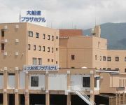
Ofunato Plaza Hotel
Ofunato Onsen
Videos from this area
These are videos related to the place based on their proximity to this place.
東日本大震災・復興状況 大船渡市-2
岩手県道9号線 大船渡合庁前→赤崎町市街→外口 →赤崎町市街→野々田埠頭 15、March 2012 Iwate Prefecture Route 9 (r9) Ofunato Gocho-Mae - Ikawa - Akasaki -...
[V0488] 陸中19:大津波被災前の大船渡湾沿いで蛸ノ浦から碁石海岸へ
動画開始地点: 地図拡大表示の中心点 (RECORDING START POINT): Center point of this map http://maps.live.com/?v=2&cp=39.039727423020814~141.73721053131564&lvl=13&dir=0...
震災11ケ月後の2012・2・27大船渡町笹崎〜下船渡、県道沿い.mp4
東日本大震災の被害を被った大船渡市内、笹崎〜下船渡までの県道沿いの様子。途中、嵩上げ工事がされているが、一部県道から迂回路に回され...
Videos provided by Youtube are under the copyright of their owners.
Attractions and noteworthy things
Distances are based on the centre of the city/town and sightseeing location. This list contains brief abstracts about monuments, holiday activities, national parcs, museums, organisations and more from the area as well as interesting facts about the region itself. Where available, you'll find the corresponding homepage. Otherwise the related wikipedia article.
Ryori
Ryori is a launching site for sounding rockets in Japan at {{#invoke:Coordinates|coord}}{{#coordinates:39|02|N|141|50|E||| | |name= }} in Iwate Prefecture. Ryori has been in use since April 1970, but it is not used for launching satellites.


!['[V0488] 陸中19:大津波被災前の大船渡湾沿いで蛸ノ浦から碁石海岸へ' preview picture of video '[V0488] 陸中19:大津波被災前の大船渡湾沿いで蛸ノ浦から碁石海岸へ'](https://img.youtube.com/vi/MawGv_miF7A/mqdefault.jpg)


