Safety Score: 2,8 of 5.0 based on data from 9 authorites. Meaning we advice caution when travelling to Japan.
Travel warnings are updated daily. Source: Travel Warning Japan. Last Update: 2024-08-13 08:21:03
Delve into Ryōishi
Ryōishi in Kamaishi-shi (Iwate) is located in Japan about 278 mi (or 447 km) north-east of Tokyo, the country's capital town.
Current time in Ryōishi is now 10:19 AM (Saturday). The local timezone is named Asia / Tokyo with an UTC offset of 9 hours. We know of 8 airports close to Ryōishi. The closest airport in Japan is Hanamaki Airport in a distance of 41 mi (or 66 km), West. Besides the airports, there are other travel options available (check left side).
There is one Unesco world heritage site nearby. It's Hiraizumi – Temples, Gardens and Archaeological Sites Representing the Buddhist Pure Land in a distance of 47 mi (or 76 km), South-West. If you need a hotel, we compiled a list of available hotels close to the map centre further down the page.
While being here, you might want to pay a visit to some of the following locations: Kamaishi, Ofunato, Miyako, Tono and Rikuzentakata. To further explore this place, just scroll down and browse the available info.
Local weather forecast
Todays Local Weather Conditions & Forecast: 14°C / 58 °F
| Morning Temperature | 7°C / 44 °F |
| Evening Temperature | 10°C / 49 °F |
| Night Temperature | 9°C / 47 °F |
| Chance of rainfall | 0% |
| Air Humidity | 70% |
| Air Pressure | 1024 hPa |
| Wind Speed | Gentle Breeze with 7 km/h (5 mph) from North |
| Cloud Conditions | Few clouds, covering 13% of sky |
| General Conditions | Few clouds |
Sunday, 17th of November 2024
14°C (58 °F)
9°C (49 °F)
Light rain, gentle breeze, overcast clouds.
Monday, 18th of November 2024
7°C (45 °F)
1°C (35 °F)
Rain and snow, moderate breeze, overcast clouds.
Tuesday, 19th of November 2024
5°C (42 °F)
1°C (34 °F)
Light snow, gentle breeze, broken clouds.
Hotels and Places to Stay
Hamabeno Ryouriyado Houraikan
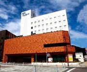
Hotel Sunroute Kamaishi
Hotel Route Inn Kamaishi
White Base Otsuchi
Videos from this area
These are videos related to the place based on their proximity to this place.
Tsunami at Kamaishi port, Iwate Prefecture
The 311 Tsunami at Kamaishi port in Iwate Prefecture, Japan. Notes: This video is somehow unique, since it shows the actual comings and goings of the tsunami and not just the arrival of the...
Tsunami Minami-sanrikucho Miyagi & Kamaishi Iwate
Scenes from the Tsunami at Minami-sanrikucho Miyagi & Kamaishi Iwate on 11th March 2011. Japan Tsunami and aftermath.
Kamaishi Ramen Legacy Lives On!
A distinctive fast-cooking ramen came to be in this steel town with time-pressed workers. Kamaishi was slammed by the tsunami last year, wiping out many of the restaurants that served it. But...
東日本大震災・復興状況 釜石市(部分) 災害復旧工事区間
矢ノ浦橋→新浜町 March 15, 2012 Yanoura Bridge - Niihama-cyo Kamaishi City Iwate Prefecture (Earthquake & Tsunami stricken area.)
岩手県釜石高校「釜高祭」復興支援あこーすてぃく・らいぶ 予告編
"High School Cultural Festival Kamaishi"Link 〜 bonds. 岩手県釜石高校「釜高祭」復興支援あこーすてぃく・らいぶ On Air 2011/09/03 JP 23:00 http://ustre.am/CmBk.
釜石線 C58239 SL銀河 釜石駅の転車台2本撮り Turntable Steam Locomotive
2014年7月14日撮影 今年の春に営業運転デビューし釜石線で活躍中の蒸気機関車C58239「SL銀河」の回転台(ターンテーブル)での方向転換作業をそれぞ...
[VM0311G]_140502_岩手県釜石市07_震災04年目_水海海岸_鳥谷坂トンネル_釜石漁港_小縄崎_釜石港
直前区間(Prev.): [VM0311F] https://www.youtube.com/watch?v=1HLU_DDqxVc&list=PL3XG6QTilWq2EXh2NwUwhOykBcpl_tqfd&index=121 直後区間(Next): [VM0311H] ...
三陸鉄道 全線運行再開 下り 南リアス線 車窓(後編) 吉浜駅~釜石駅 View of the train
2014年4月8日撮影 2011年3月11日東日本大震災が発生し三陸沿岸を走るこの三陸鉄道南リアス線も甚大な被害を受けました。復旧工事を進められていた...
震災前と現在の釜石市の町並みを比較動画(平成24年11月16日)
釜石駅前付近から大町経由、釜石市役所付近まで□ 平成24年11月16日に釜石市から浪板まで自動車で行ってきました。 ドライブレコーダー(車...
Videos provided by Youtube are under the copyright of their owners.
Attractions and noteworthy things
Distances are based on the centre of the city/town and sightseeing location. This list contains brief abstracts about monuments, holiday activities, national parcs, museums, organisations and more from the area as well as interesting facts about the region itself. Where available, you'll find the corresponding homepage. Otherwise the related wikipedia article.
Kamaishi, Iwate
Kamaishi, Iwate is a small, historic city located on the Sanriku rias coast of Iwate, Japan. As of 2008, the city has an estimated population of 41,022 and a density of 92.9 persons per km². The total area is 441.42 km². It is famous in modern times for its steel production and most recently for its promotion of eco-tourism. Fishing and shellfish production are also important economic activities.
Kamaishi Station
Kamaishi Station is a railway station in Kamaishi, Iwate, Japan, operated by East Japan Railway Company (JR East) and the Sanriku Railway.
Unosumai Station
Unosumai Station is a train station in Kamaishi, Iwate Prefecture, Japan.
Ryōishi Station
Ryōishi Station is a train station in Kamaishi, Iwate Prefecture, Japan.


!['[VM0311G]_140502_岩手県釜石市07_震災04年目_水海海岸_鳥谷坂トンネル_釜石漁港_小縄崎_釜石港' preview picture of video '[VM0311G]_140502_岩手県釜石市07_震災04年目_水海海岸_鳥谷坂トンネル_釜石漁港_小縄崎_釜石港'](https://img.youtube.com/vi/B7mQC86YrT4/mqdefault.jpg)


