Safety Score: 2,8 of 5.0 based on data from 9 authorites. Meaning we advice caution when travelling to Japan.
Travel warnings are updated daily. Source: Travel Warning Japan. Last Update: 2024-08-13 08:21:03
Explore Saikai-chinoura
Saikai-chinoura in Hakui Gun (Ishikawa-ken) is located in Japan about 195 mi (or 314 km) north-west of Tokyo, the country's capital.
Local time in Saikai-chinoura is now 09:42 PM (Friday). The local timezone is named Asia / Tokyo with an UTC offset of 9 hours. We know of 10 airports in the wider vicinity of Saikai-chinoura, of which two are larger airports. The closest airport in Japan is Noto Airport in a distance of 19 mi (or 30 km), North-East. Besides the airports, there are other travel options available (check left side).
There is one Unesco world heritage site nearby. It's Historic Villages of Shirakawa-go and Gokayama in a distance of 52 mi (or 84 km), South. If you need a place to sleep, we compiled a list of available hotels close to the map centre further down the page.
Depending on your travel schedule, you might want to pay a visit to some of the following locations: Hakui, Nanao, Wajima, Kahoku and Himi. To further explore this place, just scroll down and browse the available info.
Local weather forecast
Todays Local Weather Conditions & Forecast: 16°C / 61 °F
| Morning Temperature | 14°C / 57 °F |
| Evening Temperature | 15°C / 59 °F |
| Night Temperature | 14°C / 58 °F |
| Chance of rainfall | 0% |
| Air Humidity | 81% |
| Air Pressure | 1020 hPa |
| Wind Speed | Light breeze with 4 km/h (3 mph) from South-West |
| Cloud Conditions | Overcast clouds, covering 100% of sky |
| General Conditions | Light rain |
Saturday, 16th of November 2024
18°C (65 °F)
16°C (60 °F)
Sky is clear, light breeze, clear sky.
Sunday, 17th of November 2024
21°C (70 °F)
14°C (56 °F)
Heavy intensity rain, fresh breeze, overcast clouds.
Monday, 18th of November 2024
8°C (46 °F)
5°C (42 °F)
Moderate rain, moderate breeze, overcast clouds.
Hotels and Places to Stay
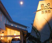
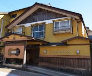
(RYOKAN) Umi no Oka Club
Seaside Villa Bokkai
(RYOKAN) Kogetsukan
Videos from this area
These are videos related to the place based on their proximity to this place.
[V0092] 011012 琴ヶ浜から能登半島沖地震で被害を受けた道下・深見・六郎木地区を経て曽々木海岸まで進む Japanese country roads; Sosogi beach
動画開始地点: 地図拡大表示の中心点 (RECORDING START POINT): Center point of this map http://maps.live.com/default.aspx?v=2&FORM=LMLTCP&cp=37.22698~136.704512&style=...
キャンピングカーの旅-車載カメラで輪島-志賀走行
Wajima - Shiga runs with the in-vehicle camera of the camper キャンピングカーの車載カメラで輪島-志賀走行 撮影した車載カメラ SONY α55 TAMRON SP AF10-24mm...
Noto Peninsula Ishikawa Japan 能登半島 気多大社 能登金剛 ヤセの断崖:旅
能登半島へ旅をしていくつか観光してきました。 気多大社と能登金剛の巌門、それからヤセの断崖です。 巌門では遊覧船が出ていましたが、乗...
時空のさざ波 能登 Sea in Noto Peninsula by EOS 7D
石川県の能登半島。時を経て寄せては引く様々な波の表情をハイビジョン撮影。(カメラ:EOS 7D) 制作:オフィスリキッド http://www.tokusen-net.jp/li...
Videos provided by Youtube are under the copyright of their owners.


!['[V0092] 011012 琴ヶ浜から能登半島沖地震で被害を受けた道下・深見・六郎木地区を経て曽々木海岸まで進む Japanese country roads; Sosogi beach' preview picture of video '[V0092] 011012 琴ヶ浜から能登半島沖地震で被害を受けた道下・深見・六郎木地区を経て曽々木海岸まで進む Japanese country roads; Sosogi beach'](https://img.youtube.com/vi/mK-87RE7uu8/mqdefault.jpg)


