Safety Score: 2,8 of 5.0 based on data from 9 authorites. Meaning we advice caution when travelling to Japan.
Travel warnings are updated daily. Source: Travel Warning Japan. Last Update: 2024-08-13 08:21:03
Delve into Sakuragawa
Sakuragawa in Sakuragawa-shi (Ibaraki) is located in Japan about 45 mi (or 73 km) north-east of Tokyo, the country's capital town.
Current time in Sakuragawa is now 07:37 PM (Thursday). The local timezone is named Asia / Tokyo with an UTC offset of 9 hours. We know of 8 airports close to Sakuragawa, of which two are larger airports. The closest airport in Japan is Hyakuri Airport in a distance of 17 mi (or 28 km), East. Besides the airports, there are other travel options available (check left side).
There are several Unesco world heritage sites nearby. The closest heritage site in Japan is Shrines and Temples of Nikko in a distance of 44 mi (or 71 km), North-West. If you need a hotel, we compiled a list of available hotels close to the map centre further down the page.
While being here, you might want to pay a visit to some of the following locations: Tsukuba, Chikusei, Kasumigaura, Shimo-tsuma and Ishioka. To further explore this place, just scroll down and browse the available info.
Local weather forecast
Todays Local Weather Conditions & Forecast: 11°C / 51 °F
| Morning Temperature | 10°C / 49 °F |
| Evening Temperature | 11°C / 52 °F |
| Night Temperature | 10°C / 50 °F |
| Chance of rainfall | 5% |
| Air Humidity | 75% |
| Air Pressure | 1015 hPa |
| Wind Speed | Light breeze with 5 km/h (3 mph) from South |
| Cloud Conditions | Overcast clouds, covering 100% of sky |
| General Conditions | Moderate rain |
Friday, 22nd of November 2024
13°C (55 °F)
11°C (51 °F)
Broken clouds, light breeze.
Saturday, 23rd of November 2024
13°C (56 °F)
9°C (48 °F)
Scattered clouds, gentle breeze.
Sunday, 24th of November 2024
12°C (54 °F)
9°C (48 °F)
Sky is clear, light breeze, clear sky.
Hotels and Places to Stay
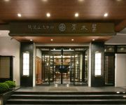
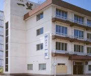
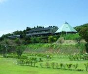
(RYOKAN) Tsukubasan Onsen Tsukubasan Edoya
(RYOKAN) Tsukubasan Onsen Tsukubasanhotel Aokiya
(RYOKAN) Tsukubasan Onsen Saika no Yado Ichibo
Tsukubasan Onsen Tsukuba Grand Hotel
(RYOKAN) ホテル岩盤浴 いやしの里
Videos from this area
These are videos related to the place based on their proximity to this place.
Climbing Mount Tsukuba - Pentax K-x
Ibaraki, Japan. A few kilometres south of Mito, a rather large twin peak awaits climbers with bad Japanese. Shot on a white Pentax K-x with the kit 18-55 lens. Cross Processing was turned...
筑波山(朝日峠P→朝日峠南側下り)(Mt. Tsukuba, Ibaraki, Japan)
場所:茨城県 筑波パープルライン(表筑波スカイライン)(筑波山) Place: Tsukuba Purple Line (Omote Tsukuba Skyline)(Mt. Tsukuba), Ibaraki Prefecture, Japan 車種:三菱...
筑波山(子授け地蔵→料金所跡)(Mt. Tsukuba, Ibaraki, Japan)
場所:茨城県 筑波パープルライン(表筑波スカイライン)(筑波山) Place: Tsukuba Purple Line (Omote Tsukuba Skyline)(Mt. Tsukuba), Ibaraki Prefecture, Japan 車種:三菱...
Conch Shell Horng at the Mt. Tsukuba
Musical composition is "A conch shell of the entering inn" I blewd at the Tsukuba top of a mountain. 「宿入りの貝」です。筑波山の山頂で立てました。
筑波山(朝日峠P→料金所跡)(Mt. Tsukuba, Ibaraki, Japan)
場所:茨城県 筑波パープルライン(表筑波スカイライン)(筑波山) Place: Tsukuba Purple Line (Omote Tsukuba Skyline)(Mt. Tsukuba), Ibaraki Prefecture, Japan 車種:三菱...
筑波山(朝日峠北側下り)(Mt. Tsukuba, Ibaraki, Japan)
場所:茨城県 筑波パープルライン(表筑波スカイライン)(筑波山) Place: Tsukuba Purple Line (Omote Tsukuba Skyline)(Mt. Tsukuba), Ibaraki Prefecture, Japan 車種:三菱...
筑波山(朝日峠南側下り)(Mt. Tsukuba, Ibaraki, Japan)
場所:茨城県 筑波パープルライン(表筑波スカイライン)(筑波山) Place: Tsukuba Purple Line (Omote Tsukuba Skyline)(Mt. Tsukuba), Ibaraki Prefecture, Japan 車種:三菱...
Videos provided by Youtube are under the copyright of their owners.
Attractions and noteworthy things
Distances are based on the centre of the city/town and sightseeing location. This list contains brief abstracts about monuments, holiday activities, national parcs, museums, organisations and more from the area as well as interesting facts about the region itself. Where available, you'll find the corresponding homepage. Otherwise the related wikipedia article.
Mount Tsukuba
Mount Tsukuba (筑波山 Tsukuba-san) is an 877 m mountain located near Tsukuba, Japan. It is one of the most famous mountains in Japan, particularly well known for its double peaks, Nyotai-san 877 m and Nantai-san 871 m . Many people climb the so-called "purple mountain" every year for the panoramic view of the Kantō plain from the summit. On clear days the Tōkyō skyline, Lake Kasumigaura and even Mount Fuji are visible from the mountain top.
Makabe, Ibaraki
Makabe, Ibaraki is a town located in Makabe District, Ibaraki, Japan. On October 1, 2005, Makabe was merged with the village of Yamato, also from Makabe District, and the town of Iwase, from Nishiibaraki District, to form the new city of Sakuragawa. As of 2003, the town had an estimated population of 19,368 and a density of 305.49 persons per km². The total area was 63.40 km².
Mount Tsukuba Cable Car
The Mount Tsukuba Cable Car, officially the Mount Tsukuba Cable Railway Line, is a Japanese funicular line on Mount Tsukuba, Tsukuba, Ibaraki. It is the only funicular line Tsukuba Kankō Railway (筑波観光鉄道, Tsukuba Kankō Tetsudō, "Tsukuba Sightseeing Railway") operates, while it also operates an aerial tramway, hotels and restaurants. The company belongs to Keisei Group.
Mount Tsukuba Ropeway
The Mount Tsukuba Ropeway is Japanese aerial lift line in Tsukuba, Ibaraki, operated by Tsukuba Kankō Railway (筑波観光鉄道, Tsukuba Kankō Tetsudō, "Tsukuba Sightseeing Railway"). The line, opened in 1965, climbs Mount Tsukuba. The company belongs to Keisei Group.


