Safety Score: 2,8 of 5.0 based on data from 9 authorites. Meaning we advice caution when travelling to Japan.
Travel warnings are updated daily. Source: Travel Warning Japan. Last Update: 2024-08-13 08:21:03
Explore Kamakura
Kamakura in Kawanabe-gun (Hyōgo) is a city in Japan about 251 mi (or 403 km) west of Tokyo, the country's capital.
Local time in Kamakura is now 01:14 PM (Friday). The local timezone is named Asia / Tokyo with an UTC offset of 9 hours. We know of 9 airports in the vicinity of Kamakura, of which 3 are larger airports. The closest airport in Japan is Osaka International Airport in a distance of 15 mi (or 24 km), South-East. Besides the airports, there are other travel options available (check left side).
There are several Unesco world heritage sites nearby. The closest heritage site in Japan is Historic Monuments of Ancient Kyoto (Kyoto, Uji and Otsu Cities) in a distance of 25 mi (or 40 km), East. If you need a place to sleep, we compiled a list of available hotels close to the map centre further down the page.
Depending on your travel schedule, you might want to pay a visit to some of the following locations: Kawanishi, Sanda, Sasayama, Takarazuka and Ikeda. To further explore this place, just scroll down and browse the available info.
Local weather forecast
Todays Local Weather Conditions & Forecast: 16°C / 60 °F
| Morning Temperature | 14°C / 57 °F |
| Evening Temperature | 14°C / 57 °F |
| Night Temperature | 14°C / 57 °F |
| Chance of rainfall | 2% |
| Air Humidity | 88% |
| Air Pressure | 1020 hPa |
| Wind Speed | Light breeze with 3 km/h (2 mph) from South |
| Cloud Conditions | Overcast clouds, covering 100% of sky |
| General Conditions | Light rain |
Saturday, 16th of November 2024
19°C (66 °F)
17°C (62 °F)
Broken clouds, gentle breeze.
Sunday, 17th of November 2024
20°C (68 °F)
14°C (57 °F)
Light rain, gentle breeze, broken clouds.
Monday, 18th of November 2024
11°C (52 °F)
5°C (41 °F)
Moderate rain, moderate breeze, overcast clouds.
Hotels and Places to Stay
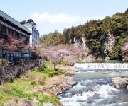
(RYOKAN) Iwayakan
Videos from this area
These are videos related to the place based on their proximity to this place.
Life in Japan: First Golf Lesson (最初のゴルフレッスン)
Maya and Alex played golf for a very first time. I must agree that sometimes it was looking more like hokey on grass but it was not so bad - especially Maya had a few good strikes (Alex also:))...
2012 第34回三田まつり 花火大会
第34回 三田まつり 花火大会 開催日時:2012年8月4日(土) 20:00~20:30 開催場所:三田市川除(武庫川河川敷) 打ち上げ数:2500発 昨年の人出:3万人 撮影:iPhone...
兵庫県三田市・光明寺の紅葉 #eizosuisen
Foliage of the temple! 兵庫県三田市・光明寺の素敵な紅葉をご覧下さい! Subscribe from here! チャンネル登録はこちらから! http://www.youtube.com/subscription_ce...
【兵庫県】篠山市 - 三田市【バイクツーリング】
篠山市小枕より 後編 未UP MAP https://mapsengine.google.com/map/edit?mid=z6WcMMoOJ1SM.k4ptAAIJlqcI twitter https://twitter.com/gon_erow 篠山のマンホールの位置は殺し...
Videos provided by Youtube are under the copyright of their owners.
Attractions and noteworthy things
Distances are based on the centre of the city/town and sightseeing location. This list contains brief abstracts about monuments, holiday activities, national parcs, museums, organisations and more from the area as well as interesting facts about the region itself. Where available, you'll find the corresponding homepage. Otherwise the related wikipedia article.
Mount Taka (Osaka/Hyōgo)
Mount Taka is a 720.8 m mountain of Hokusetsu Mountains, located on the border of Inagawa, Hyōgo and Nose, Ōsaka, Japan. This mountain is one of Osaka 50 mountains, and an important part of Hokusetsu Natural Park.


!['神戸電鉄三田駅 電車出発風景[駅撮]' preview picture of video '神戸電鉄三田駅 電車出発風景[駅撮]'](https://img.youtube.com/vi/YXyJ4ZDBRS8/mqdefault.jpg)


