Safety Score: 2,8 of 5.0 based on data from 9 authorites. Meaning we advice caution when travelling to Japan.
Travel warnings are updated daily. Source: Travel Warning Japan. Last Update: 2024-08-13 08:21:03
Explore Mukaigawa
Mukaigawa in Hiroshima is a city in Japan about 421 mi (or 678 km) west of Tokyo, the country's capital.
Local time in Mukaigawa is now 09:49 PM (Thursday). The local timezone is named Asia / Tokyo with an UTC offset of 9 hours. We know of 10 airports in the vicinity of Mukaigawa, of which two are larger airports. The closest airport in Japan is Hiroshimanishi Airport in a distance of 10 mi (or 16 km), North. Besides the airports, there are other travel options available (check left side).
There are several Unesco world heritage sites nearby. The closest heritage site in Japan is Itsukushima Shinto Shrine in a distance of 9 mi (or 15 km), North-West. If you need a place to sleep, we compiled a list of available hotels close to the map centre further down the page.
Depending on your travel schedule, you might want to pay a visit to some of the following locations: Etajima, Kure, Hiroshima, Hatsukaichi and Otake. To further explore this place, just scroll down and browse the available info.
Local weather forecast
Todays Local Weather Conditions & Forecast: 13°C / 56 °F
| Morning Temperature | 11°C / 51 °F |
| Evening Temperature | 15°C / 59 °F |
| Night Temperature | 13°C / 55 °F |
| Chance of rainfall | 0% |
| Air Humidity | 57% |
| Air Pressure | 1020 hPa |
| Wind Speed | Gentle Breeze with 8 km/h (5 mph) from South-East |
| Cloud Conditions | Clear sky, covering 7% of sky |
| General Conditions | Sky is clear |
Friday, 22nd of November 2024
16°C (60 °F)
11°C (52 °F)
Sky is clear, fresh breeze, clear sky.
Saturday, 23rd of November 2024
11°C (52 °F)
9°C (48 °F)
Light rain, moderate breeze, clear sky.
Sunday, 24th of November 2024
12°C (53 °F)
10°C (50 °F)
Few clouds, moderate breeze.
Hotels and Places to Stay
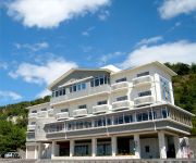
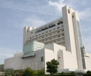
Sun Beach Okimi
Clayton Bay Hotel
Nomi Kaijo Lodge
Business Hotel Urashima
Videos from this area
These are videos related to the place based on their proximity to this place.
呉市 海上自衛隊巡りPart12 呉地方隊艦艇一般公開 訓練支援艦くろべ3/3 Kure City JMSDF Tour,Training support ship Kurobe,Hiroshima
広島県呉市 海上自衛隊 巡り Part 12 呉地方隊 艦艇一般公開 の様子です。3/3は 訓練支援艦 ATS-4202 「くろべ」後部デッキと格納庫です。 Kure City...
Adventures in Japan Part Two: Miyajima
Part Two of "Adventures in Japan" documentary by Jamal Johns. We take a trip to Miyajima Island located near Hiroshima Japan. Here, we embark on a journey to the many Buddhist Temples and...
[V0103] 040101 広島湾や安芸灘に浮かぶ江田島から対岸すぐの呉市まで早瀬大橋と音戸大橋で延々遠回りする Japanese country roads; Hayase Bridge, Ondo Bridge
動画開始地点: 地図拡大表示の中心点 (RECORDING START POINT): Center point of this map http://maps.live.com/default.aspx?v=2&FORM=LMLTCP&cp=34.262672~132.444767&style...
第二音戸大橋~呉(2倍速) 2nd Ondo Bridge to Kure City (2x speed)
「警固屋音戸バイパス」の第二音戸大橋から呉市街までの連続車載動画です。 呉の夜景(灰ヶ峰より) : http://ww4.tiki.ne.jp/~mmurakami/setoy/hirosima/haiga.h...
広島県のドライブ動画(車載動画)2015.02.01呉市音戸大橋から江田島市早瀬大橋 Hiroshima Drive Video On board camera,Kure,Etajima
広島県のドライブ動画(車載動画) 2015.02.01です。 国道487号線,県道35号線 呉市 音戸大橋から江田島市 早瀬大橋の往復です。 Hiroshima Drive Video (On...
Videos provided by Youtube are under the copyright of their owners.
Attractions and noteworthy things
Distances are based on the centre of the city/town and sightseeing location. This list contains brief abstracts about monuments, holiday activities, national parcs, museums, organisations and more from the area as well as interesting facts about the region itself. Where available, you'll find the corresponding homepage. Otherwise the related wikipedia article.
Etajima
is an island in Hiroshima Bay located in southwestern Hiroshima Prefecture, Japan. From the city of Hiroshima, the island is about 7 km out at sea. The island is about 6 km from the city of Kure. It is connected to Kure by two bridges. Etajima holds two annual marathons, including the "Mikan (Orange) Marathon", and the "Kaki (Oyster) Marathon". The Mikan Marathon has been held for more than two decades. It is held every year in October, at the beginning of the orange season.
Japanese cruiser Izumo
(sometimes spelled Idzumo) was an armored cruiser of the Imperial Japanese Navy. Although very similar to the Asama-class cruisers, her differences are significant enough to classify her as the lead ship in the separate Izumo-class, which also included her sister ship, the Iwate. Izumo was named after Izumo Province, an ancient province of Japan (corresponding to present-day Shimane Prefecture).
Japanese cruiser Iwate
Japanese cruiser Iwate was an Izumo-class armored cruiser of the Imperial Japanese Navy. It was named after Iwate prefecture in northern Japan, and it was a sister ship of the Izumo.
Japanese cruiser Aoba
Japanese cruiser Aoba was the lead ship in the two-vessel Aoba-class of heavy cruisers in the Imperial Japanese Navy. It is named after Mount Aoba, a volcano located behind Maizuru, Kyoto.
JDS Wakaba (DE-261)
JDS Wakaba was the former IJN Nashi, a Tachibana-class destroyer. The Nashi was sunk in July 1945, but salvaged in 1954 and refitted to join the JMSDF in 1956 as Wakaba, later being utilised as a radar trials ship. As such she was the only ship of the Imperial Japanese Navy to become part of the post-war Japan Maritime Self-Defense Force, and for some time was the biggest ship in the JMSDF. 'Nashi' is a type of pear.
Naval Academy Etajima
Etajima base (JMSDF Etajima Naval Base) in Etajima city, Hiroshima prefecture is located in the Etajima-cho government building and is the base of the Japan Maritime Self-Defense Force. Beside the housing the 1st Technical School and the Officer Candidates School, it is home to the local Kure Naval District, LCAC training facilities, and the Self Defense Force oil storage. In addition, the Special Forces of the Maritime Self Defense Force is located here.


!['130317_艦艇公開呉基地[00]' preview picture of video '130317_艦艇公開呉基地[00]'](https://img.youtube.com/vi/d973uouYtZI/mqdefault.jpg)


!['[V0103] 040101 広島湾や安芸灘に浮かぶ江田島から対岸すぐの呉市まで早瀬大橋と音戸大橋で延々遠回りする Japanese country roads; Hayase Bridge, Ondo Bridge' preview picture of video '[V0103] 040101 広島湾や安芸灘に浮かぶ江田島から対岸すぐの呉市まで早瀬大橋と音戸大橋で延々遠回りする Japanese country roads; Hayase Bridge, Ondo Bridge'](https://img.youtube.com/vi/-CpcEvsHbck/mqdefault.jpg)


