Safety Score: 2,8 of 5.0 based on data from 9 authorites. Meaning we advice caution when travelling to Japan.
Travel warnings are updated daily. Source: Travel Warning Japan. Last Update: 2024-08-13 08:21:03
Delve into Yutakamachi-mitarai
Yutakamachi-mitarai in Kure-shi (Hiroshima) is a city located in Japan about 400 mi (or 644 km) west of Tokyo, the country's capital town.
Current time in Yutakamachi-mitarai is now 10:09 PM (Thursday). The local timezone is named Asia / Tokyo with an UTC offset of 9 hours. We know of 12 airports closer to Yutakamachi-mitarai, of which 4 are larger airports. The closest airport in Japan is Hiroshima Airport in a distance of 18 mi (or 29 km), North. Besides the airports, there are other travel options available (check left side).
There are several Unesco world heritage sites nearby. The closest heritage site in Japan is Hiroshima Peace Memorial (Genbaku Dome) in a distance of 28 mi (or 44 km), North-West. In need of a room? We compiled a list of available hotels close to the map centre further down the page.
Since you are here already, you might want to pay a visit to some of the following locations: Takehara, Imabari-shi, Higashihiroshima, Kure and Mihara. To further explore this place, just scroll down and browse the available info.
Local weather forecast
Todays Local Weather Conditions & Forecast: 14°C / 57 °F
| Morning Temperature | 10°C / 49 °F |
| Evening Temperature | 14°C / 57 °F |
| Night Temperature | 12°C / 53 °F |
| Chance of rainfall | 0% |
| Air Humidity | 57% |
| Air Pressure | 1019 hPa |
| Wind Speed | Gentle Breeze with 8 km/h (5 mph) from South-East |
| Cloud Conditions | Few clouds, covering 13% of sky |
| General Conditions | Few clouds |
Friday, 22nd of November 2024
14°C (58 °F)
10°C (49 °F)
Scattered clouds, moderate breeze.
Saturday, 23rd of November 2024
11°C (51 °F)
7°C (45 °F)
Few clouds, moderate breeze.
Sunday, 24th of November 2024
11°C (51 °F)
8°C (47 °F)
Few clouds, gentle breeze.
Hotels and Places to Stay
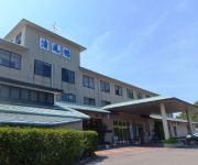
(RYOKAN) Kinoe Onsen Hotel Seifukan
Videos from this area
These are videos related to the place based on their proximity to this place.
[V0034] 031231 蒲刈2:ほのぼのとした上蒲刈島の大浦港から折り返して安芸灘大橋まで戻り感慨にふける Japanese country roads; Kamagari
動画開始地点: 地図拡大表示の中心点 (RECORDING START POINT): Center point of this map http://maps.live.com/default.aspx?v=2&FORM=LMLTCP&cp=34.185301~132.756441&style...
第14回かまがり恵みフェア2014 ♪ Stand by Me etc.
2014年11月23日、呉市蒲刈町・県民の浜・特設ステージ 「第14回かまがり恵みフェア2014」に豊島BANDが出演! 1.大きな古時計 2.島人ぬ宝 3.ともだち...
豊島大橋と豊島(一周)2倍速
route map: http://maps.google.co.jp/maps/ms?hl=ja&ie=UTF8&date=&time=&ttype=dep&noexp=0&noal=0&sort=time&msa=0&msid=111233632671326086336.00045c686ca9fc66b6643&ll=34.174175 ...
[V0324] 斎灘4:高縄半島から波方半島のしまなみ海道の来島海峡大橋へ
動画開始地点: 地図拡大表示の中心点 (RECORDING START POINT): Center point of this map http://maps.live.com/?v=2&cp=34.058617540379295~132.8859981894493&lvl=13&sty=r&...
瀬戸内海に浮かぶ軍艦島~契島・ちぎりじま ~ Island like the Battleship ~
東邦亜鉛(株)の日本随一の生産能力を持つ全体が鉛製錬所になっている島。そのカタチが軍艦に似てるので"軍艦島"とも呼ばれます。
Scenery of Mitarai town Kure city Hiroshima Japan. 御手洗をゆく
2014年1月の御手洗。 かつて風待ち潮待ちの港として栄えた町、御手洗を歩けばタイムスリップした気分になる。 手作りの道路標識、壁にはまった...
yt3D 呉市御手洗 町並み保存地区 前編 「泣ける!広島県」 そうちゃん2歳 Mitarai Kure Hiroshima #1 | KidsOfNinja 【そうちゃんのぶらり、公園の旅】
So-chan walked around Mitarai preserved historic district area located Yutaka, Kure, Hiroshima in Japan. (Part1) 広島県呉市豊町の「御手洗」町並み保存地区をぶらり歩いて...
Videos provided by Youtube are under the copyright of their owners.
Attractions and noteworthy things
Distances are based on the centre of the city/town and sightseeing location. This list contains brief abstracts about monuments, holiday activities, national parcs, museums, organisations and more from the area as well as interesting facts about the region itself. Where available, you'll find the corresponding homepage. Otherwise the related wikipedia article.
Okamura Island
Okamura Island is a small island in the Inland Sea of Japan. Administratively, it is part of the city of Imabari, Ehime Prefecture. The island is famous for mikan and butterflies. As of 2006, the population was about 1,000. The area is 3.13 km² and the circumference is 11.1 km. Access is from Imabari by fast or slow ferry boat.


!['[V0034] 031231 蒲刈2:ほのぼのとした上蒲刈島の大浦港から折り返して安芸灘大橋まで戻り感慨にふける Japanese country roads; Kamagari' preview picture of video '[V0034] 031231 蒲刈2:ほのぼのとした上蒲刈島の大浦港から折り返して安芸灘大橋まで戻り感慨にふける Japanese country roads; Kamagari'](https://img.youtube.com/vi/fW80LX_lOws/mqdefault.jpg)


!['[V0324] 斎灘4:高縄半島から波方半島のしまなみ海道の来島海峡大橋へ' preview picture of video '[V0324] 斎灘4:高縄半島から波方半島のしまなみ海道の来島海峡大橋へ'](https://img.youtube.com/vi/dAFDq4zJqlA/mqdefault.jpg)


