Safety Score: 2,8 of 5.0 based on data from 9 authorites. Meaning we advice caution when travelling to Japan.
Travel warnings are updated daily. Source: Travel Warning Japan. Last Update: 2024-08-13 08:21:03
Delve into Koyō
Koyō in Hiroshima is located in Japan about 407 mi (or 656 km) west of Tokyo, the country's capital town.
Current time in Koyō is now 10:20 PM (Thursday). The local timezone is named Asia / Tokyo with an UTC offset of 9 hours. We know of 11 airports close to Koyō, of which 3 are larger airports. The closest airport in Japan is Hiroshima Airport in a distance of 18 mi (or 29 km), North-East. Besides the airports, there are other travel options available (check left side).
There are several Unesco world heritage sites nearby. The closest heritage site in Japan is Hiroshima Peace Memorial (Genbaku Dome) in a distance of 18 mi (or 30 km), North-West. If you need a hotel, we compiled a list of available hotels close to the map centre further down the page.
While being here, you might want to pay a visit to some of the following locations: Kure, Higashihiroshima, Takehara, Etajima and Hiroshima. To further explore this place, just scroll down and browse the available info.
Local weather forecast
Todays Local Weather Conditions & Forecast: 13°C / 56 °F
| Morning Temperature | 11°C / 51 °F |
| Evening Temperature | 15°C / 59 °F |
| Night Temperature | 13°C / 55 °F |
| Chance of rainfall | 0% |
| Air Humidity | 57% |
| Air Pressure | 1020 hPa |
| Wind Speed | Gentle Breeze with 8 km/h (5 mph) from South-East |
| Cloud Conditions | Clear sky, covering 7% of sky |
| General Conditions | Sky is clear |
Friday, 22nd of November 2024
16°C (60 °F)
11°C (52 °F)
Sky is clear, fresh breeze, clear sky.
Saturday, 23rd of November 2024
11°C (52 °F)
9°C (48 °F)
Light rain, moderate breeze, clear sky.
Sunday, 24th of November 2024
12°C (53 °F)
10°C (50 °F)
Few clouds, moderate breeze.
Hotels and Places to Stay
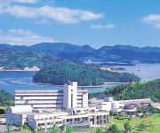
Greenpia Setouchi
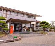
Kokumin Shukusha Noro Kogen Lodge
Videos from this area
These are videos related to the place based on their proximity to this place.
[V0033] 031231 蒲刈1:安芸灘大橋と蒲刈大橋で瀬戸内海に浮かぶ下蒲刈島と上蒲刈島を周遊する Japanese country roads; Kamagari
動画開始地点: 地図拡大表示の中心点 (RECORDING START POINT): Center point of this map http://maps.live.com/default.aspx?v=2&FORM=LMLTCP&cp=34.217627~132.682073&style...
下蒲刈島 (2倍速) Shimokamagari Island
安芸灘諸島の下蒲刈島を一周撮影しました。(2010.8.4 SONY NEX3で撮影) 下蒲刈島は、「安芸灘とびしま海道」の最初の島です。 一周14km程度な...
2008.11.23 広島県呉市蒲刈~豊島大橋~岡村島その2
BGM:The Police / Hole In My Life/So Lonely 安芸灘大橋通過~県道288号線下蒲刈島(県道288号線)から蒲刈大橋通過し上蒲刈島(県道287号線)へ。
上蒲刈島(一周)
route map: http://maps.google.co.jp/maps/ms?hl=ja&ie=UTF8&date=&time=&ttype=dep&noexp=0&noal=0&sort=time&msa=0&msid=111233632671326086336.00045ce7c24cdeace6687&z=13 ...
Videos provided by Youtube are under the copyright of their owners.
Attractions and noteworthy things
Distances are based on the centre of the city/town and sightseeing location. This list contains brief abstracts about monuments, holiday activities, national parcs, museums, organisations and more from the area as well as interesting facts about the region itself. Where available, you'll find the corresponding homepage. Otherwise the related wikipedia article.
Akinada Bridge
The Akinada Bridge is a suspension bridge in Hiroshima, Japan. Completed in 2000, it has a main span of 750 m. It was constructed by PentaOcean Construction.
Mount Noro
is one the most popular mountains around Hiroshima, Japan. Mount Noro is the part of Setonaikai National Park. Mount Misen is famous for mountain climbing, trekking, camping and sakura, camellia, hydrangea, autumn leaves and maples and sunset view. There are historical shrines and temples include Noro Shrine and Kōbō Temple .
Ato Station
Ato Station is a railway station in Kure, Hiroshima Prefecture, Japan.
Akikawajiri Station
Akikawajiri Station is a railway station in Kure, Hiroshima Prefecture, Japan.


!['[V0033] 031231 蒲刈1:安芸灘大橋と蒲刈大橋で瀬戸内海に浮かぶ下蒲刈島と上蒲刈島を周遊する Japanese country roads; Kamagari' preview picture of video '[V0033] 031231 蒲刈1:安芸灘大橋と蒲刈大橋で瀬戸内海に浮かぶ下蒲刈島と上蒲刈島を周遊する Japanese country roads; Kamagari'](https://img.youtube.com/vi/tFHwj7r4p4I/mqdefault.jpg)


