Safety Score: 2,8 of 5.0 based on data from 9 authorites. Meaning we advice caution when travelling to Japan.
Travel warnings are updated daily. Source: Travel Warning Japan. Last Update: 2024-08-13 08:21:03
Discover Miharu
Miharu in Tamura-gun (Fukushima-ken) with it's 19,708 citizens is a town in Japan about 128 mi (or 206 km) north of Tokyo, the country's capital city.
Current time in Miharu is now 05:03 PM (Saturday). The local timezone is named Asia / Tokyo with an UTC offset of 9 hours. We know of 9 airports near Miharu, of which two are larger airports. The closest airport in Japan is Fukushima Airport in a distance of 15 mi (or 23 km), South. Besides the airports, there are other travel options available (check left side).
There are several Unesco world heritage sites nearby. The closest heritage site in Japan is Shrines and Temples of Nikko in a distance of 68 mi (or 109 km), South-West. Looking for a place to stay? we compiled a list of available hotels close to the map centre further down the page.
When in this area, you might want to pay a visit to some of the following locations: Koriyama, Motomiya, Tamura, Nihommatsu and Sukagawa. To further explore this place, just scroll down and browse the available info.
Local weather forecast
Todays Local Weather Conditions & Forecast: 6°C / 43 °F
| Morning Temperature | 4°C / 39 °F |
| Evening Temperature | 4°C / 40 °F |
| Night Temperature | 5°C / 40 °F |
| Chance of rainfall | 2% |
| Air Humidity | 88% |
| Air Pressure | 1019 hPa |
| Wind Speed | Moderate breeze with 10 km/h (6 mph) from South-East |
| Cloud Conditions | Overcast clouds, covering 100% of sky |
| General Conditions | Light rain |
Sunday, 24th of November 2024
8°C (46 °F)
3°C (37 °F)
Few clouds, gentle breeze.
Monday, 25th of November 2024
9°C (48 °F)
3°C (37 °F)
Scattered clouds, gentle breeze.
Tuesday, 26th of November 2024
11°C (52 °F)
11°C (52 °F)
Light rain, gentle breeze, broken clouds.
Hotels and Places to Stay
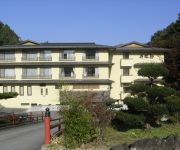
(RYOKAN) Wakamatsu Ryokan (Fukushima)
(RYOKAN) Mitsuyoshiya Ryokan
Business Ryokan Miraju
Smile Hotel Koriyama
Videos from this area
These are videos related to the place based on their proximity to this place.
Fukushima miharu takizakura updated
One month after the earthquake,the shooting began. Miharu is a small town about 47 km (29 mi) from the Fukushima Daiichi Nuclear Power Plant. Takizakura has carried on its life for more...
「三春滝桜」ライトアップ(HD1280x720p) Miharu Weeping cherry tree Night view
桜として初めて1922(大正11)年に国の天然記念物に指定され、山梨の「神代桜」、岐阜の「薄墨桜」と並んで 「日本三大桜」と称される「三春滝...
日本三大桜の銘木 三春の滝桜 Miharu Cherry tree
福島県田村郡三春町にある日本三大桜の銘木「滝桜」は、ベニシダレザクラでは日本最長の樹齢1000年です。 また三春周辺の桜の銘木(塩ノ崎の大...
三春滝桜ライトアップ Miharu TakiZakura Light Up( Shot on RED EPIC )
国の天然記念物に指定されている日本三大桜の一つの「三春滝桜」(福島県田村郡三春町)で行われたライトップの映像です。
三春の滝桜と福島の桜銘木 Taki-Zakura and famous cherry tree in FUKUSHIMA
三春の滝桜(福島県田村郡三春町、樹齢1000年)とほぼ同時期に見頃を迎えた福島周辺の桜の名木です。 秋山の駒桜(福島県伊達市川俣町秋山、樹...
福島県 三春滝桜
三春滝桜の詳細情報や地図はこちら↓ http://www.healing-japan.tv/spot-350.html 以下は、日本全国の著名な桜名所・巨木桜をHD画質でご覧いただけるプ...
Videos provided by Youtube are under the copyright of their owners.
Attractions and noteworthy things
Distances are based on the centre of the city/town and sightseeing location. This list contains brief abstracts about monuments, holiday activities, national parcs, museums, organisations and more from the area as well as interesting facts about the region itself. Where available, you'll find the corresponding homepage. Otherwise the related wikipedia article.
Fukushima Prefecture
Fukushima Prefecture is a prefecture of Japan located in the Tōhoku region on the island of Honshu. The capital is the city of Fukushima.
Miharu Dam
Miharu Dam is a dam in the Fukushima Prefecture of Japan, completed in 1997.
Kanameta Station
Kanameta Station is a railway station in Tamura, Fukushima Prefecture, Japan.
Miharu Station
Miharu Station is a railway station in Miharu, Tamura District, Fukushima Prefecture, Japan.
Miharu Takizakura
The Miharu Takizakura (三春滝桜, litt. waterfall cherry tree of Miharu) is an ancient cherry tree in Miharu, Fukushima, in northern Japan. It is a weeping higan cherry (Prunus pendula "Pendula Rosea", benishidarezakura in Japanese) and is over 1,000 years old. It flowers in mid to late April, and its light pink flowers spread in all directions from the branches, like a waterfall.


