Safety Score: 2,8 of 5.0 based on data from 9 authorites. Meaning we advice caution when travelling to Japan.
Travel warnings are updated daily. Source: Travel Warning Japan. Last Update: 2024-08-13 08:21:03
Discover Minami-ebi
Minami-ebi in Fukushima-ken is a place in Japan about 157 mi (or 253 km) north-east of Tokyo, the country's capital city.
Current time in Minami-ebi is now 02:51 PM (Friday). The local timezone is named Asia / Tokyo with an UTC offset of 9 hours. We know of 10 airports near Minami-ebi, of which two are larger airports. The closest airport in Japan is Sendai Airport in a distance of 31 mi (or 50 km), North. Besides the airports, there are other travel options available (check left side).
There are two Unesco world heritage sites nearby. The closest heritage site in Japan is Hiraizumi – Temples, Gardens and Archaeological Sites Representing the Buddhist Pure Land in a distance of 90 mi (or 145 km), North. If you need a hotel, we compiled a list of available hotels close to the map centre further down the page.
While being here, you might want to pay a visit to some of the following locations: Minami-Soma, Soma, Kakuda, Iwanuma and Natori-shi. To further explore this place, just scroll down and browse the available info.
Local weather forecast
Todays Local Weather Conditions & Forecast: 18°C / 64 °F
| Morning Temperature | 14°C / 57 °F |
| Evening Temperature | 15°C / 59 °F |
| Night Temperature | 13°C / 56 °F |
| Chance of rainfall | 1% |
| Air Humidity | 77% |
| Air Pressure | 1018 hPa |
| Wind Speed | Gentle Breeze with 6 km/h (4 mph) from South |
| Cloud Conditions | Overcast clouds, covering 100% of sky |
| General Conditions | Light rain |
Saturday, 16th of November 2024
16°C (60 °F)
15°C (59 °F)
Overcast clouds, gentle breeze.
Sunday, 17th of November 2024
21°C (69 °F)
18°C (65 °F)
Broken clouds, moderate breeze.
Monday, 18th of November 2024
9°C (48 °F)
4°C (40 °F)
Moderate rain, fresh breeze, overcast clouds.
Hotels and Places to Stay
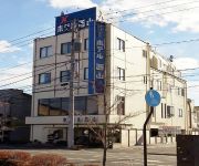
Rest Hotel Pal
Hotel Nishiyama
Komodo Inn Minamisoma
Videos from this area
These are videos related to the place based on their proximity to this place.
Dog Roaming at Fukushima Daiichi Nuclear Power Plant - 8x speed
What appears to be a dog (shepherd?) is roaming the grounds of the crippled Fukushima Nuclear Power Plant. Recorded from TEPCO live feed on June 3, 2011 at 8x normal speed.
南相馬市 介護老人保健施設ヨッシーランド 2011 3 19 am7 12
南相馬市原町区上渋佐に位置する介護老人保健施設ヨッシーランドは津波到達最終地点に近いところだ。 建物はかろうじてその概観をとどめてい...
[V0463] 南東北17:松川浦大橋で松川浦一周を終え鵜の尾岬から再び南下する
動画開始地点: 地図拡大表示の中心点 (RECORDING START POINT): Center point of this map http://maps.live.com/?v=2&cp=37.78573532445337~140.9695770633764&lvl=13&dir=0&sty...
Minami-Sōma (南相馬) / Fukushima Pref. 5 months after the 3-11 earthquake: Boats everywhere
This video has been taken during a volunteering trip, 5 months after the heavy earthquake + tsunami that battered the north-east of Japan on 11 March 2011. This video shows former farmland,...
[V0465] 南東北19:真野川河口の烏崎漁港から北泉海岸を経て小浜海岸へ
動画開始地点: 地図拡大表示の中心点 (RECORDING START POINT): Center point of this map http://maps.live.com/?v=2&cp=37.70420857310762~141.01074494844448&lvl=13&dir=0&...
Pro Snowboarder Kazu joins the JEARS team in Soma
The JEARS team together with pro snowboarder Kazu head to Soma in Fukushima prefecture. While driving through the debris field we find a lone dog and rescue him. He is now safe in our shelter...
Videos provided by Youtube are under the copyright of their owners.


!['[V0463] 南東北17:松川浦大橋で松川浦一周を終え鵜の尾岬から再び南下する' preview picture of video '[V0463] 南東北17:松川浦大橋で松川浦一周を終え鵜の尾岬から再び南下する'](https://img.youtube.com/vi/CWo3fE2j5QQ/mqdefault.jpg)


!['[V0465] 南東北19:真野川河口の烏崎漁港から北泉海岸を経て小浜海岸へ' preview picture of video '[V0465] 南東北19:真野川河口の烏崎漁港から北泉海岸を経て小浜海岸へ'](https://img.youtube.com/vi/dGOwGp9AJaE/mqdefault.jpg)


