Safety Score: 2,8 of 5.0 based on data from 9 authorites. Meaning we advice caution when travelling to Japan.
Travel warnings are updated daily. Source: Travel Warning Japan. Last Update: 2024-08-13 08:21:03
Discover Komine
Komine in Kitakyushu-shi (Fukuoka) is a town in Japan about 523 mi (or 842 km) west of Tokyo, the country's capital city.
Current time in Komine is now 03:20 PM (Monday). The local timezone is named Asia / Tokyo with an UTC offset of 9 hours. We know of 10 airports near Komine, of which 3 are larger airports. The closest airport in Japan is Kitakyūshū Airport in a distance of 16 mi (or 26 km), East. Besides the airports, there are other travel options available (check left side).
There are several Unesco world heritage sites nearby. The closest heritage site in Japan is Itsukushima Shinto Shrine in a distance of 96 mi (or 154 km), East. Looking for a place to stay? we compiled a list of available hotels close to the map centre further down the page.
When in this area, you might want to pay a visit to some of the following locations: Nakama, Nogata, Kitakyushu, Miyawaka and Tagawa. To further explore this place, just scroll down and browse the available info.
Local weather forecast
Todays Local Weather Conditions & Forecast: 13°C / 55 °F
| Morning Temperature | 9°C / 48 °F |
| Evening Temperature | 12°C / 54 °F |
| Night Temperature | 11°C / 51 °F |
| Chance of rainfall | 0% |
| Air Humidity | 46% |
| Air Pressure | 1028 hPa |
| Wind Speed | Gentle Breeze with 9 km/h (5 mph) from West |
| Cloud Conditions | Clear sky, covering 4% of sky |
| General Conditions | Sky is clear |
Tuesday, 26th of November 2024
13°C (55 °F)
11°C (51 °F)
Heavy intensity rain, fresh breeze, overcast clouds.
Wednesday, 27th of November 2024
11°C (51 °F)
8°C (46 °F)
Light rain, fresh breeze, overcast clouds.
Thursday, 28th of November 2024
8°C (47 °F)
10°C (50 °F)
Moderate rain, fresh breeze, overcast clouds.
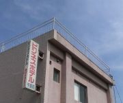
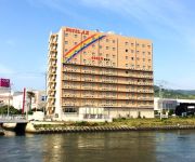
Hotels and Places to Stay
Arc Inn Kurosaki
Arc Inn Kurosaki Plus
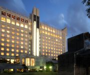
Crown Palais Kita-Kyushu
(RYOKAN) Nogata Ikoinomura
Hotel Crown Palais Kitakyushu
Pearl City Kurosaki
Nishitetsu Inn Kurosaki
Hotel Senboso
Kinokuniya Hotel
Hotel AZ Kitakyushu Wakamatsu
Videos from this area
These are videos related to the place based on their proximity to this place.
Paragliding in Kitakyushu,Japan - Mt.Sarakura 16/Oct/2010 北九州皿倉山
Mt.Sarakura is located in Kitakyushu Quasi-National Park,standing 622 meters above sea level. From the top,you can get a magnificent panoramic view.of the landscape. Especially,the night...
TimeLapse Kita-Kyusyu Industrial area 2011
北九州工業地帯・皿倉山・関門海峡 微速度動画 一部HDR 撮影機材:CANON 5D mark2, SIGMA 24-70mm 動画編集:QuickTimePro, Adobe Premiere CS5 音楽素材:Musicshake...
自動車の目: 中間 Drive in Nakama City
中間市の中心部を自動車で一周する。 Driver's View: Nakama City. The former coal-mining town has turned out to be a bedroom community of Kitakyûsyû after the suburban sprawl...
自動車の目: 黒崎 Drive in Kurosaki, Kitakyûsyû City
北九州市の副都心・黒崎界隈を一筆書きで巡る。2007年撮影では山手通り以南に遊休地が目立つ。 Driver's View: Kurosaki District, the sub-CBD of Kitakyûsyû...
路線バス(西鉄バスと北九州市営バス)@西鉄黒崎バスセンター Nishitetsu Bus & Kitakyushu City Bus@Nishitetsu Kurosaki Bus Center.
2014年11月29日、JR黒崎駅側にあるビル「コムシティ」1階、筑豊電気鉄道 黒崎駅前駅隣に在る、西鉄黒崎バスセンター(北九州市八幡西区黒崎三丁目)...
[HD] 望遠ズームHDR-CX500V / 標高620m山頂から都市眺望 View of the city
夜景スポットの福岡県・皿倉山頂(標高620m)からSony HDR-CX500Vの望遠ズーム機能(標準レンズ)で、北九州市の小倉都心部、若戸大橋、黒崎地区、...
Videos provided by Youtube are under the copyright of their owners.
Attractions and noteworthy things
Distances are based on the centre of the city/town and sightseeing location. This list contains brief abstracts about monuments, holiday activities, national parcs, museums, organisations and more from the area as well as interesting facts about the region itself. Where available, you'll find the corresponding homepage. Otherwise the related wikipedia article.
Hobashira Cable
The Hobashira Cable is the name of Japanese funicular line, as well as its operator. The line climbs Mount Sarakura in Kitakyūshū, Fukuoka. The line does not have any official name. It opened in 1957. The company also operates Sarakurayama Slope Car . It links the funicular terminus and the top of the mountain.







!['[HD] 望遠ズームHDR-CX500V / 標高620m山頂から都市眺望 View of the city' preview picture of video '[HD] 望遠ズームHDR-CX500V / 標高620m山頂から都市眺望 View of the city'](https://img.youtube.com/vi/9quqnPtfEzY/mqdefault.jpg)
