Safety Score: 2,8 of 5.0 based on data from 9 authorites. Meaning we advice caution when travelling to Japan.
Travel warnings are updated daily. Source: Travel Warning Japan. Last Update: 2024-08-13 08:21:03
Explore Dōnaru
Dōnaru in Shikoku-chūō Shi (Ehime) is located in Japan about 364 mi (or 586 km) west of Tokyo, the country's capital.
Local time in Dōnaru is now 02:27 AM (Wednesday). The local timezone is named Asia / Tokyo with an UTC offset of 9 hours. We know of 10 airports in the wider vicinity of Dōnaru, of which two are larger airports. The closest airport in Japan is Kōchi Ryōma Airport in a distance of 26 mi (or 42 km), South. Besides the airports, there are other travel options available (check left side).
There are several Unesco world heritage sites nearby. The closest heritage site in Japan is Hiroshima Peace Memorial (Genbaku Dome) in a distance of 75 mi (or 121 km), North-West. If you need a place to sleep, we compiled a list of available hotels close to the map centre further down the page.
Depending on your travel schedule, you might want to pay a visit to some of the following locations: Shikokuchuo, Kan'onji, Miyoshi, Mitoyo and Kami. To further explore this place, just scroll down and browse the available info.
Local weather forecast
Todays Local Weather Conditions & Forecast: 17°C / 63 °F
| Morning Temperature | 10°C / 51 °F |
| Evening Temperature | 14°C / 57 °F |
| Night Temperature | 9°C / 49 °F |
| Chance of rainfall | 0% |
| Air Humidity | 50% |
| Air Pressure | 1018 hPa |
| Wind Speed | Gentle Breeze with 6 km/h (4 mph) from East |
| Cloud Conditions | Clear sky, covering 1% of sky |
| General Conditions | Sky is clear |
Wednesday, 4th of December 2024
14°C (57 °F)
7°C (45 °F)
Sky is clear, gentle breeze, clear sky.
Thursday, 5th of December 2024
12°C (53 °F)
7°C (44 °F)
Overcast clouds, light breeze.
Friday, 6th of December 2024
12°C (53 °F)
8°C (46 °F)
Broken clouds, gentle breeze.
Hotels and Places to Stay
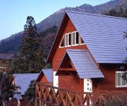
Kiri no Mori Cottage
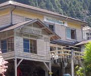
Guesthouse Momonga Village
Videos from this area
These are videos related to the place based on their proximity to this place.
翠波峰(四国中央市) 4倍速 Shikokuchuo City
松山自動車道の三島川之江ICから、具定展望台を経由し、翠波峰(891.9m)までの道案内です。 night view : http://ww4.tiki.ne.jp/~mmurakami/setoy/sikoku/e_iyo3sima.h...
[V0334] 斎灘14:余木崎で香川県に突入し燧灘で観音寺市の有明浜海岸へ
動画開始地点: 地図拡大表示の中心点 (RECORDING START POINT): Center point of this map http://maps.live.com/?v=2&cp=34.02225589918814~133.56915950775146&lvl=13&sty=r&...
特急列車(8000系2000系アンパンマン列車)停車駅 伊予三島 JR四国予讃線
JR四国予讃線、伊予三島駅の特急列車、しおかぜ・いしづちの発着シーンです。特急型電車8000系、特急型気動車2000系(アンパンマン列...
みしま太鼓祭り・三島神社例大祭【愛媛県四国中央市】(平成26年)
平成26年10月23日(木)愛媛県四国中央市伊予三島、三島神社例大祭、太鼓台宮入の様子です。西町太鼓台、真古町太鼓台、上町太鼓台、金子町太...
平成24年10月21日 大月祭り太鼓台 ちょうさ Otsuki Festival October 21, 2012
三好市山城町大月の四所神社祭礼。 戦前には大月、小川谷、大野、大谷・頼広、柴川・脇・瀬貝の5台の「ちょうさ」が登場していましたが、現在...
Videos provided by Youtube are under the copyright of their owners.


!['[V0334] 斎灘14:余木崎で香川県に突入し燧灘で観音寺市の有明浜海岸へ' preview picture of video '[V0334] 斎灘14:余木崎で香川県に突入し燧灘で観音寺市の有明浜海岸へ'](https://img.youtube.com/vi/xVheYpFfFCo/mqdefault.jpg)


