Safety Score: 2,8 of 5.0 based on data from 9 authorites. Meaning we advice caution when travelling to Japan.
Travel warnings are updated daily. Source: Travel Warning Japan. Last Update: 2024-08-13 08:21:03
Discover Mori
Mori in Imabari (Ehime) is a city in Japan about 389 mi (or 626 km) west of Tokyo, the country's capital city.
Local time in Mori is now 07:01 PM (Saturday). The local timezone is named Asia / Tokyo with an UTC offset of 9 hours. We know of 12 airports in the vicinity of Mori, of which 4 are larger airports. The closest airport in Japan is Hiroshima Airport in a distance of 12 mi (or 20 km), North-West. Besides the airports, there are other travel options available (check left side).
There are several Unesco world heritage sites nearby. The closest heritage site in Japan is Hiroshima Peace Memorial (Genbaku Dome) in a distance of 34 mi (or 55 km), West. Looking for a place to stay? we compiled a list of available hotels close to the map centre further down the page.
When in this area, you might want to pay a visit to some of the following locations: Mihara, Takehara, Onomichi, Imabari-shi and Higashihiroshima. To further explore this place, just scroll down and browse the available info.
Local weather forecast
Todays Local Weather Conditions & Forecast: 10°C / 50 °F
| Morning Temperature | 8°C / 47 °F |
| Evening Temperature | 9°C / 48 °F |
| Night Temperature | 7°C / 44 °F |
| Chance of rainfall | 0% |
| Air Humidity | 61% |
| Air Pressure | 1026 hPa |
| Wind Speed | Moderate breeze with 11 km/h (7 mph) from South |
| Cloud Conditions | Broken clouds, covering 84% of sky |
| General Conditions | Broken clouds |
Sunday, 24th of November 2024
11°C (51 °F)
7°C (45 °F)
Sky is clear, gentle breeze, clear sky.
Monday, 25th of November 2024
12°C (53 °F)
10°C (51 °F)
Sky is clear, gentle breeze, clear sky.
Tuesday, 26th of November 2024
13°C (56 °F)
12°C (53 °F)
Moderate rain, fresh breeze, overcast clouds.
Hotels and Places to Stay
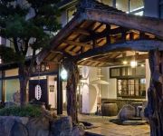
(RYOKAN) Shimanami Kaido Restaurant & Ryokan Fujimien
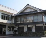
(RYOKAN) 住之江旅館
(RYOKAN) Tsutsui
(RYOKAN) Ryokan Chaume
(RYOKAN) Onyado Sazanami
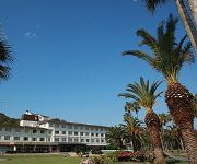
(RYOKAN) Kyukamura Okunoshima
(RYOKAN) Shimanami Ryokan
(RYOKAN) Hotel Suehiro
(RYOKAN) Mishuku Ryokan Hiyoshi
Videos from this area
These are videos related to the place based on their proximity to this place.
[HD] しまなみ海道全線(6倍速)2009.3.15
しまなみ海道全線を連続してご覧いただけます。 Road tour of Japan Shimanami japan sightseeing tour.
6歳 しまなみ海道サイクリング(1) ~生口島⇒多々羅大橋⇒大三島~ H26.4.6
2014シーズンスタート。因島大橋を単体で渡った後、車で移動。生口橋前から生口島に入り、島内を走行して多々羅大橋に登る。最後は道の駅で本...
Okunoshima Takehara city Hiroshima Japan. 大久野島をゆく
2014年2月の大久野島。 第二次大戦中は毒ガス製造所を秘匿するため地図から消された島だった。 In February, 2014, I walked around in Okunoshima. It was the...
[V0080] 030605 愛媛県側の多々羅大橋から伯方の塩の伯方島を通過し大島東岸を経て3連の来島海峡大橋へ Japanese country roads; Yoshiumi Kurushima Kaikyo Bridge
動画開始地点: 地図拡大表示の中心点 (RECORDING START POINT): Center point of this map http://maps.live.com/default.aspx?v=2&FORM=LMLTCP&cp=34.258702~133.048006&style...
[V0328] 斎灘8:多々羅大橋往復し大三島・伯方島から伊予大島半周再開
動画開始地点: 地図拡大表示の中心点 (RECORDING START POINT): Center point of this map http://maps.live.com/?v=2&cp=34.296936389319455~133.00675123929977&lvl=13&sty=r...
多々羅大橋 空撮 Shimanami Kaido Tatara Bridge
多々羅大橋は、しまなみ海道を作る橋の一つです。大三島ICを下りてすぐの多々羅しまなみ公園に行くと、瀬戸内海の青く広い景色とともに、多々...
Ohkunoshima - Hotel
Die Insel der Häschen, sogar innerhalb des Hotels konnte man sie antreffen, sodass wir das Video mit einer kleinen Kaninchenjagd beginnen. Später dann zeigen wir euch noch, wie die Lobby...
Videos provided by Youtube are under the copyright of their owners.
Attractions and noteworthy things
Distances are based on the centre of the city/town and sightseeing location. This list contains brief abstracts about monuments, holiday activities, national parcs, museums, organisations and more from the area as well as interesting facts about the region itself. Where available, you'll find the corresponding homepage. Otherwise the related wikipedia article.
Tatara Bridge
The Tatara Bridge is a cable-stayed bridge that is part of the Nishiseto Expressway, commonly known as the Shimanami Kaidō しまなみ海道. The bridge has a center span of 890 metres . As of 2010 it has the fourth longest main span of any cable-stayed bridge after the Sutong Bridge. The expressway is a series of roads and bridges that is one of the three routes of the Honshū-Shikoku Bridge Project connecting the islands of Honshū and Shikoku across the Seto Inland Sea in Japan.
Ōkunoshima
Ōkunoshima is a small island located in the Inland Sea of Japan in the city of Takehara, Hiroshima Prefecture. It is accessible by ferry from Tadanoumi and Ōmishima. There are campsites, walking trails and places of historical interest on the island. It is often called Usagi Shima because of the numerous wild rabbits that roam the island; they are rather tame and will approach humans.
Ōyamazumi Shrine
Ōyamazumi Shrine is located on the island of Omishima in the Seto Inland Sea. The shrine is dedicated to the gods who protect sailors and soldiers. Because of this, many daimyo and other military leaders have made offerings at the shrine in hopes of military success, or in thanks for victory in battle. The offerings of swords, armor, and other military equipment are now housed in the largest museum of fighting equipment used during the age of the samurai in Japan.


!['[HD] しまなみ海道全線(6倍速)2009.3.15' preview picture of video '[HD] しまなみ海道全線(6倍速)2009.3.15'](https://img.youtube.com/vi/_cFhfG2XKJI/mqdefault.jpg)


!['[V0080] 030605 愛媛県側の多々羅大橋から伯方の塩の伯方島を通過し大島東岸を経て3連の来島海峡大橋へ Japanese country roads; Yoshiumi Kurushima Kaikyo Bridge' preview picture of video '[V0080] 030605 愛媛県側の多々羅大橋から伯方の塩の伯方島を通過し大島東岸を経て3連の来島海峡大橋へ Japanese country roads; Yoshiumi Kurushima Kaikyo Bridge'](https://img.youtube.com/vi/TUJtbSVZCUE/mqdefault.jpg)
!['[V0328] 斎灘8:多々羅大橋往復し大三島・伯方島から伊予大島半周再開' preview picture of video '[V0328] 斎灘8:多々羅大橋往復し大三島・伯方島から伊予大島半周再開'](https://img.youtube.com/vi/XQy7GhMRvr8/mqdefault.jpg)

