Safety Score: 2,8 of 5.0 based on data from 9 authorites. Meaning we advice caution when travelling to Japan.
Travel warnings are updated daily. Source: Travel Warning Japan. Last Update: 2024-08-13 08:21:03
Delve into Nakamichidai
The district Nakamichidai of in Awa-gun (Chiba) is a district located in Japan about 39 mi south of Tokyo, the country's capital town.
In need of a room? We compiled a list of available hotels close to the map centre further down the page.
Since you are here already, you might want to pay a visit to some of the following locations: Minamiboso, Tateyama, Futtsu, Kimitsu and Miura. To further explore this place, just scroll down and browse the available info.
Local weather forecast
Todays Local Weather Conditions & Forecast: 16°C / 61 °F
| Morning Temperature | 18°C / 64 °F |
| Evening Temperature | 15°C / 59 °F |
| Night Temperature | 14°C / 57 °F |
| Chance of rainfall | 0% |
| Air Humidity | 58% |
| Air Pressure | 1011 hPa |
| Wind Speed | Fresh Breeze with 16 km/h (10 mph) from North-East |
| Cloud Conditions | Overcast clouds, covering 100% of sky |
| General Conditions | Light rain |
Thursday, 5th of December 2024
14°C (57 °F)
12°C (54 °F)
Light rain, gentle breeze, overcast clouds.
Friday, 6th of December 2024
14°C (58 °F)
13°C (55 °F)
Sky is clear, strong breeze, clear sky.
Saturday, 7th of December 2024
11°C (52 °F)
12°C (53 °F)
Light rain, strong breeze, overcast clouds.
Hotels and Places to Stay
Villa Katsuyama Avail
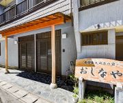
(RYOKAN) Umi to Yuhi no Tenboburo no Yado Oshinaya
(RYOKAN) Kajiya Ryokan
(RYOKAN) Amimoto no Yado Rokuya
(RYOKAN) Anaguchiso
Sunset Breeze Hota
(RYOKAN) Nokogiriyama Kanaya Onsen Kinsenkan
(RYOKAN) Konaya Ryokan
(RYOKAN) Nenkamminshuku Komatsuen
Nishi no Yado Kura
Videos from this area
These are videos related to the place based on their proximity to this place.
みんなで鋸南町のキャッチコピーを考えてみよう20150212
2015年2月12日、木村俊昭氏(東京農業大学教授、地域活性化学会理事他)を講師にお招きし、日比谷高等学校勝山寮で開催した、ようこそ鋸南プ...
大仏と観音が共同生活 The great image of buddha and the goddess of mercy live together.
豪華絢爛千葉の旅→http://amzn.to/oEwwUO Amusing movie MEGWIN TV http://megwin.com/ facebook http://www.facebook.com/pages/Amusing-movie-MEGWIN-TV/241796149175117 Twitter ...
Huge great image of buddha and huge goddess of mercy's mountains 巨大大仏と観音3
豪華絢爛千葉の旅→http://amzn.to/oEwwUO Amusing movie MEGWIN TV http://megwin.com/ facebook http://www.facebook.com/pages/Amusing-movie-MEGWIN-TV/241796149175117 Twitter ...
君は地獄を見たことがあるか? Have you seen the hell?
豪華絢爛千葉の旅→http://amzn.to/oEwwUO Amusing movie MEGWIN TV http://megwin.com/ facebook http://www.facebook.com/pages/Amusing-movie-MEGWIN-TV/241796149175117 Twitter ...
Mt Nokogiri & Daibutsu Buddha
Our excursion on Sunday October 27, 2013 to Mount Nokogiri on southern Chiba's Boso Peninsula and the Daibutsu Stone Buddha.
(HD)鋸山ロープウェー~地獄のぞき 2012.02.27
2012/02/27 使用した音楽はこちら。 【サイト名】フリー音楽素材 H/MIX GALLERY 【アドレス】http://www.hmix.net/ 【曲名】ホシノキセキ.
Videos provided by Youtube are under the copyright of their owners.
Attractions and noteworthy things
Distances are based on the centre of the city/town and sightseeing location. This list contains brief abstracts about monuments, holiday activities, national parcs, museums, organisations and more from the area as well as interesting facts about the region itself. Where available, you'll find the corresponding homepage. Otherwise the related wikipedia article.
Uraga Channel
The Uraga Channel is a waterway connecting Tokyo Bay to the Sagami Gulf. It is an important channel for ships headed from Tokyo, Yokohama, and Chiba to the Pacific Ocean and beyond.
Tomiura, Chiba
Tomiura, Chiba is a former town located in Awa District, Chiba, Japan. As of March 20, 2006, the town had an estimated population of 5,698 and a density of 221 persons per km². The total area was 25.69 km².
Miyoshi, Chiba
Miyoshi, Chiba is a former village located in Awa District, Chiba, Japan. As of March 20, 2006, the village had an estimated population of 4,560 and a density of 135 persons per km². The total area was 33.92 km².
Awa District, Chiba
Awa District, Chiba is a district located in Chiba, Japan. As of August 2010, the district had an estimated population of 8,992 and a density of 198 persons per km². Its total area was 45.16 square kilometres . Awa District at present consists only of the town of Kyonan
Uraga, Kanagawa
Uraga, Kanagawa is a subdivision of the city of Yokosuka, Kanagawa Prefecture, Japan. It is located on the south eastern side of the Miura Peninsula, at the northern end of the Uraga Channel, at the entrance of Tokyo Bay.
Japanese battleship Aki
The Aki (安芸, Aki was a semi-dreadnought type battleship of the Imperial Japanese Navy, designed and built in Japan by the Kure Naval Arsenal. The name Aki comes from Aki Province, now a part of Hiroshima prefecture.
Fukuryu
Suicide divers were a part of the Japanese Special Attack Units prepared to resist the invasion of the Home islands by Allied forces. They were armed with a mine containing 15 kg of explosive, fitted to a 5 m bamboo pole. They would dive and stick the pole into the hull of an enemy ship, destroying themselves in the process. They were equipped with a diving jacket and trousers, diving shoes, and a diving helmet fixed by four bolts.
Nokogiriyama Ropeway
The Nokogiriyama Ropeway is the name of Japanese aerial lift line, as well as its operator. The line climbs Mount Nokogiri (Nokogiri-yama) from the outer Tokyo Bay coast in Futtsu, Chiba. It opened in 1962. Nokogiriyama Ropeway Company belongs to Keisei Group.
Tokyo-Wan Ferry
The Tokyo-Wan Ferry (東京湾フェリー, Tōkyō-Wan Ferī, "Tokyo Bay Ferry") is Japanese car ferry operator. Its line links Yokosuka, Kanagawa and Futtsu, Chiba, across Tokyo Bay in some 40 minutes. Headquartered in Yokosuka, the company started its service from 1957. The ferry started to accept PASMO smart cards from June 2008. At the Port of Kanaya, connection tickets to Keihin Electric Express Railway (Keikyū) Lines are available.
Mount Nokogiri (Chiba)
literally "saw mountain" is a low mountain on the Bōsō Peninsula on Honshu, Japan. It lies on the southern border of the city of Futtsu and the town Kyonan in Awa District in Chiba Prefecture. The mountain runs east to west, having the characteristic sawtoothed profile of a Japanese saw . It falls steeply into Tokyo Bay on its western side, where it is pierced by two road tunnels and a rail tunnel, carrying the Uchibo Line south from Futtsu to Tateyama.
Ōnuki Station
Ōnuki Station is a railway station operated by JR East's Uchibō Line located in Futtsu, Chiba Prefecture, Japan. It is 46.6 kilometers from the terminus of the Uchibō Line at Soga Station.
Sanukimachi Station
Sanukimachi Station is a railway station operated by JR East's Uchibō Line located in Futtsu, Chiba Prefecture, Japan. It is 50.7 kilometers from the terminus of the Uchibō Line at Soga Station.
Takeoka Station
Takeoka Station is a railway station operated by JR East's Uchibō Line located in Futtsu, Chiba Prefecture, Japan. It is 60.2 kilometers from the terminus of the Uchibō Line at Soga Station.
Kazusa-Minato Station
Kazusa-Minato Station is a railway station operated by JR East's Uchibō Line located in Futtsu, Chiba Prefecture, Japan. It is 55.1 kilometers from the terminus of the Uchibō Line at Soga Station.
Hamakanaya Station
Hamakanaya Station is a railway station in Futtsu, Chiba, Japan, operated by East Japan Railway Company (JR East).
Hota Station (Chiba)
Hota Station is a railway station operated by JR East's Uchibō Line located in Kyonan, Awa District, Chiba Prefecture, Japan. It is 67.5 kilometres from the terminus of the Uchibō Line at Soga Station.
Awa-Katsuyama Station
Awa-Katsuyama Station is a railway station operated by JR East's Uchibō Line located in Kyonan, Awa District, Chiba Prefecture, Japan. It is 70.9 kilometers from the terminus of the Uchibō Line at Soga Station.
Iwai Station
Iwai Station is a railway station operated by JR East's Uchibō Line located in Minamibōsō, Chiba Prefecture Japan. It is 73.7 kilometers from the terminus of the Uchibō Line at Soga Station.
Tomiura Station (Chiba)
Tomiura Station is a railway station operated by JR East's Uchibō Line located in Tateyama, Chiba Prefecture Japan. It is 79.8 kilometers from the terminus of the Uchibō Line at Soga Station.
Nakofunakata Station
Nakofunakata Station is a railway station operated by JR East's Uchibō Line located in Tateyama, Chiba Prefecture, Japan. It is 82.1 kilometers from the terminus of the Uchibō Line at Soga Station.
Tateyama Station (Chiba)
Tateyama Station is a railway station in Tateyama, Chiba Japan, operated by East Japan Railway Company (JR East).
Nago-dera
Nago-dera is a Buddhist temple located in the city of Tateyama in southern Chiba Prefecture, Japan. The temple is also called "Nago-ji" using the alternate pronunciation of the final Chinese character in its name, or the "Nago Kannon", after its primary object of worship.
Daifuku-ji
Daifuku-ji is a Buddhist temple located in the city of Tateyama in Chiba Prefecture, and is a temple of the Chizen Sect of Shingon Buddhism. According to tradition, the temple was founded by Gyōki (668 - 749) in 717 early in the Nara period. It was later revived by a visit by the Tendai Buddhist priest Ennin (794 - 864) early in the Heian period. The date at which the temple returned to the Shingon sect is unknown.
Nihon-ji
is a Buddhist temple in the city of Kyonan, Chiba Prefecture, Japan. The temple is located on the slopes of Mount Nokogiri and is known for its Nihon-ji Daibutsu. Nihon-ji was established as a Hossō sect temple, was transferred to the Tendai sect, and is now a Sōtō Zen temple. Since its founding the temple has fallen into ruin and seen revival numerous times.
Takagoyama Prefectural Natural Park
Takagoyama Prefectural Natural Park is a Prefectural Natural Park in south-central Chiba Prefecture, Japan. First designated for protection in 1935, the park's central feature is Mount Takago . The park spans the municipalities of Futtsu and Kimitsu. In 1956 the habitat the mountain provides for the Japanese macaque was designated a Natural Monument.


