Safety Score: 2,8 of 5.0 based on data from 9 authorites. Meaning we advice caution when travelling to Japan.
Travel warnings are updated daily. Source: Travel Warning Japan. Last Update: 2024-08-13 08:21:03
Discover Orito
Orito in Shimokita-gun (Aomori) is a place in Japan about 409 mi (or 658 km) north of Tokyo, the country's capital city.
Current time in Orito is now 10:49 AM (Sunday). The local timezone is named Asia / Tokyo with an UTC offset of 9 hours. We know of 8 airports near Orito, of which one is a larger airport. The closest airport in Japan is Hakodate Airport in a distance of 18 mi (or 29 km), North. Besides the airports, there are other travel options available (check left side).
There is one Unesco world heritage site nearby. It's Shirakami-Sanchi in a distance of 84 mi (or 136 km), South-West. If you need a hotel, we compiled a list of available hotels close to the map centre further down the page.
While being here, you might want to pay a visit to some of the following locations: Hakodate, Mutsu, Hokuto, Aomori and Muroran. To further explore this place, just scroll down and browse the available info.
Local weather forecast
Todays Local Weather Conditions & Forecast: 13°C / 55 °F
| Morning Temperature | 14°C / 57 °F |
| Evening Temperature | 7°C / 44 °F |
| Night Temperature | 4°C / 39 °F |
| Chance of rainfall | 4% |
| Air Humidity | 84% |
| Air Pressure | 1010 hPa |
| Wind Speed | Fresh Breeze with 14 km/h (9 mph) from North-East |
| Cloud Conditions | Overcast clouds, covering 100% of sky |
| General Conditions | Moderate rain |
Monday, 18th of November 2024
3°C (37 °F)
-0°C (32 °F)
Light snow, fresh breeze, overcast clouds.
Tuesday, 19th of November 2024
4°C (39 °F)
2°C (36 °F)
Light snow, moderate breeze, overcast clouds.
Wednesday, 20th of November 2024
9°C (49 °F)
9°C (49 °F)
Light rain, moderate breeze, overcast clouds.
Hotels and Places to Stay
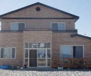
(RYOKAN) Try Out Minshuku Aoi
Videos from this area
These are videos related to the place based on their proximity to this place.
「あさこはうす」へお手紙を! Asako House
コスモス ブログ http://cosmosnantes.blogspot.fr/2013/06/blog-post_16.html 手紙の宛先 〒039-4601 青森県下北郡大間町字小奥戸396...
【HD】青森県 大間崎 - がんばれ東北!
大間崎の詳細情報や地図はこちら↓ http://www.healing-japan.tv/spot-152.html 大間崎(おおまざき)は、本州最北端のなだらかな岬で、北海道が間近に...
日の出・本州最北端大間崎から北海道の景観(歴史秘話ヒストリアOP)癒しの曲
神々しい日の出と間近に見える北海道(歴史秘話ヒストリア)オープニングテーマ・・・"Japanese Sunrise" 日出ずる国・日本 Runjapan 本州最北端青...
June 26, 2018 Sai Village Tour DAY 1
Stuffed animals went on a 3-day tour to Sai Village, Aomori Japan. 青森県佐井村ツアー初日のダイジェストです。 http://www.vill.sai.lg.jp/en/index.html.
Videos provided by Youtube are under the copyright of their owners.
Attractions and noteworthy things
Distances are based on the centre of the city/town and sightseeing location. This list contains brief abstracts about monuments, holiday activities, national parcs, museums, organisations and more from the area as well as interesting facts about the region itself. Where available, you'll find the corresponding homepage. Otherwise the related wikipedia article.
Shimokita Peninsula
The Shimokita Peninsula (下北半島, Shimokita-hantō) is the remote northeastern cape of the Japanese island of Honshū, stretching out towards Hokkaidō. Administratively the area is a part of Aomori Prefecture. Shaped like an axe pointing west, the peninsula has a thin "axe handle" connecting the mountainous "axe blade" to the mainland. The coasts maintain a thin scattering of population but the interior is practically uninhabited.


