Safety Score: 3,0 of 5.0 based on data from 9 authorites. Meaning we advice caution when travelling to Italy.
Travel warnings are updated daily. Source: Travel Warning Italy. Last Update: 2024-08-13 08:21:03
Explore Arni
Arni in Provincia di Lucca (Tuscany) with it's 157 inhabitants is a city in Italy about 189 mi (or 304 km) north-west of Rome, the country's capital.
Local time in Arni is now 05:16 AM (Friday). The local timezone is named Europe / Rome with an UTC offset of one hour. We know of 11 airports in the vicinity of Arni, of which 5 are larger airports. The closest airport in Italy is Massa Cinquale Airport in a distance of 8 mi (or 12 km), South-West. Besides the airports, there are other travel options available (check left side).
There are several Unesco world heritage sites nearby. The closest heritage site in Italy is Piazza del Duomo, Pisa in a distance of 25 mi (or 40 km), South. We found 3 points of interest in the vicinity of this place. If you need a place to sleep, we compiled a list of available hotels close to the map centre further down the page.
Depending on your travel schedule, you might want to pay a visit to some of the following locations: Fontana delle Monache, Seravezza, Pontestazzemese, Montignoso and San Vito-Cerreto. To further explore this place, just scroll down and browse the available info.
Local weather forecast
Todays Local Weather Conditions & Forecast: 14°C / 56 °F
| Morning Temperature | 9°C / 48 °F |
| Evening Temperature | 11°C / 52 °F |
| Night Temperature | 11°C / 51 °F |
| Chance of rainfall | 0% |
| Air Humidity | 42% |
| Air Pressure | 1023 hPa |
| Wind Speed | Light breeze with 3 km/h (2 mph) from South-West |
| Cloud Conditions | Clear sky, covering 5% of sky |
| General Conditions | Sky is clear |
Saturday, 16th of November 2024
14°C (56 °F)
11°C (52 °F)
Sky is clear, light breeze, clear sky.
Sunday, 17th of November 2024
13°C (55 °F)
14°C (57 °F)
Light rain, light breeze, overcast clouds.
Monday, 18th of November 2024
15°C (59 °F)
12°C (54 °F)
Light rain, gentle breeze, overcast clouds.
Hotels and Places to Stay
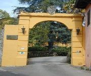
Residenza San Michele
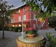
Bed & Breakfast Villa A Case Rosse
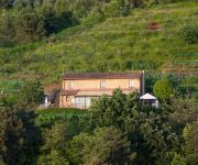
Agriturismo Karma
Videos from this area
These are videos related to the place based on their proximity to this place.
RISTORANTE MICHELANGELO SERAVEZZA (LUCCA)
RISTORANTE MICHELANGELO http://www.ristorantemichelangelo-1.com 223, V. S. MICHELE - AZZANO (ALTA VERSILIA) Tel 00390584773312 Il ristorante Michelangelo dispone di un'ampia ...
www.panoramicando.com Falco Pellegrino sul Monte Folgorito (Alpi Apuane)
http://www.panoramicando.com/Panoramicando/Home.html video girato il 8 gennaio 2013.
Le meraviglie dell' Antro del Corchia...
Grotta turistica Antro del Corchia, Levigliani di Stazzema.
ALPI APUANE 8 Dicembre al Rifugio Del Freo Pietrapana
Ogni anno l'otto Dicembre molti gruppi del CAI "Club Alpino Italiano" e amici della montagna si ritrovano al Rifugio del Freo "Pietrapana" alla Foce di Mosceta per ricordare amici e parenti...
Apicoltura in Garfagnana - Vagli Sotto - La Lezza -
Apicoltura Daniela Dini: questo è il nostro apiario di Vagli Sotto nel Parco Regionale delle Alpi Apuane.
Fabbriche di Careggine, paese Fantasma nel Lago di Vagli (1994)
il Lago di Vagli è situato nel comune di Vagli Sotto, provincia di Lucca; formato artificialmente con lo sbarramento (diga) del torrente Edron nel 1947 da parte della SELT Valdarno (oggi ENEL...
TREKKING - Campocatino - Eremo di San Viviano - di Sergio Colombini
Campocatino è una bella conca erbosa modellata da un antico ghiacciaio sospeso, è sovrastata dal monte Roccandagia. Nella conca ci sono tante casette in pietra usate un tempo dai pastori...
Parapendio Monte Sumbra - Alpi Apuane
2005 - Parapendio. Decolli ancora pirleschi di Roberto Donati e Enzo Kung Pignone dal monte Sumbra (1765 mt) - Alpi Apuane. L'atterraggio è sul lago di Vagli, là sotto... Paragliding take-off...
Videos provided by Youtube are under the copyright of their owners.
Attractions and noteworthy things
Distances are based on the centre of the city/town and sightseeing location. This list contains brief abstracts about monuments, holiday activities, national parcs, museums, organisations and more from the area as well as interesting facts about the region itself. Where available, you'll find the corresponding homepage. Otherwise the related wikipedia article.
Monte Tambura
Monte Tambura is a mountain (1,891 m) in the Alpi Apuane, in Tuscany, central Italy. It is the second highest peak in the chain after Monte Pisanino. Located on the boundary between the province of Lucca and the province of Massa-Carrara, the Tambura is part of the Natural Regional Park of the Alpi Apuane.


