Safety Score: 3,0 of 5.0 based on data from 9 authorites. Meaning we advice caution when travelling to Italy.
Travel warnings are updated daily. Source: Travel Warning Italy. Last Update: 2024-08-13 08:21:03
Delve into Pian dei Meini
Pian dei Meini in Province of Pisa (Tuscany) with it's 20 habitants is a town located in Italy about 154 mi (or 247 km) north-west of Rome, the country's capital town.
Time in Pian dei Meini is now 11:30 AM (Friday). The local timezone is named Europe / Rome with an UTC offset of one hour. We know of 11 airports closer to Pian dei Meini, of which 5 are larger airports. The closest airport in Italy is Lucca / Tassignano Airport in a distance of 13 mi (or 21 km), North. Besides the airports, there are other travel options available (check left side).
There are several Unesco world heritage sites nearby. The closest heritage site in Italy is Piazza del Duomo, Pisa in a distance of 13 mi (or 22 km), North-West. We saw 4 points of interest near this location. In need of a room? We compiled a list of available hotels close to the map centre further down the page.
Since you are here already, you might want to pay a visit to some of the following locations: Pontedera, Ponsacco, Calcinaia, Capannoli and Bientina. To further explore this place, just scroll down and browse the available info.
Local weather forecast
Todays Local Weather Conditions & Forecast: 12°C / 53 °F
| Morning Temperature | 4°C / 38 °F |
| Evening Temperature | 8°C / 46 °F |
| Night Temperature | 6°C / 43 °F |
| Chance of rainfall | 0% |
| Air Humidity | 51% |
| Air Pressure | 1023 hPa |
| Wind Speed | Light breeze with 3 km/h (2 mph) from South-West |
| Cloud Conditions | Few clouds, covering 24% of sky |
| General Conditions | Few clouds |
Saturday, 16th of November 2024
13°C (55 °F)
7°C (45 °F)
Sky is clear, calm, clear sky.
Sunday, 17th of November 2024
10°C (51 °F)
11°C (52 °F)
Light rain, light breeze, overcast clouds.
Monday, 18th of November 2024
15°C (59 °F)
11°C (51 °F)
Light rain, light breeze, overcast clouds.
Hotels and Places to Stay
Armonia
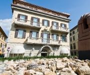
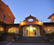
Tower Inn Pisa Valdera
Boccaccio
Hotel Borgo il Poeta
Calamidoro
BricHotel
Il Falchetto
La Pace Hotel
Sextum
Centro Neide
Videos from this area
These are videos related to the place based on their proximity to this place.
ALLUVIONE PONTEDERA 4 NOVEMBRE 1966
Il giorno 3 novembre il fiume Era raggiunge il limite di piena. L'Arno, ormai non più in grado di ricevere le acque dell'affluente, inizia a crescere al ritmo di un metro l'ora. La notte...
Pontedera (La Borra): Complesso Residenze del Parco, Appartamenti da 2 a 4 Vani Nuovi
Pontedera, località La Borra, in una zona immersa nel verde con parco alberato di circa 6000 mq., vicino alla pista ciclabile, è in fase di realizzazione il complesso “Residenze del Parco”....
TREKKING - Da Pontedera a Villa Saletta - di Sergio Colombini
Questo itineraro inizia da Pontedera (Laghi del Braccini), passa da Treggiaia, Forcoli, Colleoli, Palaia, Partino e arriva a Villa Saletta. Il percorso è di 22 chilometri, non presenta difficoltà...
Highlights 28 07 14 - ITF Pro Circuit Città di Pontedera Banca Sistema
Terzo giorno del torneo ITF Pro Circuit Città di Pontedera Banca Sistema. Videomaker: Lorenzo Costagliola Comunicazione: progettoimmagina.com.
Videos provided by Youtube are under the copyright of their owners.
Attractions and noteworthy things
Distances are based on the centre of the city/town and sightseeing location. This list contains brief abstracts about monuments, holiday activities, national parcs, museums, organisations and more from the area as well as interesting facts about the region itself. Where available, you'll find the corresponding homepage. Otherwise the related wikipedia article.
Era (river)
The Era is a river in Tuscany in Italy. It rises near Volterra and flows into the Arno river at Pontedera. The Era is 54 km long, and its main tributaries are: (to the left) Cascina river, Ragone torrent, Sterza torrent, and (to the right) Capriggine torrent and Roglio torrent. In 1966 the river flooded the town of Pontedera.
Pontedera Airfield
Pontedera Airfield is an abandoned military airfield in Italy, located within the town of Pontedera, in Tuscany in the administrative province of Pisa. It was an all-weather temporary field built by the XII Engineer Command using a graded earth compacted surface, with a prefabricated hessian (burlap) surfacing known as PHS. PHS was made of an asphalt-impregnated jute which was rolled out over the compacted surface over a square mesh track (SMT) grid of wire joined in 3-inch squares.
Pontedera Airport
The Pontedera airport was an airport located in Pontedera, Italy. It was built south-west of the city centre in 1913.


