Safety Score: 3,0 of 5.0 based on data from 9 authorites. Meaning we advice caution when travelling to Italy.
Travel warnings are updated daily. Source: Travel Warning Italy. Last Update: 2024-08-13 08:21:03
Delve into Valdurna
Valdurna in Bolzano (Trentino-Alto Adige) with it's 49 habitants is located in Italy about 339 mi (or 546 km) north of Rome, the country's capital town.
Current time in Valdurna is now 04:36 AM (Friday). The local timezone is named Europe / Rome with an UTC offset of one hour. We know of 12 airports close to Valdurna, of which 5 are larger airports. The closest airport in Italy is Bolzano Airport in a distance of 20 mi (or 32 km), South. Besides the airports, there are other travel options available (check left side).
There are several Unesco world heritage sites nearby. The closest heritage site in Italy is The Dolomites in a distance of 35 mi (or 57 km), East. We encountered 3 points of interest near this location. If you need a hotel, we compiled a list of available hotels close to the map centre further down the page.
While being here, you might want to pay a visit to some of the following locations: Sarnthein, Campo di Trens, Villandro - Villanders, Villandro and Sterzing. To further explore this place, just scroll down and browse the available info.
Local weather forecast
Todays Local Weather Conditions & Forecast: 10°C / 51 °F
| Morning Temperature | 2°C / 36 °F |
| Evening Temperature | 5°C / 42 °F |
| Night Temperature | 5°C / 42 °F |
| Chance of rainfall | 0% |
| Air Humidity | 38% |
| Air Pressure | 1022 hPa |
| Wind Speed | Gentle Breeze with 6 km/h (4 mph) from South |
| Cloud Conditions | Few clouds, covering 21% of sky |
| General Conditions | Few clouds |
Saturday, 16th of November 2024
12°C (53 °F)
5°C (41 °F)
Sky is clear, light breeze, clear sky.
Sunday, 17th of November 2024
11°C (51 °F)
3°C (38 °F)
Few clouds, light breeze.
Monday, 18th of November 2024
5°C (42 °F)
1°C (34 °F)
Light snow, gentle breeze, broken clouds.
Hotels and Places to Stay
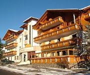
The Panoramic Lodge
Feldrand
Videos from this area
These are videos related to the place based on their proximity to this place.
Schwanensee - Die sterbenden Schwäne 2
Ballett vom Feinsten auf einer Hochzeit in Astfeld-Sarntal-Südtirol.
Baurhof - Urlaub auf dem Bauernhof
Der idyllische Bauernhof befindet sich in Südtirol. Besser gesagt im schönen Sarntal, wo die Traditionen noch gelebt werden. Genießen Sie die Berge, die frische Luft und vor allem die Ruhe....
Die Sarnar Schüeplattlarlearpeitl 2
Eine spätberufene Sarner Schuhplattlergruppe während ihres ersten Auftrittes.
Die Sarnar Schüeplattlarlearpeitl 1
Eine spätberufene Sarner Schuhplattlergruppe während ihres ersten Auftrittes.
Penser Joch 2211m / Südtirol / Italien (2. Penser Tal)
DE Abfahrt über die Südrampe in Richtung Bozen/Bolzano hinab in das Penser Tal nach Weißenbach/Riobianco. ENG Descent southwards direction Bozen/Bolzano through the Penser Valley to ...
Bergwerkstauchen Sarntal - Mine diving in South Tirol
Tauchgang in einem "abgesoffenen" Bergbau in Südtirol.
Alpok Trilógia.2011.3.rész. Irány Észak (Italy-Austria) HD 720p..mp4
Biciklitúra az Alpokban 3 részben. 2011.08.11.-08.19. 3.rész/privát kommentár/ Trentino-Dél Tirol Útvonal: Riva del Garda (78m) -- Ballino (750m) -- Ponte Arche (523m) -- Molveno (865m)...
[AT/SM] [HD] Penserjoch from Bolzano to Strada Provinciale 135
Description: [AT/SM] [HD] "Penserjoch" from "Bolzano" to "Strada Provinciale 135" Resolution: 1280x720p/25fps (170° Ultra Wide Field of View) Tags: 135, 135, 450, 750, Africa, Africa Twin,...
Videos provided by Youtube are under the copyright of their owners.
Attractions and noteworthy things
Distances are based on the centre of the city/town and sightseeing location. This list contains brief abstracts about monuments, holiday activities, national parcs, museums, organisations and more from the area as well as interesting facts about the region itself. Where available, you'll find the corresponding homepage. Otherwise the related wikipedia article.
Durnholzer See
The Durnholzer See is a lake in the Sarntal Alps in South Tyrol, Italy. It belongs to the municipality of Sarntal.
Durnholzer Tal
The Durnholzer Tal is a tributary valley of the Sarntal in South Tyrol, Italy. The village in the valley is Mühlwald, which is a frazione of the municipality of Sarntal.


!['[AT/SM] [HD] Penserjoch from Bolzano to Strada Provinciale 135' preview picture of video '[AT/SM] [HD] Penserjoch from Bolzano to Strada Provinciale 135'](https://img.youtube.com/vi/bCF5qbIf4CM/mqdefault.jpg)

