Safety Score: 3,0 of 5.0 based on data from 9 authorites. Meaning we advice caution when travelling to Italy.
Travel warnings are updated daily. Source: Travel Warning Italy. Last Update: 2024-08-13 08:21:03
Discover Canete
Canete in Provincia di Sondrio (Lombardy) with it's 15 citizens is a town in Italy about 341 mi (or 549 km) north-west of Rome, the country's capital city.
Current time in Canete is now 05:31 PM (Thursday). The local timezone is named Europe / Rome with an UTC offset of one hour. We know of 9 airports near Canete, of which 4 are larger airports. The closest is airport we know is Samedan Airport in Switzerland in a distance of 24 mi (or 38 km). The closest airport in Italy is Bergamo / Orio Al Serio Airport in a distance of 46 mi (or 38 km), North-East. Besides the airports, there are other travel options available (check left side).
There are several Unesco world heritage sites nearby. The closest heritage site in Italy is Rhaetian Railway in the Albula / Bernina Landscapes in a distance of 21 mi (or 33 km), North-East. Looking for a place to stay? we compiled a list of available hotels close to the map centre further down the page.
When in this area, you might want to pay a visit to some of the following locations: Villa, Villa di Chiavenna, Promontogno, Prosto and Piuro. To further explore this place, just scroll down and browse the available info.
Local weather forecast
Todays Local Weather Conditions & Forecast: 13°C / 55 °F
| Morning Temperature | 5°C / 41 °F |
| Evening Temperature | 9°C / 49 °F |
| Night Temperature | 7°C / 44 °F |
| Chance of rainfall | 0% |
| Air Humidity | 40% |
| Air Pressure | 1021 hPa |
| Wind Speed | Light breeze with 5 km/h (3 mph) from South |
| Cloud Conditions | Clear sky, covering 0% of sky |
| General Conditions | Sky is clear |
Friday, 15th of November 2024
16°C (61 °F)
8°C (46 °F)
Sky is clear, light breeze, few clouds.
Saturday, 16th of November 2024
16°C (61 °F)
9°C (48 °F)
Sky is clear, light breeze, clear sky.
Sunday, 17th of November 2024
15°C (59 °F)
8°C (47 °F)
Scattered clouds, light breeze.
Hotels and Places to Stay
Crimea
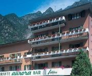
Aurora
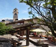
Stüa Granda Hotel
Videos from this area
These are videos related to the place based on their proximity to this place.
in Mana da Villa di Chiavenna IT a La Palù CH.3GP
giretto tra le montagne italiane, al confine della Svizzera, con ingresso in dogana ... guida rilassata a contemplare il paesaggio mozzafiato ...
SAVOGNO.mp4
Il paese di Savogno e' situato ad un'altezza di circa 1000 mt arroccato sul fianco della montagna lungo una dirittura che mette in comunicazione le valli del Reno superiore con la Valchiavenna.Fin...
2010_07_04 - Savogno e l'Alpe Alpigia
La Valle Alpigia si trova a 3 km da Chiavenna, proprio sopra le cascate dell'acqua Fraggia. La prima tappa è Savogno: un bel paesino il cui campanile della chiesa resta visibile dalla statale...
Ricorrenza del 4 novembre a S Croce di Piuro
Riprese video di Arcangelo Aquino presso la chiesa rotonda di Santa Croce di Piuro e al monumento dei caduti.
Appartamento in Vendita da Privato - VIA DEI CENNI 3, Piuro
Vedi tutti i dettagli dell'annuncio su ClickCase.it: http://www.clickcase.it/appartamento-in-casa-bifamiliare-ristrutturato-in-vendita-piuro-276.html Descrizione annuncio: Da Privato....
Wasistdas Vivere L'Arte
Piuro Vivere l'Arte. Festival dell'arte in Val Bregaglia. Installazioni di arte contemporanea del gruppo Wasistdas (Che cos'é questo?) in collaborazione con: Associazione italo-svizzera per...
Videos provided by Youtube are under the copyright of their owners.
Attractions and noteworthy things
Distances are based on the centre of the city/town and sightseeing location. This list contains brief abstracts about monuments, holiday activities, national parcs, museums, organisations and more from the area as well as interesting facts about the region itself. Where available, you'll find the corresponding homepage. Otherwise the related wikipedia article.
Val Bregaglia
The Val Bregaglia (Italian), Val Bargaja (Lombard), or Bergell Tal (German) is an alpine valley of Switzerland and Italy at the base of which runs the river Mera River (or Maira). It begins at the Maloja Pass (1815 m) which connects it to the Engadin (the valley of the river Inn, which is part of the Danube basin) and extends westwards to Chiavenna shortly after which the Mera joins with the Liro and turns south towards Lake Como.


