Safety Score: 3,0 of 5.0 based on data from 9 authorites. Meaning we advice caution when travelling to Italy.
Travel warnings are updated daily. Source: Travel Warning Italy. Last Update: 2024-08-13 08:21:03
Explore Prariond
Prariond in Valle d'Aosta (Aosta Valley) with it's 13 inhabitants is a city in Italy about 375 mi (or 604 km) north-west of Rome, the country's capital.
Local time in Prariond is now 11:18 AM (Friday). The local timezone is named Europe / Rome with an UTC offset of one hour. We know of 12 airports in the vicinity of Prariond, of which 5 are larger airports. The closest airport in Italy is Aosta Airport in a distance of 16 mi (or 25 km), North-East. Besides the airports, there are other travel options available (check left side).
There are several Unesco world heritage sites nearby. The closest heritage site in Italy is Residences of the Royal House of Savoy in a distance of 50 mi (or 80 km), South-East. If you need a place to sleep, we compiled a list of available hotels close to the map centre further down the page.
Depending on your travel schedule, you might want to pay a visit to some of the following locations: Valgrisenche, Rhemes-Saint-Georges, Avise, Rhemes-Notre-Dame and La Salle. To further explore this place, just scroll down and browse the available info.
Local weather forecast
Todays Local Weather Conditions & Forecast: -2°C / 28 °F
| Morning Temperature | -9°C / 16 °F |
| Evening Temperature | -6°C / 22 °F |
| Night Temperature | -9°C / 17 °F |
| Chance of rainfall | 2% |
| Air Humidity | 73% |
| Air Pressure | 1011 hPa |
| Wind Speed | Moderate breeze with 9 km/h (6 mph) from East |
| Cloud Conditions | Broken clouds, covering 64% of sky |
| General Conditions | Snow |
Saturday, 23rd of November 2024
1°C (33 °F)
-7°C (19 °F)
Sky is clear, gentle breeze, clear sky.
Sunday, 24th of November 2024
1°C (34 °F)
-4°C (24 °F)
Overcast clouds, light breeze.
Monday, 25th of November 2024
5°C (40 °F)
6°C (42 °F)
Light rain, light breeze, overcast clouds.
Hotels and Places to Stay
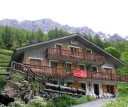
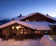
Maison des Myrtilles
Hotel Ristorante Paramont
Col du Mont
Hotel Ristoro Vagneur
Le Vieux Quartier
Videos from this area
These are videos related to the place based on their proximity to this place.
DISCESA DA VENS SU SAINT NICOLAS (DESCENT TO SAINT NICOLAS)
Discesa in MTB da Vens a Saint Nicolas con panorami sulla Valle d'Aosta. MTB descent from Vens to saint Nicolas sightseeing Aosta Valley landscapes.
Tour de ski - 2011 - Rhême-Notre-Dame
Realizzazione delle riprese durante le competizioni, diurne e notturne, e montaggio di un cortometraggio di 10 minuti circa di sintesi dell'evento pubblicato su DVD-Video e su web.
In viaggio in Val di Rhemes
Lungo la strada che porta a Rhemes Notre Dame nella più bella valle della Val d'Aosta!
Discesa sci-alpinistica dal Col di Sort
Discesa sci-alpinistica dal Col di Sort, da Rhemes Notre Dame (AO).
Videos provided by Youtube are under the copyright of their owners.
Attractions and noteworthy things
Distances are based on the centre of the city/town and sightseeing location. This list contains brief abstracts about monuments, holiday activities, national parcs, museums, organisations and more from the area as well as interesting facts about the region itself. Where available, you'll find the corresponding homepage. Otherwise the related wikipedia article.
Refuge des Anges au Morion
Refuge des Anges au Morion is a refuge in the Alps in Italy.


