Safety Score: 4,2 of 5.0 based on data from 9 authorites. Meaning please reconsider your need to travel to Israel.
Travel warnings are updated daily. Source: Travel Warning Israel. Last Update: 2024-08-13 08:21:03
Delve into Shekhunat Ge’ulim
The district Shekhunat Ge’ulim of in Northern District is a district located in Israel about 72 mi north of Jerusalem, the country's capital town.
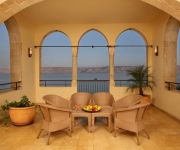
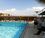
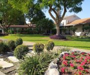
In need of a room? We compiled a list of available hotels close to the map centre further down the page.
Since you are here already, you might want to pay a visit to some of the following locations: Al Butayhah, Fiq, Ash Shunah ash Shamaliyah, Nazareth and Kafr Asad. To further explore this place, just scroll down and browse the available info.
Local weather forecast
Todays Local Weather Conditions & Forecast: 25°C / 77 °F
| Morning Temperature | 18°C / 64 °F |
| Evening Temperature | 23°C / 74 °F |
| Night Temperature | 19°C / 66 °F |
| Chance of rainfall | 0% |
| Air Humidity | 30% |
| Air Pressure | 1014 hPa |
| Wind Speed | Gentle Breeze with 7 km/h (4 mph) from South-East |
| Cloud Conditions | Broken clouds, covering 62% of sky |
| General Conditions | Broken clouds |
Saturday, 16th of November 2024
25°C (76 °F)
19°C (66 °F)
Sky is clear, gentle breeze, clear sky.
Sunday, 17th of November 2024
23°C (73 °F)
18°C (65 °F)
Overcast clouds, light breeze.
Monday, 18th of November 2024
22°C (72 °F)
17°C (62 °F)
Light rain, moderate breeze, scattered clouds.
Hotels and Places to Stay
SCOTS HOTEL
Arazim Tiberias
Arcadia
Ohalo Manor Hotel
C-Hotel Tiberias
Panorama
HAMEI TIBERIAS HOTEL (Ex. MINERAL)
Merom Golan Resort Village
Degania Bet Resort
Ahuzat Kinorot
Videos from this area
These are videos related to the place based on their proximity to this place.
Leonardo Club Tiberias Hotel
http://www.fattal-hotels.com/tiberias-hotels/leonardo-club-tiberias The all-inclusive Fattal Chain Leonardo Club Tiberias Hotel is the only hotel in the north that offers an all-inclusive vacation...
The luxurious Scots hotel, Tiberias, Sea of Galilee, Israel. An amazing experience
Zahi Shaked A tour guide in Israel and his camera +972 54 6905522 zahigo25@walla.com צחי שקד, מורה דרך ומדריך תיירים. מצלם אותם בכל הזדמנות 0546905522...
Turning Tiberias central bus station into a park, museum, tourism and transportation center
Tiberias is the main city to the shores of the Sea of Galilee. It is rich with history and a major tourism center. It's main bus station was built in the 1950s in a modernist international...
Walking Where Jesus Walked and Shooting Uzi's Billandsara's photos around Tiberias, Israel
Preview of Billandsara's blog at TravelPod. Read the full blog here: http://www.travelpod.com/travel-blog-entries/billandsara/6/1206812580/tpod.html This blog preview was made by TravelPod...
Guided tour through western Israel Brian796's photos around Tiberias, Israel (travel pics)
Preview of Brian796's blog at TravelPod. Read the full blog here: http://www.travelpod.com/travel-blog-entries/brian796/2/1265029143/tpod.html This blog preview was made by TravelPod using...
Leonardo Plaza Tiberias Hotel
http://www.fattal-hotels.com/tiberias-hotels/leonardo-plaza-tiberias Come enjoy an exclusive and peaceful vacation across from the magical Sea of Galilee at the Leonardo Plaza Tiberias Hotel....
The tomb of the Rambam (Maimonides) - a tour of Tiberias and Safed with Bein Harim Tourism Services
Zahi Shaked A tour guide in Israel and his camera zahigo25@walla.com +972-54-6905522 tel סיור עם מורה הדרך ומדריך הטיולים צחי שקד 0546905522 My name is Zahi...
Color Fountain in Tiberias Фонтан в Тверии, Израиль
http://freeparking.ucoz.ru/ Color Fountain in Tiberias, Israel Поющие фонтаны, Танцующие фонтаны в Твериии, Светомузыкальное водное...
Videos provided by Youtube are under the copyright of their owners.
Attractions and noteworthy things
Distances are based on the centre of the city/town and sightseeing location. This list contains brief abstracts about monuments, holiday activities, national parcs, museums, organisations and more from the area as well as interesting facts about the region itself. Where available, you'll find the corresponding homepage. Otherwise the related wikipedia article.
Sea of Galilee
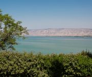
The Sea of Galilee, also Kinneret, Lake of Gennesaret, or Lake Tiberias, is the largest freshwater lake in Israel, and it is approximately 53 km in circumference, about 21 km long, and 13 km wide. The lake has a total area of 166 km, and a maximum depth of approximately 43 m (141 feet). At 211.315 metres below sea level, it is the lowest freshwater lake on Earth and the second-lowest lake overall.
Near East
The Near East is a geographical term that covers different countries for geographers, archaeologists, and historians, on the one hand, and for political scientists, economists, and journalists, on the other. The term originally applied to the maximum extent of the Ottoman Empire, which had been settled to the north by the Great Turkish War of the late 17th century, ending with the Treaty of Karlowitz, June 26, 1699.
Arab al-Mawasi massacre
On November 2, 1948, two squads of Israeli Defence Forces soldiers captured an encampment of Bedouins at 'Arab al-Mawasi in the eastern Galilee. While some soldiers guarded the Arabs, others went to a nearby hilltop where the headless bodies of two Israeli soldiers were found. In retaliation, the Arabs' dwellings were destroyed and 15 or 16 adult males were shot, 14 of whom died. Unusually, the Arab oral history and the IDF archives agree on the number of dead.
Magdala
Magdala is the name of at least two places in ancient Israel mentioned in the Jewish Talmud and one place that may be mentioned in the Christian New Testament. Magdala was also a high stronghold in Ethiopia that was taken on April 13, 1868, by Sir Robert Napier, created Baron Napier of Magdala.
Gennesaret
Gennesaret, Gennesareth or Ginosar, ("a garden of riches") was a town alloted to the tribe of Naphtali, called "Kinnereth", sometimes in the plural form "Kinneroth" . In later times the name was gradually changed to Genezareth, Genezar and Gennesaret. No trace of the Gennesaret city remains. Flavius Josephus refers to the area as having very rich soil. This city stood on the northwestern shore of the lake to which it gave its name: Lake of Gennesaret.
Tabgha
Tabgha is an area situated on the north-western shore of the Sea of Galilee in Israel. It is the traditional site of the miracle of the multiplication of the loaves and fishes and the fourth resurrection appearance of Jesus in Christianity. Until 1948, it was the site of an Arab village. The site's name is derived from the Greek name Heptapegon ("seven springs"). St. Jerome referred to Tabgha as "the solitude" (=eremos).
Ohalo
Ohalo is the common designation for the archaeological site Ohalo II in the vicinity of the Sea of Galilee, and one of the best preserved hunter-gatherer archaeological sites of the Last Glacial Maximum, having been radiocarbon dated to around 19,400 BP. The site is significant because of the numerous fruit and cereal grain remains preserved therein, (intact ancient plant remains being exceedingly rare finds due to their quick decomposition).
Lower Galilee
The Lower Galilee, is a region within the North District of Israel. The Lower Galilee reaches from Jezreel Valley in the south to the Upper Galilee (Beit HaKerem Valley) in the north. Its eastern border is the Jordan River and the Sea of Galilee. Its western border is the Zvulun Valley and Acre. The Lower Galilee is the southern part of the Galilee. It's called "Lower" since it is less mountainous than the Upper Galilee. The peaks of the Lower Galilee raise up to 500 meters above sea level.
Emek HaYarden Regional Council
The Emek HaYarden Regional Council, is a regional council in the Jordan River Valley between the Sea of Galilee in the north and Beit She'an in the south. It was the first regional council in Israel, formed in 1949. Most of the settlements are located on Route 90 a north-south road which traverses the council's territory parallel to the Jordan River. The offices of the council are located between Degania Alef and the Tzemah Industrial Zone.
1938 Tiberias pogrom
The Tiberias pogrom took place on October 2, 1938 during the 1936–1939 Arab revolt in Palestine, in the city of Tiberias. Tiberias was then located in the British Mandate of Palestine and today is located in the State of Israel.
Church of the Beatitudes
The Church of the Beatitudes is a Roman Catholic church located by the Sea of Galilee near Tabgha and Capernaum in Israel.
Horns of Hattin
Horns of Hattin is an extinct volcano with twin peaks overlooking the plains of Hattin in the Lower Galilee, Israel.
Ubeidiya
Tel Ubeidiya (Tel-`Ubaydiyya; תל-עובידיה; تل العبيدية), some 3 km south of Lake Tiberias, in the Jordan Rift Valley, Israel, is an archaeological site of the Pleistocene, ca. 1.5 million years ago, preserving traces of the earliest migration of Homo erectus out of Africa. The site yielded hand axes of the Acheulean type. The site was discovered in 1959 and excavated between 1960 and 1974, mainly under by Ofer Bar-Yosef and Naama Goren-Inbar.
Battle of Al-Sannabra
In the Battle of Al-Sannabra (1113), a Crusader army led by King Baldwin I of Jerusalem was defeated by a Muslim army sent by the Sultan of the Seljuk Turks and commanded by Mawdud ibn Altuntash of Mosul.
Battles of the Kinarot Valley
The Battles of the Kinarot Valley, is a collective name for a series of military engagements between the Haganah and the Syrian army during the 1948 Arab–Israeli War, fought between May 15–22, 1948 in the Kinarot Valley. It includes two main sites: the Battle of Degania–Tzemah, and battles near Masada – Sha'ar HaGolan. The engagements were part of the battles of the Jordan Valley, which also saw fighting against Transjordan in the area of Gesher.
Kinneret College
The Kinneret College on the Sea of Galilee, or simply Kinneret College, is a college located on the southern shores of the Sea of Galilee in northern Israel. The College was established in 1965 by the regional council of the kibbutzim in the area. The students in the College come from all parts of Israel but especially from the Galilee. This is reflected in the multi-cultural and multi-faith background of the student population: Jewish and Arab, secular and religious.
Tel Ali
Tel Ali is an archaeological site located one mile south of the Sea of Galilee, in the central Jordan Valley, Israel. It has been excavated twice. First, during the years 1955–1959, Moshe Prausnitz conducted salvage excavations on behalf of the Israel Department of Antiquities. He published only preliminary reports and most of the excavation finds remained unstudied.
Nabi Shu'ayb
Nabi Shu'aib (also transliterated Nabi Shoaib, meaning "the Prophet Jethro") is the name used in English to refer to a site in the destroyed village of Hittin not far from Tiberias, where the tomb of the Islamic prophet Shuaib (Biblical Jethro) is believed to be located. A central figure in the Druze religion, the tomb of Nabi Shuaib, has been a site of annual pilgrimage for the Druze for centuries.
Church of the Multiplication
The Church of the Multiplication of the Loaves and Fishes, shortened to (The Church of the Multiplication), is a Roman Catholic church located in Tabgha, on the northwest shore of the Sea of Galilee in Israel. The modern church rests on the site of two earlier churches.
Church of the Primacy of St. Peter
The Church of the Primacy of St. Peter is a Franciscan church located in Tabgha, Israel, on the northwest shore of the Sea of Galilee. It commemorates Jesus' reinstatement of Peter as chief among the Apostles.
Ghuwayr Abu Shusha
Ghuwayr Abu Shusha was a Palestinian Arab village in the District of Tiberias. It was depopulated during the 1947–1948 Civil War in Mandatory Palestine on April 21, 1948. It was located 8 km north of Tiberias, nearby Wadi Rubadiyya. In 1945, it had a population of 1,240. A shrine for a local sage known as al-Shaykh Muhammad remains. The village also contained Khirbat Abu Shusha, which had the ruins of water-powered mills.
Tomb of Maimonides
According to Jewish tradition, the Tomb of Maimonides is located in central Tiberias, on the western shore of the Sea of Galilee, Israel. Maimonides died in Fustat, Egypt on 20 December 1204, where it is believed that he was briefly buried before being reinterred in Tiberias. The Tomb of Maimonides is one of the most important Jewish pilgrimage sites in Israel, and one of Tiberias's most visited tourist attractions.
Hamat Tiberias
Hamat Tiberias is an ancient archaeological site and an Israeli national park on the Tiberias-Zemach road that runs along the shore of the Kinneret to Tiberias. Second century Hammata is believed to have been built on the ruins of the biblical city of Hammath.
Mugharet el-Zuttiyeh
Mugharet el-Zuttiyeh ("Cave of the Robbers") is a prehistoric archaeology site in Galilee, Israel. It is situated 0.8 km from the Nahal Amud outlet, approximately 30 m above the wadi bed (148 m below sea level). It was found to house a fossil today known as the "Galilee skull" and "Galilee Man". The skull is the first ancient fossilised hominid found in Western Asia. It's taxonomy is that of H. heidelbergensis.
Yardenit
Yardenit, also known as the Yardenit Baptismal Site, is a baptism site located along the Jordan River in the Galilee region of northern Israel, which is frequented by Christian pilgrims. The site is located south of the river's outlet from the Sea of Galilee, near Kibbutz Kvutzat Kinneret, which owns and manages the site. According to Christian tradition, the baptism of Jesus actually took place in Qasr el Yahud, north of the Dead Sea and east of Jericho.


