Safety Score: 4,2 of 5.0 based on data from 9 authorites. Meaning please reconsider your need to travel to Israel.
Travel warnings are updated daily. Source: Travel Warning Israel. Last Update: 2024-08-13 08:21:03
Delve into Sājūr
Sājūr in Northern District with it's 3,547 habitants is a city located in Israel about 81 mi (or 131 km) north of Jerusalem, the country's capital town.
Current time in Sājūr is now 12:59 AM (Saturday). The local timezone is named Asia / Jerusalem with an UTC offset of 2 hours. We know of 10 airports closer to Sājūr, of which 4 are larger airports. The closest airport in Israel is Ben Ya'akov Airport in a distance of 14 mi (or 22 km), East. Besides the airports, there are other travel options available (check left side).
There are several Unesco world heritage sites nearby. The closest heritage site in Israel is Old City of Acre in a distance of 15 mi (or 24 km), West. We saw 8 points of interest near this location. In need of a room? We compiled a list of available hotels close to the map centre further down the page.
Since you are here already, you might want to pay a visit to some of the following locations: Bent Jbail, Nazareth, Al Butayhah, Tyre and Haifa. To further explore this place, just scroll down and browse the available info.
Local weather forecast
Todays Local Weather Conditions & Forecast: 21°C / 70 °F
| Morning Temperature | 13°C / 56 °F |
| Evening Temperature | 16°C / 61 °F |
| Night Temperature | 14°C / 57 °F |
| Chance of rainfall | 0% |
| Air Humidity | 35% |
| Air Pressure | 1016 hPa |
| Wind Speed | Gentle Breeze with 7 km/h (4 mph) from South-East |
| Cloud Conditions | Broken clouds, covering 56% of sky |
| General Conditions | Broken clouds |
Saturday, 16th of November 2024
20°C (69 °F)
14°C (57 °F)
Sky is clear, gentle breeze, clear sky.
Sunday, 17th of November 2024
19°C (65 °F)
13°C (56 °F)
Overcast clouds, light breeze.
Monday, 18th of November 2024
17°C (62 °F)
12°C (54 °F)
Light rain, gentle breeze, broken clouds.
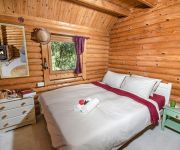
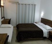
Hotels and Places to Stay
Kibbutz Inbar Country Lodging
The Scandinavian Village - Teva Ba'Har
Kibbutz Moran-Guest Accommodations
Hacienda ForestView
Videos from this area
These are videos related to the place based on their proximity to this place.
DJI Phantom vision 2 plus - Ofira park, Karmiel, Israel
This is a second test flight of the Phantom vision 2 plus in Ofira Park in Karmiel. It was a bit windy today as you can see from the trees...
Karmiel Summer Course Video Clip
Introduction to the Summer Course For Foreign Teachers and Dancers of Israeli Folk Dancing As part of the Karmiel Dance Festival.
הבית הכתום - אנדרס שניידר מעצב שיער, תספורות בכרמיאל - shear TV
שיער טי וי ערוץ השיער והיופי באינטרוויזיה מציג: http://www.shear.co.il/ הבית הכתום - אנדרס שניידר מעצב שיער Singer: ANA BARBARA...
כרמיאל לגדול ולגדל
זה בעצם הסיפור של כולנו - משפחה או קריירה, בית או עבודה, לגדול או לגדל? מסתבר שיש מקום שבו אפשר את שניהם. איפה...
Videos provided by Youtube are under the copyright of their owners.
Attractions and noteworthy things
Distances are based on the centre of the city/town and sightseeing location. This list contains brief abstracts about monuments, holiday activities, national parcs, museums, organisations and more from the area as well as interesting facts about the region itself. Where available, you'll find the corresponding homepage. Otherwise the related wikipedia article.
Kamanneh
Kamanneh or Kamane is a Bedouin village in Misgav Regional Council in Israel. It is the result of the merger between Suweid (Kammaneh East) and Kamun (Kammaneh West) and the new village consists of six main neighborhoods. It is located off Mount Kamun north of the Israeli-Arab city of Sakhnin. According to the Israel Central Bureau of Statistics the village had a population 1,100 at the end of 2005.
Peki'in Synagogue
The Peki’in Synagogue, located in the centre of Peki'in, Northern Israel, is said to have built into its walls two stones taken from the walls of the Jewish Temple in Jerusalem. The current structure dates from 1873 and is said to have been built on a site of an ancient synagogue dating from the era of Rabbi Shimon bar Yochai, around the 3rd-4th century CE. Funding for the construction, attested to on a plaque commemorating the donation, was given by a Jew named Rafael Halevy from Beirut.
Mikhmanim
Mikhmanim is a communal village in the hills of the Galilee. Established in 1980, it is situated atop Mt. Kammon, the highest peak in the Lower Galilee, overlooking the city of Karmiel. Mikhmanim is under the jurisdiction of the Misgav Regional Council, which organizes cultural events and youth activities for all the villages in the area. The community currently (April 2011) numbers about 70 families, with 150 children.
Highway 85 (Israel)
Highway 85 is an east-west highway in Northern Israel. It is one of the most important roads through the Galilee, connecting the western Galilee with the Eastern Galilee. The road begins in Akko on the west coast of Israel and ends in the east just north of Lake Kinneret.
Shezor
Shezor is a moshav in the Galilee in northern Israel. It is located near the similarly named Arab village, Sajur. It belongs to the Merom HaGalil Regional Council. The community was founded as a Nachal planned community that was settled in 1953 by immigrants to Israel from Morocco. After most of the original settlers left the community, new immigrants arrived from Iraq and Iran. The moshav is named for an ancient city named "Shezur" that apparently existed nearby.
Hussniyya
Hussniyya is a Bedouin village in northern Israel. Located in the Galilee near Karmiel, it falls under the jurisdiction of Misgav Regional Council. In 2006 it had a population of 545. The village was recognized by the state in 1996. Its inhabitants belong to the Swaid tribe. The women of Hussniya offer guided tours of the area focusing on picking and cooking wild plants.
Harashim
Harashim is a communal settlement in northern Israel. Located in the Galilee to the north of Karmiel, it falls under the jurisdiction of Misgav Regional Council. In 2006 it had a population of 196. The village was established in 1980 as part of the Lookouts in the Galilee plan to encourage Jewish settlement in the region. Its name is derived from an ancient Jewish settlement in the area and the fact that some of the residents worked as blacksmiths.
Har HaAri
Har HaAri is a mountain in the Upper Galilee in northern Israel. It is 1047 meters (3435 ft) high. It is one of the highest mountain in Israel and is located about 1 kilometer south of Beit Jann. It is named after The Ari. It is close to the Druze holy place Bhaa Aldin. The mountain is a popular place for paragliding because of the landscape that can be seen from it. On a clear day you can see the Gilboa mountains and the Mediterranean Sea from it.


