Safety Score: 4,2 of 5.0 based on data from 9 authorites. Meaning please reconsider your need to travel to Israel.
Travel warnings are updated daily. Source: Travel Warning Israel. Last Update: 2024-08-13 08:21:03
Discover Beit Jann
Beit Jann in Northern District with it's 10,002 citizens is a town in Israel about 83 mi (or 134 km) north of Jerusalem, the country's capital city.
Current time in Beit Jann is now 10:13 PM (Friday). The local timezone is named Asia / Jerusalem with an UTC offset of 2 hours. We know of 10 airports near Beit Jann, of which 4 are larger airports. The closest airport in Israel is Ben Ya'akov Airport in a distance of 11 mi (or 18 km), East. Besides the airports, there are other travel options available (check left side).
There are several Unesco world heritage sites nearby. The closest heritage site in Israel is Old City of Acre in a distance of 17 mi (or 28 km), West. We discovered 8 points of interest in the vicinity of this place. Looking for a place to stay? we compiled a list of available hotels close to the map centre further down the page.
When in this area, you might want to pay a visit to some of the following locations: Bent Jbail, Al Butayhah, Nazareth, Tyre and Fiq. To further explore this place, just scroll down and browse the available info.
Local weather forecast
Todays Local Weather Conditions & Forecast: 21°C / 70 °F
| Morning Temperature | 13°C / 56 °F |
| Evening Temperature | 16°C / 61 °F |
| Night Temperature | 14°C / 57 °F |
| Chance of rainfall | 0% |
| Air Humidity | 35% |
| Air Pressure | 1016 hPa |
| Wind Speed | Gentle Breeze with 7 km/h (4 mph) from South-East |
| Cloud Conditions | Broken clouds, covering 56% of sky |
| General Conditions | Broken clouds |
Saturday, 16th of November 2024
20°C (69 °F)
14°C (57 °F)
Sky is clear, gentle breeze, clear sky.
Sunday, 17th of November 2024
19°C (65 °F)
13°C (56 °F)
Overcast clouds, light breeze.
Monday, 18th of November 2024
17°C (62 °F)
12°C (54 °F)
Light rain, gentle breeze, broken clouds.
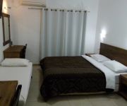
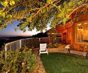
Hotels and Places to Stay
Eretz Hagalil
La Marquise
Kibbutz Inbar Country Lodging
Kibbutz Moran-Guest Accommodations
Amirey Hagalil Boutique Hotel
Ohn-Bar Guesthouse
The Scandinavian Village - Teva Ba'Har
Dream Time
Videos from this area
These are videos related to the place based on their proximity to this place.
קבר רבי שמעון בר יוחאי A visit to the tomb of Rabbi Shimon Bar Yochai, Meron Israel
Zahi Shaked A tour guide in Israel and his camera zahigo25@walla.com +972-54-6905522 tel סיור עם מורה הדרך ומדריך הטיולים צחי שקד 0546905522 My name is Zahi...
Tomb of Rabbi Shimon Bar Yochai - a tour of Tiberias and Safed Israel. Bein Harim Tourism Services
Zahi Shaked A tour guide in Israel and his camera zahigo25@walla.com +972-54-6905522 tel סיור עם מורה הדרך ומדריך הטיולים צחי שקד 0546905522 My name is Zahi...
סיפור הקבר של אחד הרבנים המפורסמים ביותר - קבר רבי שמעון בר יוחאי, מירון, ישראל
Zahi Shaked A tour guide in Israel and his camera zahigo25@walla.com +972-54-6905522 tel סיור עם מורה הדרך ומדריך הטיולים צחי שקד 0546905522 My name is Zahi ...
בתים מספרים - פסטיבל הזית 2008
בתים פתוחים ומארחים בפסטיבל הזית 2008. עץ הזית מאחד את תושבי הגליל בחגיגה של טעמים, מראות ואמנות. הופק עבור...
Dr Dabour דוקטור דבור
מעבדות דוקטור דבור משלבות ידע מסורתי בתחומי הקוסמטיקה, בתהליכי ייצור מתקדמים. המזמין: מכון הייצוא, מינהל...
בית גן بيت جن ! אחלה כפר בעולם.
in the morning coming back from the zabode lands. 23-5-2009 05:24 am.
Panorama (North) from Mount Meron, Israel
Northward panorama from Mount Meron, Israel: Jish, Nachal Dishon, Dovev, Bar'am, Yiron, Avivim, Manara, Yaroun.
Guytatt Vs Wild boars
A wild boar Mom and 6 cubs came to visit us during a 10 days hike in northern Israel.
Предновогодняя чистка косметики. Избавляемся от ненужной, часть 1 | Cleaning out my makeup, part 1
Для лучшего просмотра выбери HD::: Всем привет! Я Габи и добро пожаловать на мой канал! С приближен...
Videos provided by Youtube are under the copyright of their owners.
Attractions and noteworthy things
Distances are based on the centre of the city/town and sightseeing location. This list contains brief abstracts about monuments, holiday activities, national parcs, museums, organisations and more from the area as well as interesting facts about the region itself. Where available, you'll find the corresponding homepage. Otherwise the related wikipedia article.
Shezor
Shezor is a moshav in the Galilee in northern Israel. It is located near the similarly named Arab village, Sajur. It belongs to the Merom HaGalil Regional Council. The community was founded as a Nachal planned community that was settled in 1953 by immigrants to Israel from Morocco. After most of the original settlers left the community, new immigrants arrived from Iraq and Iran. The moshav is named for an ancient city named "Shezur" that apparently existed nearby.
Ein al-Asad
Ein al-Asad is a Druze village in northern Israel. Located near Maghar in the Galilee, it falls under the jurisdiction of Merom HaGalil Regional Council. In 2006 it had a population of 806. The community was founded in 1899 by Druze people from Beit Jann, and was named after an eponymous wellspring outside the village.
Har HaAri
Har HaAri is a mountain in the Upper Galilee in northern Israel. It is 1047 meters (3435 ft) high. It is one of the highest mountain in Israel and is located about 1 kilometer south of Beit Jann. It is named after The Ari. It is close to the Druze holy place Bhaa Aldin. The mountain is a popular place for paragliding because of the landscape that can be seen from it. On a clear day you can see the Gilboa mountains and the Mediterranean Sea from it.


