Safety Score: 4,2 of 5.0 based on data from 9 authorites. Meaning please reconsider your need to travel to Israel.
Travel warnings are updated daily. Source: Travel Warning Israel. Last Update: 2024-08-13 08:21:03
Explore Qiryat Hayyim HaMa‘arvit
The district Qiryat Hayyim HaMa‘arvit of in Haifa District is located in Israel about 74 mi north of Jerusalem, the country's capital.
If you need a place to sleep, we compiled a list of available hotels close to the map centre further down the page.
Depending on your travel schedule, you might want to pay a visit to some of the following locations: Haifa, Nazareth, Tyre, Bent Jbail and Al Butayhah. To further explore this place, just scroll down and browse the available info.
Local weather forecast
Todays Local Weather Conditions & Forecast: 22°C / 72 °F
| Morning Temperature | 17°C / 63 °F |
| Evening Temperature | 20°C / 68 °F |
| Night Temperature | 19°C / 66 °F |
| Chance of rainfall | 0% |
| Air Humidity | 46% |
| Air Pressure | 1016 hPa |
| Wind Speed | Gentle Breeze with 8 km/h (5 mph) from South-East |
| Cloud Conditions | Broken clouds, covering 66% of sky |
| General Conditions | Broken clouds |
Saturday, 16th of November 2024
22°C (72 °F)
19°C (66 °F)
Sky is clear, gentle breeze, clear sky.
Sunday, 17th of November 2024
22°C (72 °F)
18°C (64 °F)
Light rain, gentle breeze, broken clouds.
Monday, 18th of November 2024
21°C (69 °F)
17°C (62 °F)
Light rain, gentle breeze, scattered clouds.
Hotels and Places to Stay
DAN CARMEL HAIFA HOTEL
DAN PANORAMA HAIFA
GALEI KINNERETH
ART GALLERY HOTEL
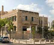
Colony Hotel Haifa
Crowne Plaza HAIFA
CARMEL FOREST SPA RESORT
Theodor Haifa
Eden
Sea Plaza
Videos from this area
These are videos related to the place based on their proximity to this place.
שדרות בן גוריון - קרית ביאליק - Ben-Gurion Boulevard - Kiriat Bialik
נסיעה בשדרות בן גוריון קרית ביאליק Driving in Ben-Gurion Boulevard Kiriat Bialik אורך המסלול: 1.0 ק"מ Length of the trip: 1.0 km מפה של המסלול...
שדרות משה גושן - קרית מוצקין - Moshe Goshen Boulevard - Kiriat Motzkin
נסיעה בשדרות משה גושן קרית מוצקין Driving in Moshe Goshen Boulevard Kiriat Motzkin אורך המסלול: 1.2 ק"מ Length of the trip: 1.2 km מפה של המסלו...
שדרות ויצמן - קרית ביאליק - Weizmann Blvd. Kiriat Bialik
נסיעה בשדרות ויצמן בקרית ביאליק Driving in Weizmann Blvd. in Kiriat Bialik אורך המסלול: 0.9 ק"מ Length of the trip: 0.9 km מפה של המסלול...
Graban Sirena en Playa de Israel
Turistas graban una sirena en las Playas de Kiryat Yam en Israel. ¿¿QUIERES MÁS??, ¡¡VISITANOS AHORA!!, SUBIMOS NUEVOS VIDEOS DURANTE TODA LAS SEMANA ;D _ _ _ _ INFORMACIÓN ...
arenda-krvartiri-v-Haife-Kiryat-Haim
http://kvartira-haifa.ucoz.com - недорого краткосрочная аренда квартиры в Хайфе (Кирьят-Хаим, Крайот: Кирьят-Ям, Кирьят-Ата...
Male Sunbird (Nectarinia osea) צופית (זכר) שותה מי סוכר
צופית (זכר) שותה ממתקן האכלה להוראות בנייה הכנסו לכתובת http://sunbirds-alon.blogspot.com/ Alon Friedman Kiryat-Yam Israel.
שיר נשבע גל שמואל Gal Shmuel
טקס יום השואה 2013 קרית ים Holocaust Remembrance Day ceremony in 2013 Kiryat Yam.
Videos provided by Youtube are under the copyright of their owners.
Attractions and noteworthy things
Distances are based on the centre of the city/town and sightseeing location. This list contains brief abstracts about monuments, holiday activities, national parcs, museums, organisations and more from the area as well as interesting facts about the region itself. Where available, you'll find the corresponding homepage. Otherwise the related wikipedia article.
Kishon River
The Kishon River is a river in Israel that flows into the Mediterranean Sea at the city of Haifa.
Rafael Advanced Defense Systems
Rafael Advanced Defense Systems Ltd. , known as RAFAEL or Rafael, (also spelled as Raphael or Rephael; Hebrew acronym of "Authority for the Development of Armaments" - רשות לפיתוח אמצעי לחימה) is an Israeli defense technology company. It was founded as Israel’s National R&D Defense Laboratory for the development of weapons and military technology within the Ministry of Defense; in 2002 it was incorporated as a limited company.
Krayot
The Krayot are a cluster of five small cities founded in the 1930s in the Haifa Bay area, on the outskirts of the city of Haifa, Israel. The Krayot (plural of Kirya) are Kiryat Yam (pop. 36,700), Kiryat Motzkin (pop. 39,800), Kiryat Bialik (pop. 36,200), Kiryat Ata (pop. 33,800) and Kiryat Haim (pop. 26,960) In 2003, there was a proposal to merge the Krayot to form a city called Zevulun with a population of 250,000, which would make it one of the ten largest cities in Israel..
Haifa Oil Refinery massacre
The Haifa Oil Refinery massacre took place on 30 December 1947. After members of the Zionist paramilitary organisation, the Irgun, threw a number of grenades at a crowd of 100 Arab day-labourers who had gathered outside the main gate of the then British-owned Haifa Oil Refinery looking for work, six people were killed and 42 wounded.
Lev HaMifratz Mall
Lev HaMifratz Mall is a shopping mall located in Haifa, Israel. Lev HaMifratz has 3 floors of stores, a food court, an underground parking garage, and an above ground parking garage. In the past, it included an amusement park, a miniature golf course and an ice skating rink. Lev HaMifratz is also a transportation hub. Behind it is a train station, with trains to Nahariya and Tel Aviv. The entrance to the station is from the above ground parking garage.
Haifa Bay Central Bus Station
Haifa Bay Central Bus Station (Merkazit HaMifratz in Hebrew) is the main bus station of the Haifa Bay (Mifratz Haifa) district. It opened in 2002. All bus routes from the north and the Galilee which formerly terminated at the Bat Galim bus station now terminate at HaMifratz station. The Mifratz Central Bus Station serves local Egged bus lines within the city of Haifa and all suburban and intercity Egged bus routes heading to the north and the Galilee.
Haifa Bay
Haifa Bay is a bay along the Mediterranean coast of Northern Israel. Haifa Bay is Israel's only natural harbor on the Mediterranean. Fed by the Kishon River, the cities of Haifa and Acre mark its southern and northern capes, while its centre is lined with dunes and the suburban Krayot neighbourhoods. Mount Carmel rises from the southern edge, while the mountains of the Western Galilee run up to the shore at the northern boundary. The Port of Haifa lies along part of its southeastern coastline.
Haifa Airport
Haifa International Airport is an Israeli airport located in Haifa. It is located to the east of the city, close to Kishon Port and Israel Shipyards and mainly serves civilian flights, with some military usage. Most passenger flights passing through the airport are domestic operations to Eilat and Tel Aviv. The airport is named after Uri Michaeli, one of the pioneers of Jewish aviation and one of the founders of aviation in Israel.
Neve Sha'anan, Haifa
Neve Sha'anan is a neighborhood in eastern Haifa, Israel that extends from the lower inclines of Mount Carmel to midway across its slopes.
Patria disaster
The Patria disaster was the sinking on 25 November 1940 by the Haganah of a French-built ocean liner, the 11,885-ton SS Patria, in the port of Haifa, killing 267 people and injuring 172. At the time of the sinking, the Patria was carrying about 1,800 Jewish refugees from Nazi-occupied Europe whom the British authorities were deporting from Mandatory Palestine to Mauritius because they lacked entry permits.
Port of Haifa
The Port of Haifa is the largest of Israel's three major international seaports, which include the Port of Ashdod, and the Port of Eilat. It has a natural deep water harbor which operates all year long, and serves both passenger and merchant ships. It is one of the largest ports in the eastern Mediterranean in terms of freight volume and handles over 22 million tons of cargo each year. The port employs over 1,000 people, with the number rising to 5,000 when cruise ships dock in Haifa.
Kiryat Motzkin Railway Station
Kiryat Motzkin Railway Station is an Israel Railways passenger station serving the city of Kiryat Motzkin and the surrounding Kerayot region.
Kiryat Haim Railway Station
Kiryat Haim Railway Station is an Israel Railways passenger station serving the town of Kiryat Haim (administratively a neighborhood of Haifa) and the surrounding Kerayot region.
Hutzot HaMifratz Railway Station
Hutzot HaMifratz Railway Station is an Israel Railways passenger station serving Hutzot HaMifratz Mall, Israel's largest open-air mall, and the surrounding Haifa-Bay industrial zone just north of Haifa.
Lev HaMifratz Railway Station
Lev HaMifratz Railway Station is an Israel Railways passenger station in Haifa, Israel, serving Lev HaMifratz Mall, one of Haifa's largest malls, and the surrounding Haifa-Bay industrial zone just north of Haifa.
Haifa Center HaShmona Railway Station
Haifa Center HaShmona Railway Station is an Israel Railways passenger station situated on the coastal railway main line and serves the City of Haifa. Although it is called Haifa's Central Station the title is largely historical. Nowadays it is far from being central both by passenger numbers and location-wise.
Israel Railway Museum
Israel Railway Museum is the national railway museum of Israel, located in Haifa. The railway museum is owned by Israel Railways and is at Haifa East Railway Station which nowadays no longer serves passengers. 40x40px Wikimedia Commons has media related to: Israel Railway Museum
Thomas D'Alesandro Stadium
Thomas D'Alesandro Stadium, known as Kiryat Haim Stadium, is a multi-purpose stadium in Kiryat Haim, Israel. It is currently used mostly for football matches and is the home stadium of Hapoel Haifa's youth teams. It used to be home to the first teams of Hapoel as well as Maccabi Haifa, but was replaced by Kiryat Eliezer Stadium in 1955. The stadium was built with help from the Jewish community of Baltimore, Maryland and named for the mayor of Baltimore, Thomas D'Alesandro.
Highway 22 (Israel)
Highway 22, also known as the Bay Highway, is a suburban freeway in the Haifa metropolitan area connecting downtown Haifa with the city's northern exit to the Krayot area. The 17 km long freeway bypasses the Krayot, providing an alternative route to Highway 4. Also the interchanges connecting to the Carmel Tunnels and Highway 75 were improved as part of the project.
Kfar Bialik
Kfar Bialik is a moshav in northern Israel. Located near Kiryat Bialik, it falls under the jurisdiction of Zevulun Regional Council. In 2006 it had a population of 786. The village was founded in 1934 on land owned by the Jewish National Fund by immigrants from Germany. It was named after Hayyim Nahman Bialik, who died the month before the moshav's establishment.
Oil Refineries
This article is about the Israeli company. For the general term, see Oil refinery. 50x40pxThis article needs additional citations for verification. Please help improve this article by adding citations to reliable sources. Unsourced material may be challenged and removed. Oil Refineries Ltd.
Tell Abu Hawam
Tell Abu Hawam was a small city established in the Late Bronze Age (14th Century BCE) on the site of Modern-day Haifa, Israel. The sixth century BCE geographer Scylax described the city as being located "between the bay and the promontory of Zeus". It existed as a port city and a fishing village, and was moved to the site south of what is now the neighborhood of Bat Galim. The city eventually expanded into what is now the city of Haifa.
Kiryat Shmuel, Haifa
Kiryat Shmuel is a neighborhood at the perimeter of the city of Haifa in northern Israel. The neighborhood is bounded by Kiryat Haim in the south and in the west, by Kiryat Yam in the west, and by Kiryat Motzkin in the east. It is located about one kilometer from the coast, with a train station on its border with Kiryat Motzkin. Kiryat Shmuel has a population of 5,500 (2007) consisting mostly of Orthodox Jews.
Ein Nymphit
Ein Nymphit (עין נמפית, lit. Nymphit Spring) is a small nature reserve northwest of Tel Afek, south of Kfar Masaryk. It contains a perrenial spring that produces clean clear water. The water flows from the spring to Nahal Na'aman, filling some pools on the way. The spring is named for the Nymphaea caerulea that grows nearby. The reserve is 62 dunams, declared in 1968. Cyperus, Longleaf Pondweed flowers grow on the reserve, in addition to Nymphaea caerulea
Kiryat Haim
Kiryat Haim is one of the five Krayot suburbs located north of Haifa, Israel. In 2003, Kiryat Haim had a population of 40,000. Kiryat Haim is within the municipal borders of the city of Haifa, and lies on the shore of the Mediterranean Sea.


