Safety Score: 4,2 of 5.0 based on data from 9 authorites. Meaning please reconsider your need to travel to Israel.
Travel warnings are updated daily. Source: Travel Warning Israel. Last Update: 2024-08-13 08:21:03
Discover Ga‘ash
Ga‘ash in Central District is a city in Israel about 39 mi (or 63 km) north-west of Jerusalem, the country's capital city.
Local time in Ga‘ash is now 09:51 PM (Sunday). The local timezone is named Asia / Jerusalem with an UTC offset of 2 hours. We know of 12 airports in the vicinity of Ga‘ash, of which 5 are larger airports. The closest airport in Israel is Sde Dov Airport in a distance of 8 mi (or 13 km), South. Besides the airports, there are other travel options available (check left side).
There are several Unesco world heritage sites nearby. The closest heritage site in Israel is White City of Tel-Aviv -- the Modern Movement in a distance of 11 mi (or 18 km), South. We discovered 4 points of interest in the vicinity of this place. Looking for a place to stay? we compiled a list of available hotels close to the map centre further down the page.
When in this area, you might want to pay a visit to some of the following locations: Tel Aviv, Karney Shomron, Ramla, Jerusalem and Haifa. To further explore this place, just scroll down and browse the available info.
Local weather forecast
Todays Local Weather Conditions & Forecast: 19°C / 67 °F
| Morning Temperature | 20°C / 68 °F |
| Evening Temperature | 17°C / 63 °F |
| Night Temperature | 16°C / 61 °F |
| Chance of rainfall | 1% |
| Air Humidity | 63% |
| Air Pressure | 1015 hPa |
| Wind Speed | Strong breeze with 18 km/h (11 mph) from South |
| Cloud Conditions | Broken clouds, covering 61% of sky |
| General Conditions | Light rain |
Monday, 25th of November 2024
15°C (59 °F)
14°C (57 °F)
Light rain, strong breeze, overcast clouds.
Tuesday, 26th of November 2024
15°C (60 °F)
14°C (58 °F)
Light rain, gentle breeze, broken clouds.
Wednesday, 27th of November 2024
16°C (61 °F)
14°C (58 °F)
Scattered clouds, gentle breeze.
Hotels and Places to Stay
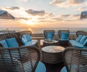
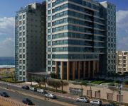
DANIEL HERZLIYA
DAN ACCADIA HERZLIYA ON SEA
Publica Isrotel Autograph Collection
The Ritz-Carlton Herzliya
Herods Herzliya
Ramada Netanya Hotel&Suite
THE SEASONS
Okeanos Suites Herzliya
Benjamin Herzliya Business Hotel
Okeanos Ba Marina
Videos from this area
These are videos related to the place based on their proximity to this place.
Elysium 1937 - 3.1 Second Bumper Change
The new cutting-edge technology in the region of changing the bumpers' color. Developed by FRC team 1937, all rights reserved ©
Leo Baeck Make Sum Noize
קליפ ההיפ-הופ הליאו-בקי המקורי! כל הכבוד למחזור נ"ז, אבל לפני שנתיים ב-2006 מחזור נ"ה עשה represent למורים ולמנהלים...
מרחצאות ואירוח חמי געש - קיבוץ געש 09-9529404 | Hamei Gaash Baths And Spa Center
מרחצאות ואירוח חמי געש הוא מרכז אירוח, ספא ונופש בקיבוץ געש אשר נמצא בשרון סמוך למרכז הארץ, קרוב לשמורת חוף...
chickadee(ירגזי) project - Wizo Hadassim - Israel שחק ירוק עמק הירגזי
חורשת עמק הירגזי - ויצו הדסים שח"ק ירוק The valley of the chickadee Project Wizo Hadassim ISRAEL ירגזי.
ביקורת רובוטריקים על -Transformers review - WFC Optimus Prime
Transformers review - WFC Optimus Prime. ביקורת על דמות נוספת מעולם הרובוטריקים - TRANSFORMERS מליין הדורות ,אופטימוס פריים WFC מהמשח...
סטופ מרקט יגור, אילנה ואבי רוזן
Video created with the Socialcam app on iPhone: http://socialcam.com אילנה ואבי רוזן.
Tricking day in Gaash(A cute hole between Herzliyya and Netanya ^___^)
This is me making a new tricks which you have neven seen on youtube.
Videos provided by Youtube are under the copyright of their owners.
Attractions and noteworthy things
Distances are based on the centre of the city/town and sightseeing location. This list contains brief abstracts about monuments, holiday activities, national parcs, museums, organisations and more from the area as well as interesting facts about the region itself. Where available, you'll find the corresponding homepage. Otherwise the related wikipedia article.
Battle of Arsuf
The Battle of Arsuf was a battle of the Third Crusade in which Richard I of England defeated Saladin (Ṣalāḥ al-Dīn Yūsuf ibn Ayyūb), founder of the Ayyubid dynasty and Sultan of Egypt and Syria, at Arsuf in Palestine. The forces of the Third Crusade had taken the city of Acre after a prolonged siege. The next strategic target for the Christian army was to secure the city of Jaffa, which would facilitate their ultimate goal, the recapture of the city of Jerusalem.
Arsuf
Arsuf also known as Arsur or Apollonia, was an ancient city and fortress located in Israel, about 15 kilometres north of modern Tel Aviv, on a cliff above the Mediterranean Sea. The city site, Tel Arsuf, was intensively excavated from 1994. In 2002 it became Apollonia National Park. In 1995 a neighborhood by the name of Arsuf was established to the north of the ancient city.
International Jewish Sports Hall of Fame
The International Jewish Sports Hall of Fame was opened July 7, 1981, in Netanya, Israel. It honors Jewish athletes and their accomplishments from anywhere around the world. It is located on the campus of the Wingate Institute for Physical Education and Sport. It has inducted over 300 athletes and sportspersons representing 25 countries. The Hall elects new honorees each year, with submissions due December 1 for votes for the following year. The Hall was founded by Joseph M.
Udim
Udim is a moshav in central Israel. Located near Netanya, it falls under the jurisdiction of Hof HaSharon Regional Council. In 2006 it had a population of 822. The moshav was established in 1948 by Holocaust survivors. Its name is taken from Zechariah 3:2, and symbolises the fact that the founders were survivors of the Holocaust; And the LORD said unto Satan: 'The LORD rebuke thee, O Satan, yea, the LORD that hath chosen Jerusalem rebuke thee; is not this man a brand plucked out of the fire?
Sidna Ali Mosque
The Sidna 'Ali Mosque is a Muslim place of worship located in the depopulated village of Al-Haram on the beach in the northern part of Herzliya in Israel.
Wingate Institute
The Wingate Institute, officially Orde Wingate Institute for Physical Education and Sports, is a sports training facility located south of Netanya, Israel, established in 1957. Named after Orde Wingate, the facility serves as the host facility for numerous Israeli national teams as well as a military training base. In 1989, the institute was awarded the Israel Prize, for sport. the National Sport Center - Tel Aviv is a supplementary compound to Wingate Institute.
Al-Haram, Jaffa
Al-Haram, also Sayyiduna Ali' or Sidna Ali, was an Arab village in the District of Jaffa in Mandatory Palestine. It was located 16 km north of Jaffa, adjacent to the ruins of the ancient city of Arsuf, also known as Apollonia. It was depopulated during the 1948 war.
Nahal Poleg
Nahal Poleg is a stream in the Sharon plain in Israel that empties into the Mediterranean Sea between Netanya and the Wingate Institute.


