Safety Score: 2,5 of 5.0 based on data from 9 authorites. Meaning we advice caution when travelling to Ireland.
Travel warnings are updated daily. Source: Travel Warning Ireland. Last Update: 2024-08-13 08:21:03
Delve into Rodena Bridge
Rodena Bridge in Wicklow (Leinster) is located in Ireland about 2,703 mi (or 4,349 km) west of Qeshlaq, the country's capital town.
Current time in Rodena Bridge is now 01:06 PM (Friday). The local timezone is named Europe / Dublin with an UTC offset of zero hours. We know of 9 airports close to Rodena Bridge, of which 4 are larger airports. The closest airport in Ireland is Castlebridge Airport in a distance of 35 mi (or 56 km), South. Besides the airports, there are other travel options available (check left side).
There is one Unesco world heritage site nearby. It's Brú na Bóinne - Archaeological Ensemble of the Bend of the Boyne in a distance of 68 mi (or 109 km), North-East. Also, if you like playing golf, there is an option about 27 mi (or 43 km). away. If you need a hotel, we compiled a list of available hotels close to the map centre further down the page.
While being here, you might want to pay a visit to some of the following locations: Wicklow, Tallaght, Dublin, Naas and Loch Garman. To further explore this place, just scroll down and browse the available info.
Local weather forecast
Todays Local Weather Conditions & Forecast: 14°C / 56 °F
| Morning Temperature | 12°C / 54 °F |
| Evening Temperature | 11°C / 51 °F |
| Night Temperature | 11°C / 52 °F |
| Chance of rainfall | 0% |
| Air Humidity | 81% |
| Air Pressure | 1026 hPa |
| Wind Speed | Gentle Breeze with 6 km/h (4 mph) from North-East |
| Cloud Conditions | Overcast clouds, covering 100% of sky |
| General Conditions | Overcast clouds |
Saturday, 16th of November 2024
11°C (52 °F)
8°C (47 °F)
Light rain, gentle breeze, overcast clouds.
Sunday, 17th of November 2024
8°C (46 °F)
5°C (41 °F)
Light rain, moderate breeze, overcast clouds.
Monday, 18th of November 2024
6°C (42 °F)
9°C (47 °F)
Moderate rain, strong breeze, broken clouds.
Hotels and Places to Stay
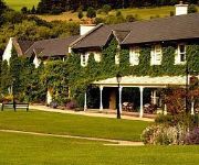
BrookLodge & Macreddin Village
Videos from this area
These are videos related to the place based on their proximity to this place.
Avoca Mill Since 1723.mov
Avoca Handweavers started weaving at the Mill in Avoca Village back in 1723. Our world famous Avoca throws still come from here. See the hand-crafted care and skill that goes into these gorgeous,...
Every Nation Dublin Weekend Away - Ovoca Manor March 2013
Every Nation Dublin Weekend Away in Ovoca Manor March 2013 A time of fellowship, fun and food! There were loads of activities from going on the zip line or enjoying the obstacle course or...
Avoca Flood
The Avoca river in Co. Wicklow, Ireland, swells and breaks its banks due to melting snow and overnight rainfall. Captured at around ten o'clock on Saturday 16th January 2010. http://www.piersmcg...
RPSI's Spare Link climbing Glenealy Bank
After a forced stop due to hot axle box detectors, 461 attempts to climb the 1-in-90 bank up to Rathdrum with 8 Cravens and a "genny" van while with a sticky mid gear. The last hour was spent...
Videos provided by Youtube are under the copyright of their owners.
Attractions and noteworthy things
Distances are based on the centre of the city/town and sightseeing location. This list contains brief abstracts about monuments, holiday activities, national parcs, museums, organisations and more from the area as well as interesting facts about the region itself. Where available, you'll find the corresponding homepage. Otherwise the related wikipedia article.
O'Byrne Park
O'Byrne Park, Aughrim is a Gaelic Athletic Association stadium in Aughrim, County Wicklow, Ireland. It is the home of Gaelic Games for County Wicklow (Gaelic football, Hurling, Camogie, Ladies Football) team. The ground has a capacity of about 10,000.
R747 road (Ireland)
The R747 road is a regional road in Ireland running north-west/south-east from the M9 near Ballitore in County Kildare to Arklow in County Wicklow, a distance of 66 km . Error: Image is invalid or non-existent. From its junction with the M9 it heads east to the former N9. It crosses this at a staggered junction and enters County Wicklow almost immediately and 10 km southeast it crosses the N81 in the town of Baltinglass.
Croghan Mountain
Croghan Kinsella (Irish: Cruachán Uí Chinnsealaigh, meaning "little stack of the Kinsella family", is a mountain in the Wicklow Mountains, on the Wicklow/Wexford border; The term "Croghan," proper, is a distinct, older term, and name, meaing "Red-Son," or "Red-Man. " The Wexford 'River Bann' rises from its southern slopes.


