Safety Score: 2,5 of 5.0 based on data from 9 authorites. Meaning we advice caution when travelling to Ireland.
Travel warnings are updated daily. Source: Travel Warning Ireland. Last Update: 2024-08-13 08:21:03
Explore Ballycorus
Ballycorus in Dún Laoghaire-Rathdown (Leinster) is a city in Ireland about 2,697 mi (or 4,340 km) north-west of Qeshlaq, the country's capital.
Local time in Ballycorus is now 02:28 PM (Friday). The local timezone is named Europe / Dublin with an UTC offset of zero hours. We know of 9 airports in the vicinity of Ballycorus, of which 4 are larger airports. The closest airport in Ireland is Dublin Airport in a distance of 14 mi (or 22 km), North. Besides the airports, there are other travel options available (check left side).
There is one Unesco world heritage site nearby. It's Brú na Bóinne - Archaeological Ensemble of the Bend of the Boyne in a distance of 41 mi (or 65 km), North-East. Also, if you like golfing, there are multiple options in driving distance. We found 1 points of interest in the vicinity of this place. If you need a place to sleep, we compiled a list of available hotels close to the map centre further down the page.
Depending on your travel schedule, you might want to pay a visit to some of the following locations: Dublin, Tallaght, Swords, Wicklow and Naas. To further explore this place, just scroll down and browse the available info.
Local weather forecast
Todays Local Weather Conditions & Forecast: 13°C / 56 °F
| Morning Temperature | 12°C / 53 °F |
| Evening Temperature | 12°C / 53 °F |
| Night Temperature | 12°C / 53 °F |
| Chance of rainfall | 0% |
| Air Humidity | 83% |
| Air Pressure | 1026 hPa |
| Wind Speed | Light breeze with 5 km/h (3 mph) from North-East |
| Cloud Conditions | Overcast clouds, covering 100% of sky |
| General Conditions | Overcast clouds |
Saturday, 16th of November 2024
9°C (48 °F)
7°C (45 °F)
Light rain, gentle breeze, overcast clouds.
Sunday, 17th of November 2024
7°C (45 °F)
3°C (38 °F)
Moderate rain, moderate breeze, overcast clouds.
Monday, 18th of November 2024
5°C (41 °F)
7°C (45 °F)
Rain and snow, moderate breeze, broken clouds.
Hotels and Places to Stay
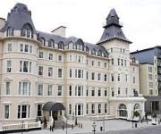
Radisson Blu St. Helen's
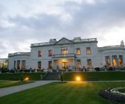
Powerscourt Hotel Autograph Collection
Talbot Hotel Stillorgan
Clayton Leopardstown
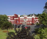
Fitzpatrick Castle
Royal Marine
The Beacon
Summerhill House
Wilton
Esplanade
Videos from this area
These are videos related to the place based on their proximity to this place.
Mobile Internet Marketing and online digital media Ireland
Mobile Internet Marketing offers clients a stepped approach to internet marketing on desktop and mobile. The results need to be measured. We are convinced th...
Mobile Internet Marketing Ireland - Digital Media Online Marketing
Customer sample of our work for Dawson Jewellers Dublin Ireland. Mobile Internet Marketing Ireland cater for your mobile web, sms, QR codes online and ofline...
Mobile Internet Marketing Ireland SMS Restaurant Campaign
Mobile Internet Marketing SMS Restaurant Campaign. We get you new customers. But how do you start and how much will it cost? We suggest you start small and grow your campaigns when you see...
Videos provided by Youtube are under the copyright of their owners.
Attractions and noteworthy things
Distances are based on the centre of the city/town and sightseeing location. This list contains brief abstracts about monuments, holiday activities, national parcs, museums, organisations and more from the area as well as interesting facts about the region itself. Where available, you'll find the corresponding homepage. Otherwise the related wikipedia article.
Clonkeen College
Clonkeen College is a Christian Brothers secondary school for boys in south Dublin, which opened in 1970. Clonkeen College has approximately 550 students and 30 staff. Kevin Barry has been the principal since 2012. The school has strong links with charities and the developing world.
Cornelscourt
Cornelscourt (Irish: Cúirt an Choirnéil) is a small suburban area of South Dublin, situated between Cabinteely and Foxrock. It has a mostly commercial rather than residential character and is best known for being the site of Ireland's first Big-box store, Dunnes Stores.
Loughlinstown
Loughlinstown (Irish: Baile Uí Lachnáin, meaning "The Town of O'Loughnin") is a south Dublin suburb. Located in the County of Dun Laoghaire-Rathdown it lies on the N11 National Primary Route. Loughlinstown is the location of St. Columcille's Hospital, which serves both south Dublin and north Wicklow. The European Foundation for the Improvement of Living and Working Conditions, an EU body, is located in Loughlinstown House.
Kilternan
Kilternan (Irish: Cill Tiarnáin, meaning "Church of Tiarnán") is a village in County of Dún Laoghaire-Rathdown, in the foothills of the Dublin Mountains south of Dublin, near the border with County Wicklow. Separated from the continuous built-up Dublin area, it is a suburban village in rural surroundings at the crossroads of the R117 and R116 regional roads.
Rathmichael
Rathmichael is a suburb in the south-east of Dublin in the county of Dún Laoghaire-Rathdown. It is situated west of Shankill from which it is separated by the M50/M11 motorways.
R117 road (Ireland)
The R117 road is a regional road in Ireland. The route (north-south) starts Harcourt Road at the end of the South Circular Road on the southside of Dublin city centre. It crosses the Grand Canal and goes through the suburbs of Ranelagh, Milltown, Windy Arbour, Dundrum, Sandyford, Stepaside and Kilternan (where it crosses the R116) before passing through the Scalp into County Wicklow.
Carrickmines
Carrickmines (Irish: Carraig Mhaighin, meaning "Plateau of rock") is suburb of Dublin in Dun Laoghaire-Rathdown, Ireland. Traditionally a residential area. The area is now divided north/south by the M50 motorway and its associated Junction 15. To the north are the older residential areas near Foxrock and to the south, along the Glenamuck Road are new retail parks, office buildings, apartments and housing schemes.
Ski Club of Ireland
The Ski Club of Ireland owns and runs the only artificial ski slope in the Republic of Ireland. It is located in Kilternan, County Dublin.


