Safety Score: 2,5 of 5.0 based on data from 9 authorites. Meaning we advice caution when travelling to Ireland.
Travel warnings are updated daily. Source: Travel Warning Ireland. Last Update: 2024-08-13 08:21:03
Discover Donaghmede
The district Donaghmede of Dublin in Dublin City (Leinster) with it's 15,299 citizens Donaghmede is a district in Ireland about 2,697 mi north-west of Qeshlaq, the country's capital city.
Looking for a place to stay? we compiled a list of available hotels close to the map centre further down the page.
When in this area, you might want to pay a visit to some of the following locations: Swords, Tallaght, Wicklow, Naas and Navan. To further explore this place, just scroll down and browse the available info.
Local weather forecast
Todays Local Weather Conditions & Forecast: 4°C / 40 °F
| Morning Temperature | 2°C / 36 °F |
| Evening Temperature | 7°C / 45 °F |
| Night Temperature | 6°C / 43 °F |
| Chance of rainfall | 0% |
| Air Humidity | 83% |
| Air Pressure | 1022 hPa |
| Wind Speed | Moderate breeze with 10 km/h (6 mph) from East |
| Cloud Conditions | Broken clouds, covering 77% of sky |
| General Conditions | Light rain |
Wednesday, 4th of December 2024
10°C (50 °F)
11°C (52 °F)
Moderate rain, fresh breeze, overcast clouds.
Thursday, 5th of December 2024
13°C (56 °F)
7°C (45 °F)
Moderate rain, strong breeze, overcast clouds.
Friday, 6th of December 2024
6°C (43 °F)
12°C (53 °F)
Moderate rain, strong breeze, overcast clouds.
Hotels and Places to Stay
Hilton Dublin Airport
Maldron Dublin Airport
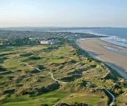
Portmarnock Hotel & Golf Link
Grand Malahide
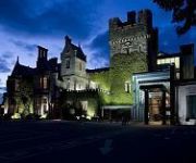
Clontarf Castle
Clayton Dublin Airport
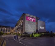
Carlton Hotel Dublin Airport
Radisson Blu Dublin Airport
Holiday Inn Express DUBLIN AIRPORT
Travelodge Dublin Airport North Swords
Videos from this area
These are videos related to the place based on their proximity to this place.
video2.mov: 2012-09-21 Dublin Countryside
See the entire trip at http://www.everytrail.com. Waiting for our pilgrimage group to arrive tomorrow. We can see the ocean from our hotel room with a view so I decided to hike out the the...
Irish Rail 723 - Howth Junction & Donaghmede Station, Dublin
Irish Rail maintenance class train number 723 passing northbound through Howth Junction & Donaghmede station in Dublin, Ireland.
IE 8510 and 8100 Class Dart Trains - Howth Junction Station, Dublin
Irish Rail 8510 class dart train number 8605 and 8100 class number 8122 meet between Kilbarrack and Howth Junction & Donaghmede stations in Dublin, Ireland.
22000 Class ICR Train number 22342 - Howth Junction, Dublin
Irish Rail 22000 class DMU intercity train number 22342 passing northbound through Howth Junction & Donaghmede station in Dublin, Ireland.
IE 29000 Class DMU Train - Howth Junction & Donaghmede, Dublin
An Irish Rail 29000 class DMU commuter train passing southbound through Howth Junction & Donaghmede station in Dublin, Ireland.
IE 29000 Class DMU Train number 29103 - Howth Junction, Dublin
Irish Rail 29000 class DMU commuter train number 29103 passing northbound through Howth Junction & Donaghmede station in Dublin, Ireland.
IR Loco 224+MK3's + IR Loco 081+taras @ Howth Junction
here we see IR Loco No 224 leading 6 MK3's on a transfer from Northwall to Dundalk which past Howth Junction at half 11 and then we see IR Loco No 081 with the Laden taras just as the MK3's...
IE 8100 Class Dart Train number 8113 - Howth Junction Station, Dublin
Irish Rail 8100/8300 class dart train number 8113 heading northbound from Kilbarrack station to Howth junction & Donaghmede station in Dublin, Ireland.
IE 22000 Class DMU Train number 22348 - Howth Junction & Donaghmede
Irish Rail 22000 class DMU intercity train number 22348 passing southbound through Howth Junction and Donaghmede station in Dublin, Ireland.
Irish Rail 8510 Class Dart Train 8603 - Howth Junction Station, Dublin
Irish Rail 8510 class Dart train number 8603 arriving at, and departing northbound from Howth Junction & Donaghmede station on its way to Malahide in Dublin, Ireland.
Videos provided by Youtube are under the copyright of their owners.
Attractions and noteworthy things
Distances are based on the centre of the city/town and sightseeing location. This list contains brief abstracts about monuments, holiday activities, national parcs, museums, organisations and more from the area as well as interesting facts about the region itself. Where available, you'll find the corresponding homepage. Otherwise the related wikipedia article.
Baldoyle
Baldoyle is a small coastal area on the northside of Dublin, Ireland. It is in the part of the historic County Dublin now administered as Fingal.
Bull Island
Bull Island (Oileán an Tairbh in Irish) or more properly North Bull Island (Oileán an Tairbh Thuaidh in Irish) is an island located in Dublin Bay in Ireland, about 5 km long and 800 m wide, lying roughly parallel to the shore off Clontarf, Raheny, Kilbarrack, and facing Sutton. The island, with a sandy beach known as Dollymount Strand running its entire length, is a relatively recent, and inadvertent, result of human intervention in the bay.
Saint Anne's Park
St Anne's Park (Irish: Páirc Naomh Áine) is a public park within Dublin City Council,situated between Raheny and Clontarf, both suburbs on the northside of Dublin, Ireland.
Sutton Park, Dublin
Sutton Park is one of the constituent housing estates which make up the district of Bayside, a residential suburb on the northside of Dublin, Ireland. Comprising multiple roads named "Sutton Park", as well as Sutton Lawns, Downs and Grove, it is located about 10 km from the city's centre.
St. Doulagh's Church
St Doulagh's Church, is one of two churches in the "United Parishes of Malahide, Portmarnock and St Doulagh's" in Fingal, Ireland. It is the oldest stone-roofed church still in use in Ireland. The church is situated approximately 10 kilometres from Dublin city, just north of the hamlet of Balgriffin. Its complex also comprises a stone pool-house and an octagnal baptistry - Ireland's only surviving standalone baptistry.
Dollymount
Dollymount is a coastal suburban area on the north coast of Dublin Bay, within Clontarf, on the northside of Dublin, Ireland, just East of Saint Anne's Park.
O'Tooles GAA
O'Tooles GAC is a Gaelic Athletic Association club based in Dublin, Ireland, formed in 1901. An earlier Saint Laurence O'Toole G.A.A. club had existed in the North Wall area from 1888 to 1896. The St. Laurence O'Toole branch of the Gaelic League held their inaugural meeting in February 1901. Brother J.A. O'Mahoney, Superior of O'Connells schools was elected the first president of O'Tooles GAC.
Raheny GAA
Raheny GAA is a Gaelic Athletic Association club based in the northside suburb of Raheny, Dublin, Ireland. They also have a website http://www. raheny. gaa. ie/
Trinity Gaels GAA
Trinity Gaels is a Gaelic Athletic Association club based in Donaghmede in Dublin, Ireland. Trinity Gaels were founded in 1975 to cater for the growing population in the Donaghmede area. The club got their name from the local Roman Catholic parish name, the parish of the Holy Trinity. Gaels won the Dublin Intermediate Football Championship in 1994 and therefore qualified to senior status. For the past few seasons Gaels have been playing in Division 1 of the league.
Gaelcholáiste Reachrann
Gaelcholáiste Reachrann is an Irish-speaking secondary school,in Donaghmede on Dublin's Northside, sharing premises and some teachers with Grange Community College. Founded in September 2001, the school's first Junior Certificate examinations were held in 2004, and its first Leaving Cert examinations in 2007. The school's founding principal was Iníon Fionnuala Ní Chaisil, and present principal is Iníon Máire Ní Gheallbháin.
Balgriffin
Balgriffin is a former rural, now largely residential, part of County Dublin, Ireland.
Kinsealy
Kinsealy (officially Kinsaley; Irish: Cionn Sáile) is an outer suburb of Dublin in Fingal, County Dublin, Ireland. Kinsaley is also the name of the surrounding electoral division and civil parish. Kinsealy is on the Northside of the city, about 7 km from the centre city, on the Malahide Road, in the former green belt between the suburbs of Balgriffin, Portmarnock and Malahide.
St. Joseph's Hospital, Dublin
St. Joseph's Hospital is a secondary hospital in Raheny, on the Northside of Dublin in Ireland. It was founded, as St. Joseph's Nursing Home, in Edenmore House, by a religious order, the Sisters of St. Joseph of Chambéry, at the request of Archbishop McQuaid and under the supervision of the order's General House in Rome. Work started on the feast of St. Joseph the Workman in 1957 and the home opened in 1958. Previous owners of the house, once known as Violet Hill, included Mr.
Naomh Barróg CLG
Naomh Barróg are a Dublin based Gaelic Athletic Association club.
Belmayne
Belmayne is a new (commenced 2007, not yet finished) development of housing, and proposed adjunct facilities, in Balgriffin, a northern suburb of Dublin, Ireland.
St. Assam's Church
St. Assam's is the name of two historic churches in the village of Raheny, Dublin, one a picturesque ruin in the middle of the village, one the structurally sound but no longer primary church built for the local Roman Catholic community of the area after the revival of religious rights. Both buildings lie within the area of the ráth (ring fort) which gave the village and district its name, and which was perhaps 110 m across.
All Saints' Church, Raheny
All Saints' Church is the Church of Ireland Parish Church of the Parish of Raheny, prominent on the Howth Road as it approaches the centre of Raheny, Dublin, Ireland. It lies in walled grounds with mature tree cover, just south of the village core, and is widely hailed as a fine architectural specimen.
Manor House School, Raheny
Manor House School is a large Roman Catholic second-level all-girls school in Raheny, Dublin, Ireland, attached to a convent, and with significant sporting facilities. The school has an enrolment of around 800 (2006).
Priorswood, Dublin
Priorswood (Irish: Coill an Phrióra) is a district formed in northern Coolock, on the Northside of Dublin, Ireland. It is part of the Dublin 17 postal district and took its name from a large house, Friarswood, situated off Belcamp Lane, near the Malahide Road, or from the townland of the same name. The house was itself named for a historic priory, thought to be that of the Knights based at Clontarf and Kilmainham.
Donaghmede Shopping Centre
Donaghmede Shopping Centre is a shopping centre, that is located in Donaghmede, a suburb in Dublin's Northside. The shopping centre is built on the site of the original Donaghmede House. The shopping centre had a H Williams supermarket, but was sold to Dunnes Stores in 1987. The shopping centre has a McDonald's restaurant, a pub called The Donaghmede Inn and a public library. It has over 50 shops and 2 levels of shopping and an open food-court of Kays Kitchen.
Father Collins Park
Father Collins Park is a public park located in Dublin, Ireland, near the boundary of Dublin city and Fingal. Its official address is Donaghmede, and it is located near the new development at Clongriffin, with Balgriffin a little to the west.
Old Connaught House
Old Connaught house is an old house located in Dublin, Ireland. {{#invoke:Coordinates|coord}}{{#coordinates:53.396389|N|6.147222|W||||| |primary |name= }}
Clongriffin railway station
Clongriffin railway station is a station beside Clongriffin on the northern section of the, also serving Balgriffin and parts of Donaghmede.
Portmarnock Community School
Portmarnock Community School is a public secondary school situated in Portmarnock, Co. Dublin. The school has 804 students and was built by the Department of Education and Science in 1979. It was one of the first Community schools to be built in Ireland.
Grange Abbey
Grange Abbey is a ruined chapel on the former Grange of Baldoyle lands, now in Donaghmede, in the townland of Baldoyle, at the northern edge of Dublin city, Ireland.


