Safety Score: 2,5 of 5.0 based on data from 9 authorites. Meaning we advice caution when travelling to Ireland.
Travel warnings are updated daily. Source: Travel Warning Ireland. Last Update: 2024-08-13 08:21:03
Discover Straffan
Straffan in County Kildare (Leinster) with it's 635 citizens is a city in Ireland about 2,715 mi (or 4,370 km) north-west of Qeshlaq, the country's capital city.
Local time in Straffan is now 09:56 AM (Friday). The local timezone is named Europe / Dublin with an UTC offset of zero hours. We know of 10 airports in the vicinity of Straffan, of which 5 are larger airports. The closest airport in Ireland is Dublin Airport in a distance of 16 mi (or 26 km), North-East. Besides the airports, there are other travel options available (check left side).
There is one Unesco world heritage site nearby. It's Brú na Bóinne - Archaeological Ensemble of the Bend of the Boyne in a distance of 51 mi (or 82 km), North-East. Also, if you like golfing, there are a few options in driving distance. We discovered 1 points of interest in the vicinity of this place. Looking for a place to stay? we compiled a list of available hotels close to the map centre further down the page.
When in this area, you might want to pay a visit to some of the following locations: Naas, Tallaght, Navan, Dublin and Swords. To further explore this place, just scroll down and browse the available info.
Local weather forecast
Todays Local Weather Conditions & Forecast: 12°C / 53 °F
| Morning Temperature | 11°C / 51 °F |
| Evening Temperature | 11°C / 52 °F |
| Night Temperature | 11°C / 52 °F |
| Chance of rainfall | 0% |
| Air Humidity | 91% |
| Air Pressure | 1026 hPa |
| Wind Speed | Gentle Breeze with 7 km/h (5 mph) from North-East |
| Cloud Conditions | Overcast clouds, covering 100% of sky |
| General Conditions | Overcast clouds |
Saturday, 16th of November 2024
10°C (51 °F)
7°C (45 °F)
Light rain, gentle breeze, overcast clouds.
Sunday, 17th of November 2024
7°C (45 °F)
4°C (39 °F)
Light rain, gentle breeze, overcast clouds.
Monday, 18th of November 2024
1°C (34 °F)
2°C (36 °F)
Rain and snow, fresh breeze, overcast clouds.
Hotels and Places to Stay
K Club
Barberstown Castle
Westgrove
Maudlins
Celbridge Manor
Glenroyal Hotel & Leisure Club
Videos from this area
These are videos related to the place based on their proximity to this place.
wypadek, accident in maynooth
wypadek w maynooth, ballygoran 2008 accident maynooth, ballygoran 2008.
27 April. People, Past, and Place: Introduction Gerry Kearns NUI Maynooth
27 April. People, Past, and Place: Studies in Irish Historical Geography II Event details: http://geography.nuim.ie/study-geography/anniversary/events/historical.
Wedding Dresses at Village at Lyons
Watch a preview of our wedding shoot in the Wonderful Village at Lyons with fabulous gowns from Belleza Bridal, Edel Tuite Bridal Designs and Protocol Bridal. Full shoot is in our Autumn Issue...
Wedding - Village at Lyons - September 2013
Dublin Djs - Award Winning Professional DJ Company. "Let's make your wedding extra special" Schedule an appointment at our Dublin office today. Contact: 01 611722 | www.dublindjs.ie Check us...
de knacker family!
clare (martina) Leanne (francy??) Nd ross hahaha and were not tryna be offensive to travellers.. ha knacker is just a word :)
073 & MK3s near Straffan October 2007
Iarnród Éireanns 073 leads a rake of MK3s up road towards Dublin between Sallins & Hazelhatch sometime in October 2007. I have little detail for this video & at a guess Id say that it is...
RPSI No 4, Irish Steam train excursion passing at speed
RPSI No4 passing on the Dublin to Cork Mainline near Sallins in Co Kildare (Feb 09)
1600 Heuston Cork at Sherlockstown 14-March-2008
The 1600 Heuston Cork service made up of a 201 & MK4s passes an up-road pushpull working to Heuston station at Sherlockstown (between Straffan & Sallins), Co. Kildare on 14-March-2008.
South County Dublin Hunt, 3rd April 2011
The South County Dublin Hunt, Hunt Trials at Abbeyfield Farm, Clane, Co. Kildare, Ireland. Enjoy. Venue Site= http://www.abbeyfieldfarm.com/
Videos provided by Youtube are under the copyright of their owners.
Attractions and noteworthy things
Distances are based on the centre of the city/town and sightseeing location. This list contains brief abstracts about monuments, holiday activities, national parcs, museums, organisations and more from the area as well as interesting facts about the region itself. Where available, you'll find the corresponding homepage. Otherwise the related wikipedia article.
Celbridge
Celbridge (from Irish: Cill Droichid, meaning "church bridge") is a town and townland on the River Liffey in County Kildare, Ireland. It is 23 km west of Dublin. As a town within the Dublin Metropolitan Area and the Greater Dublin Area, it is located at the intersection of the R403 and R405 regional roads. In recent years Celbridge has expanded dramatically, yet most of the towns services and amenities still centre around the single main street.
Straffan
Straffan (variously Teach Srafáin, Strafáin or An Cluanini in Irish) is a village in County Kildare, Ireland, situated on the banks of the River Liffey, 25 km upstream of the Irish capital Dublin. With a population, according to the census of 2006, of 439 – an increase since 2002 of 32.2% – Straffan is the 31st most populous centre in County Kildare.
Straffan GFC
Straffan is a Gaelic Athletic Association (GAA) club in Straffan, County Kildare, Ireland, which played a leading role in establishing the games in the county.
K Club
The Kildare Hotel and Golf Club (abbreviated The K Club) is a golf and leisure complex located at Straffan, County Kildare, Ireland. It is built on the old grounds of the Straffan estate, incorporating the 1830s Straffan House, and is jointly owned by Gerry Gannon and Michael Smurfit.
Whitechurch, County Kildare
Whitechurch is a townland, monastic site, and former parish situated between Straffan and Kill county Kildare near the M7 motorway in Ireland.
Barberstown Castle
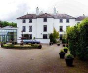
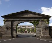
Barberstown Castle is a structure originally built in 1288 in Straffan, County Kildare, Ireland, 25 km (15 miles) west of Dublin. It has been operating as a hotel since 1971 and is surrounded by 20 acres of gardens. Renovations in 1996 revealed a previously undiscovered tunnel that links the castle to the nearby church in Straffan and is thought to have been used during penal times.
Taghadoe
Taghadoe in county Kildare is the site of an ancient monastic settlement and Round Tower, there is a graveyard and the ruins of a 19th century church. It is situated 5 km from Maynooth, off the Straffan Road. The name is probably derived from Teach Tua or House of Tua in Irish, Saint Tua (Ultan the Silent]]) the abbot of Clonmacnoise, was responsible for founding the monastic settlement here. The site dates back to the 6th Century.


