Safety Score: 3,4 of 5.0 based on data from 9 authorites. Meaning please reconsider your need to travel to Indonesia.
Travel warnings are updated daily. Source: Travel Warning Indonesia. Last Update: 2024-08-13 08:21:03
Delve into Ajibelang
Ajibelang in Sumatera Utara is located in Indonesia about 864 mi (or 1,390 km) north-west of Jakarta, the country's capital town.
Current time in Ajibelang is now 05:43 PM (Sunday). The local timezone is named Asia / Jakarta with an UTC offset of 7 hours. We know of 8 airports close to Ajibelang. The closest airport in Indonesia is Polonia International Airport in a distance of 30 mi (or 49 km), North. Besides the airports, there are other travel options available (check left side).
If you need a hotel, we compiled a list of available hotels close to the map centre further down the page.
While being here, you might want to pay a visit to some of the following locations: Kabanjahe, Saribudolok, Tigarunggu, Pematang Raya and Sondi. To further explore this place, just scroll down and browse the available info.
Local weather forecast
Todays Local Weather Conditions & Forecast: 19°C / 67 °F
| Morning Temperature | 18°C / 64 °F |
| Evening Temperature | 19°C / 65 °F |
| Night Temperature | 18°C / 64 °F |
| Chance of rainfall | 41% |
| Air Humidity | 97% |
| Air Pressure | 1012 hPa |
| Wind Speed | Light breeze with 3 km/h (2 mph) from North-East |
| Cloud Conditions | Overcast clouds, covering 100% of sky |
| General Conditions | Heavy intensity rain |
Monday, 18th of November 2024
22°C (71 °F)
18°C (65 °F)
Moderate rain, calm, overcast clouds.
Tuesday, 19th of November 2024
23°C (73 °F)
19°C (66 °F)
Moderate rain, light breeze, overcast clouds.
Wednesday, 20th of November 2024
23°C (73 °F)
18°C (65 °F)
Light rain, light breeze, overcast clouds.
Hotels and Places to Stay
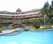
Sinabung Hills Berastagi
Videos from this area
These are videos related to the place based on their proximity to this place.
Volcano Caldera Mount Sibayak Sumatra
Here we get close and personal with a steam vent inside the caldera. Its amazing but pretty hot and stinky stuff....more yellow and tears than a Bersih rally...
Field Trip SMA/SMP Muhammadiyah Kabanjahe Ke Badan Geologi Gn.Sinabung(1)
Praktek Lapangan Geografi.
Field Trip SMA/SMP Muhammadiyah Kabanjahe Ke Badan Geologi Gn.Sinabung(2)
Praktek Lapangan Geografi.
Field Trip SMA/SMP Muhammadiyah Kabanjahe Ke Badan Geologi Gn.Sinabung(4)
Praktek Lapangan Geografi.
Field Trip SMA/SMP Muhammadiyah Kabanjahe Ke Badan Geologi Gn.Sinabung(3)
Praktek Lapangan Geografi.
Field Trip SMA/SMP Muhammadiyah Kabanjahe Ke Badan Geologi Gn.Sinabung(5)
Praktek Lapangan Geografi.
Videos provided by Youtube are under the copyright of their owners.
Attractions and noteworthy things
Distances are based on the centre of the city/town and sightseeing location. This list contains brief abstracts about monuments, holiday activities, national parcs, museums, organisations and more from the area as well as interesting facts about the region itself. Where available, you'll find the corresponding homepage. Otherwise the related wikipedia article.
Kabanjahe
Kabanjahe is a town approximately 2 hours from Medan, North Sumatra, Indonesia. Kabanjahe is to the south of Berastagi. Kabanjahe is the capital of Karo Regency. Frequent buses connect the two towns and a journey takes about 90 minutes. Most of the local people are Karo who speak the Batak Karo language. A favorite food among locals is roast pork or Babi Panggang Karo. Kabanjahe is the seat of government of Karo Regency.
Karo Regency
Karo Regency is a regency of North Sumatra, Indonesia. It is situated in the Bukit Barisan mountains. In 2000, the regency covered an area of 2,127.25 square kilometres and according to the 2000 census it had a population of 279,470. 60.99% of the regency is forested. Its regency seat is Kabanjahe. The Batak Karo language is spoken in the regency, as well as Indonesian language.


