Safety Score: 3,4 of 5.0 based on data from 9 authorites. Meaning please reconsider your need to travel to Indonesia.
Travel warnings are updated daily. Source: Travel Warning Indonesia. Last Update: 2024-08-13 08:21:03
Discover Lho Panglima
Lho Panglima in Special Region of Aceh is a town in Indonesia about 1,154 mi (or 1,857 km) north-west of Jakarta, the country's capital city.
Current time in Lho Panglima is now 05:26 PM (Sunday). The local timezone is named Asia / Jakarta with an UTC offset of 7 hours. We know of 5 airports near Lho Panglima. The closest airport in Indonesia is Maimun Saleh Airport in a distance of 2 mi (or 4 km), South-East. Besides the airports, there are other travel options available (check left side).
Looking for a place to stay? we compiled a list of available hotels close to the map centre further down the page.
When in this area, you might want to pay a visit to some of the following locations: Lampuyang, Angan, Lampuuk, Lambaro and Banda Aceh. To further explore this place, just scroll down and browse the available info.
Local weather forecast
Todays Local Weather Conditions & Forecast: 26°C / 79 °F
| Morning Temperature | 27°C / 81 °F |
| Evening Temperature | 26°C / 78 °F |
| Night Temperature | 26°C / 80 °F |
| Chance of rainfall | 22% |
| Air Humidity | 83% |
| Air Pressure | 1010 hPa |
| Wind Speed | Gentle Breeze with 7 km/h (4 mph) from South-West |
| Cloud Conditions | Overcast clouds, covering 100% of sky |
| General Conditions | Heavy intensity rain |
Monday, 18th of November 2024
28°C (82 °F)
28°C (82 °F)
Light rain, moderate breeze, overcast clouds.
Tuesday, 19th of November 2024
28°C (82 °F)
28°C (82 °F)
Light rain, fresh breeze, overcast clouds.
Wednesday, 20th of November 2024
28°C (82 °F)
28°C (82 °F)
Moderate rain, fresh breeze, overcast clouds.
Hotels and Places to Stay
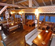
Freddies Santai Sumurtiga
Videos from this area
These are videos related to the place based on their proximity to this place.
SABANG HOTEL
http://hotelcitrasabang.blogspot.com/ https://www.facebook.com/hotelcitra.sabang Jalan Teku Umar No.15 Sabang. Telp.(0652) 21172. Hp. 0821 6709 3660 Hotel Citra terletak di Pulau Weh (Kota...
VISIT SABANG.flv
Welcome to sabang Hotel Citra, Jln. T. Umar No. 15, telp. 0652 - 2117 Hotel Citra terletak di Pulau Weh (Kota Sabang) tempat yang terkenal dengan keindahan bawah lautnya dan terdapat tugu...
kenangan di man sabang
Saya membuat video ini dengan Pembuat Rangkai Slide YouTube (http://www.youtube.com/upload)
Dive Spot di Sabang
Dalam video ini diperlihatkan tujuh dive spot di Sabang, Aceh. Ketujuhnya adalah West Seulako, East Seulako, Bate Tokong, Arus Palee, Rubiah Sea Garden, Canyon dan Underwater Volcano.
Menyelam di Sabang
Video yang direkam pada Mei 2014 ini memperlihatkan gambaran 7 titik selam di Sabang Aceh.
Videos provided by Youtube are under the copyright of their owners.
Attractions and noteworthy things
Distances are based on the centre of the city/town and sightseeing location. This list contains brief abstracts about monuments, holiday activities, national parcs, museums, organisations and more from the area as well as interesting facts about the region itself. Where available, you'll find the corresponding homepage. Otherwise the related wikipedia article.
Maimun Saleh Airport
Maimun Saleh Airport is a small airport with a runway length of 1844m (6048ft) in Sabang, Pulau Weh, Indonesia. It is situated on the island right above the northern tip of Sumatra in the Andaman Sea. It is part of the Aceh province. Currently there are no airlines serving the airport. The nearest airport with commercial service is the Sultan Iskandarmuda Airport which is located in nearby Banda Aceh.


