Safety Score: 3,4 of 5.0 based on data from 9 authorites. Meaning please reconsider your need to travel to Indonesia.
Travel warnings are updated daily. Source: Travel Warning Indonesia. Last Update: 2024-08-13 08:21:03
Delve into Digulan
Digulan in Provinsi Jawa Tengah is a city located in Indonesia about 256 mi (or 412 km) east of Jakarta, the country's capital town.
Current time in Digulan is now 02:06 PM (Monday). The local timezone is named Asia / Jakarta with an UTC offset of 7 hours. We know of 9 airports closer to Digulan, of which one is a larger airport. The closest airport in Indonesia is Adi Sumarmo Wiryokusumo Airport in a distance of 27 mi (or 43 km), East. Besides the airports, there are other travel options available (check left side).
There are several Unesco world heritage sites nearby. The closest heritage site in Indonesia is Sangiran Early Man Site in a distance of 61 mi (or 98 km), North-East. In need of a room? We compiled a list of available hotels close to the map centre further down the page.
Since you are here already, you might want to pay a visit to some of the following locations: Temanggung, Ungaran, Boyolali, Mungkid and Sleman. To further explore this place, just scroll down and browse the available info.
Local weather forecast
Todays Local Weather Conditions & Forecast: 26°C / 79 °F
| Morning Temperature | 22°C / 72 °F |
| Evening Temperature | 24°C / 75 °F |
| Night Temperature | 22°C / 72 °F |
| Chance of rainfall | 2% |
| Air Humidity | 79% |
| Air Pressure | 1009 hPa |
| Wind Speed | Light breeze with 3 km/h (2 mph) from South-West |
| Cloud Conditions | Overcast clouds, covering 100% of sky |
| General Conditions | Light rain |
Tuesday, 26th of November 2024
29°C (85 °F)
22°C (72 °F)
Moderate rain, calm, broken clouds.
Wednesday, 27th of November 2024
29°C (85 °F)
22°C (71 °F)
Moderate rain, light breeze, overcast clouds.
Thursday, 28th of November 2024
29°C (85 °F)
21°C (70 °F)
Light rain, light breeze, overcast clouds.
Hotels and Places to Stay
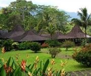
MesaStila Resort and Spa
Videos from this area
These are videos related to the place based on their proximity to this place.
Jalur Pendakian Mount Telomoyo 1.894m dpl 7 April 2015 part 1
Taken with GoPro Hero 4 Thanks To all Baper Team and My Vixion hahaha.
Kabupaten Pekalongan Karate male Team kata
This is a Team male karate team kata from Kabupaten Pekalongan.
TRIP GUNUNG TELOMOYO MAGELANG
Menghilangkan penat sehabis KRS an guys wkwkwk... ================================================ sound : https://www.youtube.com/watch?v=zInL1ZUPu7s.
Trip To Gunung Telomoyo
Ini adalah video perjalanan iseng kami pelajar dari kudus yang sedang menikmati liburan ke gunung Telomoyo pada tanggal 27 dan 28 Desember 2018.
Trip telomoyo via basecamp arsal
Cuplikan perjalanan berangkat dan pulang dari mt.telomoyo....selamat memyaksikan.
Videos provided by Youtube are under the copyright of their owners.
Attractions and noteworthy things
Distances are based on the centre of the city/town and sightseeing location. This list contains brief abstracts about monuments, holiday activities, national parcs, museums, organisations and more from the area as well as interesting facts about the region itself. Where available, you'll find the corresponding homepage. Otherwise the related wikipedia article.
Mount Telomoyo
Mount Telomoyo is a stratovolcano in Central Java, Indonesia. The volcano was constructed over the southern flank of the eroded Pleistocene-age Soropati volcano, which has a height of 1,300 metres . The Soropati volcano collapsed during the Pleistocene, leaving a U-shaped depression. Mount Telomoyo grows on the southern side of the depression, reaching over 600 metres above the depression's rim.


