Safety Score: 3,4 of 5.0 based on data from 9 authorites. Meaning please reconsider your need to travel to Indonesia.
Travel warnings are updated daily. Source: Travel Warning Indonesia. Last Update: 2024-08-13 08:21:03
Discover Benel
Benel in Jawa Timur is a city in Indonesia about 417 mi (or 671 km) east of Jakarta, the country's capital city.
Local time in Benel is now 01:09 PM (Friday). The local timezone is named Asia / Jakarta with an UTC offset of 7 hours. We know of 8 airports in the vicinity of Benel, of which two are larger airports. The closest airport in Indonesia is Abdul Rachman Saleh Airport in a distance of 2 mi (or 4 km), South-East. Besides the airports, there are other travel options available (check left side).
Looking for a place to stay? we compiled a list of available hotels close to the map centre further down the page.
When in this area, you might want to pay a visit to some of the following locations: Tamiajeng, Kambingan, Bokor, Kidal and Bumiayu. To further explore this place, just scroll down and browse the available info.
Local weather forecast
Todays Local Weather Conditions & Forecast: 30°C / 87 °F
| Morning Temperature | 21°C / 71 °F |
| Evening Temperature | 24°C / 76 °F |
| Night Temperature | 23°C / 73 °F |
| Chance of rainfall | 12% |
| Air Humidity | 57% |
| Air Pressure | 1009 hPa |
| Wind Speed | Light breeze with 3 km/h (2 mph) from South-West |
| Cloud Conditions | Overcast clouds, covering 100% of sky |
| General Conditions | Moderate rain |
Saturday, 23rd of November 2024
27°C (81 °F)
23°C (73 °F)
Moderate rain, calm, overcast clouds.
Sunday, 24th of November 2024
30°C (86 °F)
22°C (72 °F)
Light rain, calm, broken clouds.
Monday, 25th of November 2024
29°C (84 °F)
23°C (74 °F)
Moderate rain, calm, scattered clouds.
Hotels and Places to Stay
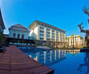
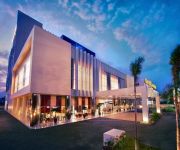
HARRIS Hotel and Conventions Malang
Atria Hotel & Conference Malang
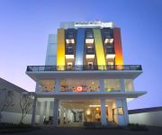
Amaris Hotel Malang
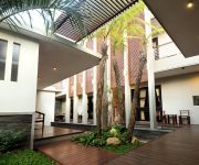
COZY Boutique Guest House
Swiss-Belinn Malang
Hotel Santosa
Videos from this area
These are videos related to the place based on their proximity to this place.
My Memories in MTs. Almaarif 01 Singosari
video ini sempat hilang selama 4 tahun, dan akhirnya ku temukan pada tanggal 28 Agustus 2014 pukul 16:24.
BMX Fandik sgs NTRL 2012.wmv
Fandik sgs (Rider singosari - malang) and juga pengelola NTRL . (NATURAL SHOP) Dengan Rizal Slow, Di tahun 2012.
Streetball's Carles Gostreem
add Facebooknya di http://www.facebook.com/carles.streetballers?fref=ts.
Videos provided by Youtube are under the copyright of their owners.
Attractions and noteworthy things
Distances are based on the centre of the city/town and sightseeing location. This list contains brief abstracts about monuments, holiday activities, national parcs, museums, organisations and more from the area as well as interesting facts about the region itself. Where available, you'll find the corresponding homepage. Otherwise the related wikipedia article.
Abdul Rachman Saleh Airport
Abdul Rachman Saleh Airport is an airport serving Malang, the second largest city in East Java province of Indonesia. This airport is named after Abdoel Rachman Saleh, an Indonesian aviator and physiologist whose plane was shot down by the Dutch when landing in Maguwo Airfield, Sleman Regency, Yogyakarta during Indonesian National Revolution. The airport was closed in October 2009 due to numerous damages found in the runway, but has opened again after some repairs were done.


