Safety Score: 3,4 of 5.0 based on data from 9 authorites. Meaning please reconsider your need to travel to India.
Travel warnings are updated daily. Source: Travel Warning India. Last Update: 2024-08-13 08:21:03
Discover Pānihāti
Pānihāti in North 24 Parganas (West Bengal) with it's 378,705 citizens is a city in India about 806 mi (or 1,297 km) south-east of New Delhi, the country's capital city.
Local time in Pānihāti is now 02:55 PM (Sunday). The local timezone is named Asia / Kolkata with an UTC offset of 5.5 hours. We know of 8 airports in the vicinity of Pānihāti, of which one is a larger airport. The closest airport in India is Netaji Subhash Chandra Bose International Airport in a distance of 5 mi (or 8 km), South-East. Besides the airports, there are other travel options available (check left side).
There are several Unesco world heritage sites nearby. The closest heritage site in India is Sundarbans National Park in a distance of 61 mi (or 99 km), South-East. Looking for a place to stay? we compiled a list of available hotels close to the map centre further down the page.
When in this area, you might want to pay a visit to some of the following locations: Kolkata, Khulna, Magura, Bagerhat and Rajshahi. To further explore this place, just scroll down and browse the available info.
Local weather forecast
Todays Local Weather Conditions & Forecast: 27°C / 81 °F
| Morning Temperature | 19°C / 66 °F |
| Evening Temperature | 26°C / 78 °F |
| Night Temperature | 22°C / 71 °F |
| Chance of rainfall | 0% |
| Air Humidity | 32% |
| Air Pressure | 1014 hPa |
| Wind Speed | Gentle Breeze with 7 km/h (4 mph) from South-East |
| Cloud Conditions | Clear sky, covering 1% of sky |
| General Conditions | Sky is clear |
Monday, 18th of November 2024
27°C (81 °F)
21°C (70 °F)
Sky is clear, gentle breeze, clear sky.
Tuesday, 19th of November 2024
27°C (81 °F)
22°C (72 °F)
Sky is clear, gentle breeze, clear sky.
Wednesday, 20th of November 2024
28°C (83 °F)
22°C (72 °F)
Sky is clear, light breeze, clear sky.
Hotels and Places to Stay
Swissotel Kolkata
The Fern Residency Kolkata
Howard Johnson
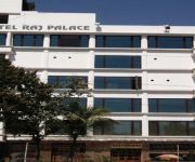
Hotel Raj Palace
AIRPORT CITY HOTEL
Barsana Hotel & Resort
Ethnotel
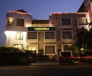
FabHotel Club Royale Airport
Kingston Boutique Hotel
Celesta Kolkata
Videos from this area
These are videos related to the place based on their proximity to this place.
Bhabapagla Temple at Sodepur Sukchar, Kolkata - Bhaba Pagla Temple
Bhabapagla (Sri Bhaba Pagla Mandir) Temple of Sodepur Sukchar near Ganga River. Bhabar Mahashaktir Ashray - BhabaPagla Sodepur sukchar Mandir / temple is situated at Sukchar of 24th Pgs.
Classical Animation Training in India, Institute of VFX and Animation
Animation Training India, Indian Animation Company, Game Design India, Game Art India Sodepur Animation Academy, Game Programming India.
Regent Ganga - Uttarpara, Hooghly-Chinsura
Visit: http://www.propertywala.com/regent-ganga-hooghly-chinsura Regent Ganga - Uttarpara, Hooghly-Chinsura - Holistic Living Regent Ganga, the self-sufficient luxury complex at economical...
A small Collection of Coins
Collection Includes RI-BI-Princely State-Foreign mixed coins. This is not the full collection- a part of total collection so show for public interest.
Xperia tipo Modern Combat 4 smooth gameplay
Xperia tipo using custom kernel clocked at 800 MHz and deodexed custom stock ROM.
Godrej Prakriti, Sodepur, Kolkata
Located in Sodepur, North Kolkata, Godrej Prakriti is one of the residential projects of Godrej Properties, offering configurations of 2BHK and 3BHK. The starting price of the apartments is...
Explosion Ground
A vast explosion test by Antam Malakar. Basic Scene setup: Background - Created and textured using Max 2014. Rendered using V-Ray Explosion created using Max 2014 PF Source + FumeFX 3.5 ...
Sodepur Sukchar Kali Mandir - Jyotirmoyee Kali Temple Sodepur Nutan Kalibari
Jyotirmoyee Maa Kali & Brahma Mandir (Temple) Nutan Kalibari, Sukchar, Sodepur (Kolkata). Sodepur Sukchar Kali Mandir - Jyotirmoyee Kali Temple Sodepur (Kolkata). Watch Maa Kali idol of ...
Videos provided by Youtube are under the copyright of their owners.
Attractions and noteworthy things
Distances are based on the centre of the city/town and sightseeing location. This list contains brief abstracts about monuments, holiday activities, national parcs, museums, organisations and more from the area as well as interesting facts about the region itself. Where available, you'll find the corresponding homepage. Otherwise the related wikipedia article.
Khardaha
Khardaha is a city and municipality of Barrackpore subdivision in North 24 Parganas district in the Indian state of West Bengal. It is a part of the area covered by Kolkata Metropolitan Development Authority.
Sodepur
Sodepur is a neighborhood in north Kolkata, formerly Calcutta. It is a part of Panihati Municipality under Barrackpore sub-division and North 24 Parganas district of the state of West Bengal. It is a part of the area covered by Kolkata Metropolitan Development Authority. The major landmark of modern Sodepur is the shopping complex named Sriniketan, and residential complex like Peerless Nagar and the high rise residential complex like Godrej Prakriti.
Kamarhati
Kamarhati is a city and a municipality under Belghoria police station of Barrackpore subdivision. in North 24 Parganas district in the Indian state of West Bengal. It is a part of the area covered by Kolkata Metropolitan Development Authority.
Uttarpara
Uttarpara is a town of Hooghly District, West Bengal, India. It is a part of the area covered by Uttarpara Kotrung Municipality. It is a town of historical importance. Uttarpara is home to some of the biggest industrial setups in the state. It has the United Spirits Distilliery, Shalimar Wire Products, Hindustan Motors which is the only vehicle plant in West Bengal which manufactures the car Ambassador. Uttarpara Kotrung is the municipality.
Aamar FM
Aamar FM (literally meaning My FM) is a FM radio channel in Kolkata, India. The on- air presentation language of the station is in the Bengali language, the only private radio station to do so. Aamar 106.2FM is self-described as “The Radio Station Built for Kolkata by Kolkatans”. All of the elements heard on Aamar 106.2FM were designed from the input and feedback collected from extensive local research studies and its “FM Radio Start-Up” pre-launch campaign.
Konnagar
Konnagar is a city and a municipality in Hooghly District in the Indian state of West Bengal. There are 20 wards in the Konnagar Municipal Area. It is under Uttarpara police station in Serampore subdivision. It is a part of the area covered by Kolkata Metropolitan Development Authority. Konnagar is under the Serampur Loksabbha Kendra and Uttarpara Bidhansava Kendra. The Website of Konnagar Municipality is http://www. konnagarmunicipality. org/
Uttarpara Amarendra Vidyapith
Uttarpara Amarendra Vidyapith (formerly known as Uttarpara English High School) which was established on 6 March 1939, is an institution of Uttarpara, a small town in Hooghly district India. The institution is named after the freedom fighter late Shri Amarendra Nath Chattopadhyay, who was resident of Uttarpara. Uttarpara Amarendra Vidyapith follows the curricula of West Bengal Board of Secondary Education (W.B.B.S.E. ) and West Bengal Council of Higher Secondary Education (W.B.C.H.S.E.
Sagar Dutta Memorial Medical College and Hospital
The Sagar Dutta Memorial Medical College and Hospital is a Government Medical College located in Kolkata, in the Indian state of West Bengal. It is affiliated with the Medical Council of India (MCI). This medical college was established in 2011 with around 100 students. The West Bengal Joint Entrance Examination provides the state-government controlled centralised test for admission to the college.


